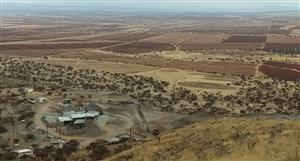
AWE’s footprint in Perth Basin approximately
600,000 net acres under lease
nwe Large footprint, covering over 2,500km2 (net)
awe Grow through exploration & acquisitions
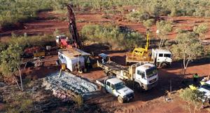
awe• Hydraulic fracture stimulation of 3 proof of
concept wells completed between July and
September 2012
• 8 separate zones in tight sands and shales
successfully stimulated
• Hydrocarbon (gas and oil/condensate) flowed
from each zone
• 13-20 Trillion cubic feet of gas potential (in
place) assessed within Middle Carynginia
• Additional target zones identified
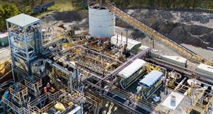
• Located in exploration permit EP 413
• 5 zones tested – hydrocarbon flow
achieved from all zones
• Separate hydraulic fracture stimulations,
plugs set between each zone
• Achieved stablised rate of 0.78 MMscf/d
from High Cliff Sandstones
• Recovery of oil from Kockatea enhances
potential
• Immediate plan to clean up, flow back
and test each zone sequentially to
evaluate the flow potential of each zone
• Flowback and evaluation of the Kockatea
to commence in October 2012
• Further evaluation of Middle & Lower
Carynginia, Irwin River Coal Measures
shales and High Cliff Sandstones is
planned
• Evaluating potential acquisition of 3D
seismic in 2013
from awe report


Add to My Watchlist
What is My Watchlist?