re: 4 banjar
Dues to Id-iot profanity filter I will have to post this in stages till I find the offending section.
I INTRODUCTION
world atlas
Zimbabwe, officially Republic of Zimbabwe, landlocked republic, southern Africa, bordered on the north-west by Zambia, on the north-east and east by Mozambique, on the south by South Africa, on the south-west by Botswana, and on the west by Botswana and the Caprivi Strip of Namibia. It was formerly the British colony of Southern Rhodesia (later Rhodesia).
The white government of the territory declared unilateral independence in 1965, adopting a republican form of government in 1970, and precipitating a war with black nationalist groups seeking independence under majority rule. In April 1980, following multi-party elections, Rhodesia became formally independent as the Republic of Zimbabwe. The total area of the country is 390,759 sq km (150,873 sq mi). The capital of Zimbabwe is Harare.
II LAND AND RESOURCES
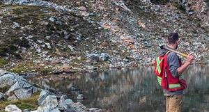
Middle Veld, Zimbabwe The Middle Veld is really two areas on either side of the Highveld, a ridge that runs across Zimbabwe from the southwest to the northeast. The temperate climate produces a rich, green landscape.Maryknoll Missioners
Zimbabwe is an upland country with a relatively temperate climate and a diversity of agricultural and mineral resources. The country occupies part of the great plateau of southern Africa. The most prominent physical feature is a broad upland that runs south-west to north-east across the country, and is most extensive in the north-east. It has an average elevation of about 1,525 m (5,000 ft) and is known as the Highveld. On either side of the Highveld the land slopes downward, in the north towards the River Zambezi and in the south towards the River Limpopo. These areas have average elevations of about 1,065 m (3,500 ft) and are known as the Middle Veld. The basins of the Zambezi, and the Limpopo, and, in the south-east, the Sabi-Lundi system are known as the Lowveld.