JUNE 2013 QUARTERLY ACTIVITIES REPORT
ASX ANNOUNCEMENT 29 JULY 2013
_____________________________________________________________________________________
Mantle Mining Corporation Limited (ASX: MNM) is pleased to provide the following update on its
activities for the quarter ended 30 June 2013:
Highlights
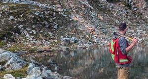
? At the Granite Castle Gold and Silver Project, design and fieldwork continued in preparation for a follow-up drill
program at the Coronation shear.
? At the Charters Towers Gold Project, design and fieldwork targeting geophysical surveys and drill programs were
undertaken specifically targeting the Balfes Creek and Great Britain prospects. At Great Britain, a review of
historic drilling highlighted significant, thick gold intersections at shallow depths.
? At the Haunted Stream Gold and Copper Project, detailed review began of 3 porphyry copper, gold and silver
prospective Exploration Licence (EL) application areas. Buchan East is prospective for porphyry copper and
copper/gold deposits, with a number of historic mines and drill holes reported with high grade gold and copper.
? At the Bacchus Marsh Brown Coal Upgrade Project, JV partner Exergen seeks to raise $50 million with which to
demonstrate CHTD at commercial scale. Exergen announced an amalgamation with Cape Range Limited (ASX:
CAG) that would result in Exergen’s shareholders becoming the major shareholders in Cape Range.
? At the Trafford (Mt Mulligan) Coal and Gas Project, initial exploration plans and landholder access agreements
are being finalized. Mantle is also awaiting the renewal of EPC 772 (coal) and grant of ATP 718P (gas).
? At the Latrobe Valley Black and Brown Coal Project, work plan development was ongoing for the next field
season. Mantle is also awaiting grant of 4 x EL applications prospective for both brown and black coal.
For further information please contact:
Ian Kraemer
Managing Director
Mantle Mining Corporation Limited
[email protected]
P: +61 7 3310 8932
About Mantle Mining Corporation Limited
Mantle Mining (ASX: MNM) is an Australian based minerals exploration company that is focussed on a range of in
high demand commodities. Mantle’s principal activities are to acquire exploration tenements and locate economically
developable deposits of coal and gold. It is Mantle’s intention to progress mineral deposits through feasibility and into
mining operations, to the benefit of all stakeholders.
www.mantlemining.com Page 2 of 17
Background on the Granite Castle Gold & Silver Project
The Granite Castle Gold and Silver Project is located 260km west of Townsville and 120km north of Hughenden in
Queensland and consists of three exploration tenements. EPM 14179 contains the Granite Castle JORC Compliant
(Measured, Indicated and Inferred) Gold and Silver Resource hosted solely in the single Granite Castle shear.
The geologic model of the Granite Castle resource is relatively simple with the majority of the resource extending from
surface, sub-vertically to 150m depth. The JORC resource occupies 600m of strike length of the Granite Castle shear
however the shear itself can be traced on surface for over 1km to the west and 200m east and remains open at depth.
Figure 1: Granite Castle exploration tenements. Figure 2: Granite Castle resource geologic model.
(green: 1-3g/t, red: 3-5g/t, pink: 5-10g/t gold).
Granite Castle Gold and Silver Resource Estimate (@ 0.2 g/t Au low grade & 30 g/t Au high grade cut-offs)
Class Tonnes Au (g/t) Au (oz) Ag (g/t) Ag (oz)
Measured 122,614 3.99 15,727 53.3 209,941
Indicated 264,021 3.44 29,198 67.6 574,182
Inferred 460,443 2.32 34,375 50.4 746,680
Total 847,078 2.91 79,301 56.2 1,530,803
Table 1: Granite Castle JORC Compliant Gold & Silver Resource Estimate.
Statements in this report relating to the Granite Castle Gold and Silver Resource Estimate are based on a report provided to the
Company by Hellman and Schofield Pty Ltd, dated 16th May 2008 and first released to the ASX by Mantle on 28th May 2008. “The
information in this report that relates to Mineral Resources is based on information compiled by Dr William Yeo, a full time
employee of Hellman and Schofield Pty Ltd. Dr Yeo is a Member of the Australasian Institute of Mining and Metallurgy and has
sufficient experience which is relevant to the style of mineralisation and type of deposit under consideration, and to the activity
which he is undertaking, to qualify as a Competent Person as defined in the 2004 Edition of the “Australasian Code for Reporting of
Exploration Results, Mineral Resources and Ore Reserves”. Dr Yeo consents to the inclusion of the matters based on his
information in the form and context in which it appears in this report.”
In addition, the project area contains a large swarm of
gold-silver mineralised shears with over 14km identified
to date. These additional shears are exposed at surface,
in close proximity to, and semi parallel to, the Granite
Castle shear.
Where drilled, holes have confirmed the presence of
shear-hosted gold mineralisation below these surface
outcrops.
It is apparent that there is excellent potential to deliver a
major expansion of the existing resource base by drilling
on multiple mineralised shears at shallow depths.
Figure 3: Mineralised shears (green), best drill results and proposed drilling areas on geology
www.mantlemining.com Page 3 of 17
Figure 5: IP section with schematic representation of Granite
Castle and Coronation shears.
Strong IP anomalies were identified on both the Granite
Castle and Coronation shears.
Figure 4: Induced Polarisation (IP) survey line locations.
As a result of this, and the numerous high grade results from historic drilling, Mantle undertook a major drilling
program to more closely define these high quality targets. The main areas of drill focus were the Coronation shear and
the Edwards prospect. Holes were designed to nominal 80m spacing allowing for targeted infill follow-up drilling.
Figure 6: Actual drill hole locations and (inclined) depths.
The best laboratory analysis results from the drilling program are shown below in Table 2, which has been broken into
grade distributions similar to those shown in the JORC compliant Resource model in Figure 2.
The Coronation shear IP data directly correlates with IP data relating to the structurally similar Granite Castle shear.
Based on that information and other geologic information the company holds, Mantle has identified an Exploration
Target for the Coronation shear based on its potential to be a large repeat of the Granite Castle shear.
Granite Castle was drilled down to 300m and contains an Exploration Target shown in Table 3. Based on the size of
the structurally similar Granite Castle shear, and noting the association of the larger IP anomaly with mineralisation at
the Coronation shear, the Exploration Target defined for the Coronation shear is also shown in Table 3.
Significantly both shears remain open at depth and there remain others yet to be tested to equivalent levels. Mantle is
applying for an upgrade to a Mineral Development Licence (MDL) at the Granite Castle project. As part of that work,
the Company intends to undertake a scoping study of development options and appropriate next steps for further
drilling and pre-feasibility work.
www.mantlemining.com Page 4 of 17
Table 2: Granite Castle Project 2012 drilling program best results – analytical summary Gold & Silver.
Granite Castle Gold and Silver Exploration Target
Target Tonnes Au (g/t) Au (oz) Ag (g/t) Ag (oz)
Granite Castle Shear 300,000 – 400,000 2.5 – 3.5 24,000 – 45,000 55 - 70 530,000 – 900,000
Coronation Shear 1,720,000 – 1,870,000 2.5 – 3.5 138,000 – 210,000 55 - 70 3,040,000 – 4,210,000
Total 2,020,000 – 2,270,000 2.5 – 3.5 162,000 – 255,000 55 - 70 3,570,000 – 5,110,000
Table 3: Granite Castle project Exploration Targets.
Statements in this report relating to the Granite Castle Gold and Silver Exploration Target are also based on the report provided to
the Company by Hellman and Schofield Pty Ltd, dated 16th May 2008 and first released to the ASX by Mantle on 28th May 2008.
“The information in this report that relates to Mineral Resources is based on information compiled by Dr William Yeo, a full time
employee of Hellman and Schofield Pty Ltd. Dr Yeo is a Member of the Australasian Institute of Mining and Metallurgy and has
sufficient experience which is relevant to the style of mineralisation and type of deposit under consideration, and to the activity
which he is undertaking, to qualify as a Competent Person as defined in the 2004 Edition of the “Australasian Code for Reporting of
Exploration Results, Mineral Resources and Ore Reserves”. Dr Yeo consents to the inclusion of the matters based on his
information in the form and context in which it appears in this report. The report also covered mineralised structures below the
Granite Castle JORC Resource and quantified a contained exploration potential (Exploration Target) within those structures.”
“Dr Yeo notes that the potential quantity and grade of the Granite Castle Exploration Target is conceptual in nature,
that there has been insufficient exploration to define a Mineral Resource, and that it is uncertain if further exploration
will result in the determination of a Mineral Resource.”
Statements in this report relating to the Coronation shear Exploration Target are based on data generated by the Company as first
released in a report to the ASX by Mantle on 5th December 2012. “The information in this report that relates to the Coronation
shear Exploration Target is based on information compiled by Mr Stuart Moore, a full time employee of Mantle Mining Corporation
Ltd. Mr Moore is a Member of the Australasian Institute of Mining and Metallurgy and has sufficient experience which is relevant to
the style of mineralisation and type of deposit under consideration, and to the activity which he is undertaking, to qualify as a
Competent Person as defined in the 2004 Edition of the “Australasian Code for Reporting of Exploration Results, Mineral
Resources and Ore Reserves”. Mr Moore consents to the inclusion of the matters based on his information in the form and context
in which it appears in this report.”
“Mr Moore notes that the potential quantity and grade of the Coronation Exploration Target is conceptual in nature,
that there has been insufficient exploration to define a Mineral Resource, and that it is uncertain if further exploration
will result in the determination of a Mineral Resource.”
Drill Hole Significant Intersections =1.0 g/t Au Significant Intersections =5.0 g/t Au Significant Intersections =10.0 g/t Au
MGA94 N MGA94 E Set up Depth
M M Dip/Azi (grid) M
GCRC572 7777928 258491 -60/197 70 18-19m [email protected] g/t Au, 40.4 ppm Ag
GCRC576 7777874 258643 -60/197 102 16-17m [email protected] g/t Au, 5.1 ppm Ag
GCRC577 7777863 258723 -50/197 48 19-20m [email protected] g/t Au, 19.2 ppm Ag
GCRC578 7777867 258725 -60/197 78 24-25m [email protected] g/t Au, 3.9 ppm Ag
GCRC586 7778036 259521 -60/180 72 28-29m [email protected] g/t Au, 29.8 ppm Ag
GCRC589 7777782 259408 -60/230 70 4-5m [email protected] g/t Au, 1.9 ppm Ag
GCRC591 7777636 259260 -50/197 54 43-46 [email protected] g/t Au, 6.33 ppm Ag 23-24m [email protected] g/t Au, 21.3 ppm Ag
44-45m [email protected] g/t Au
GCRC593 7777690 295195 -60/206 180 115-116 [email protected] g/t Au, 1.5 ppm Ag 58-59m [email protected] g/t Au, 1.9 ppm Ag
141-143m [email protected] g/t Au, 32.3 ppm Ag 96-97m [email protected] g/t Au, 2.5 ppm Ag
GCRC595 7777785 259049 -58/190 160 15-16m [email protected] g/t Au, 19.1 ppm Ag
GCRC596 7777652 259432 -58/190 215 86-88m [email protected] g/t Au, 34.6 ppm Ag 149-152m [email protected] g/t Au, 153ppm Ag
includes: 150-151m [email protected] g/t Au, 230ppm Ag
Drill Hole Significant Intersections =1.0 g/t Au
MGA94 N MGA94 E Set up Depth
(m) (m) Dip/Azi (grid) (m)
GCRC562 7778211 258514 -60/215 70 12-15m [email protected] g/t Au and 9.8 ppm Ag
GCRC563 7778344 258652 -60/176 150 102-104m [email protected] g/t Au, 25.4 ppm Ag
106-107m [email protected] g/ Au, 37.2 ppm Ag
GCRC564 7778395 258410 -60/200 90 74-75m [email protected] g/t Au, 35.1 ppm Ag 63-65m [email protected] g/t Au, 20.8 ppm Ag incudes 63-64, [email protected] g/t Au, 28.2 ppm Ag
GCRC566 7778264 258426 -60/169 70 16-18m [email protected] g/t Au, 8.7 ppm Ag
GCRC570 7778118 258245 -60/193 78 27-29m [email protected] g/t Au, 12.6 ppm Ag
Drill Hole Significant Intersections =1.0 g/t Au
MGA94 N MGA94 E Set up Depth
M M Dip/Azi (grid) M
TARC006 7785151 251307 -60/191 198 94-95m [email protected] g/t Au
Coordinates
CORONATION AREA BEST DRILLHOLE INTERSECTIONS 2012
EDWARDS AREA BEST DRILLHOLE INTERSECTIONS 2012
TAG ALLEY AREA BEST DRILLHOLE INTERSECTIONS 2012
Coordinates
Coordinates
www.mantlemining.com Page 5 of 17
Background on the Charters Towers Gold Project
The Charters Towers Gold Project is located around the township of Charters Towers in north Queensland. Mantle’s
tenement (EPM 14388) contains two main project areas; Great Britain and Gromac/Puzzler.
Figure 7: Historic mines on surface geology. Figure 8: Great Britain resource geologic model.
The Great Britain project area contains a JORC Compliant Inferred Gold Resource. The geological model at Great
Britain is relatively simple with mineralisation hosted in three shallowly dipping lenses.
Great Britain Gold Resource Estimate (@ 0.5 g/t Au low grade & 30 g/t Au high grade cut-offs)
Class Tonnes Au (g/t) Au (oz)
Inferred 2,128,000 1.8 125,000
Total 2,128,000 1.8 125,000
Table 4: Great Britain JORC Compliant Inferred Gold Resource Estimate.
Statements in this report relating to the Great Britain Gold Resource Estimate are based on a report provided to Glengarry
Resources Ltd by Resource Evaluations Pty Ltd dated August 2004 and independently confirmed by Ravensgate Minerals Industry
Consultants and included in Mantle’s 2006 Prospectus as released to the ASX by Mantle on 2nd October 2006. The Resource
Evaluations Pty Ltd report was compiled by Mr Mark Drabble, a Member of the Australasian Institute of Mining and Metallurgy and
Mr Gerry Fahey, also a Member of the Australasian Institute of Mining and Metallurgy: “This report was completed under the
overall supervision and direction of Gerry Fahey and the 3D modelling and Mineral Resource estimation was carried out by Mark
Drabble both of whom are Competent Persons as defined by the Australasian Code for the Reporting of Mineral Resources and
Ore reserves (JORC Code) 1999 edition and who consent to the inclusion in this report of the matters based on his information in
the form and context in which it appears.”
The deposit is hosted within the pre-Ordovician aged Charters Towers Metamorphics. This metamorphic sequence is
comprised of interbedded siltstones, sandstone, calc-silicate, phyllites and a rare Banded Iron Formation (BIF), all of
which have been intruded by abundant diorite dykes and sills. The entire sequence is weakly metamorphosed and
strongly altered. Alteration at Great Britain can be grouped into 4 distinctive styles, these being Chlorite, Sericite,
Carbonate and Silica. Within the deposit, gold commonly occurs in association with sericite and silica alteration. Gold
grades increase dramatically where sericite and silica alteration occur together.
In general terms, the mineralisation at Great Britain occurs in two ways; broad, continuous and low grade; and narrow,
discontinuous and high grade. Resource models developed for the Great Britain deposit have often relied on the
assumption that the mineralisation is strata bound within metasediments dipping shallowly to the north east. The
initial JORC resource at Great Britain (2004), suggests that the mineralised lodes occur as elongate NW trending,
moderately NE dipping zones of strongly sericite-silica altered metasediments and calc-silicate. The current resource
model has incorporated only the first type of mineralisation, that being broad, continuous and low grade.
Mantle acquired Great Britain in 2007, and has since undertaken detailed geological mapping and completed further
reverse circulation and diamond core drilling. The results of the mapping indicate the presence of steeply dipping NE
structures (both shear zones and intrusive dykes) that may localise high grade components of the orebody. It is
thought that these structures, controlling the second style of mineralisation, could provide significant upside to the
overall gold grade at Great Britain if their true orientation within the orebody can be accurately mapped / interpreted.
www.mantlemining.com Page 6 of 17
A review of all drilling at Great Britain showed that 40 holes are currently not included in the 2004 JORC resource
base model. Most of these were drilled post 2004, although 7 holes do pre-date the resource being calculated.
The green, blue and brown dots
represent the collar locations of holes
that intersected one or more of the
upper (green), middle (blue) and lower
(brown) mineralised zones currently
represented in the resource model.
The red squares represent the 40 new
holes.
Bearing in mind that all 40 holes that are
not currently included in the resource
have intersections greater than 1g/t
gold, the following are the best 8
intersections:
Figure 9: Drill hole locations at Great Britain
Diamond core (D) drill holes: Reverse Circulation (RC) drill holes:
GBD702: 18.6m @ 1.35g/t from 58.4m (incl: 4m @ 3.2g/t from 58.4m) GBRC704: 46m @ 1.2g/t from 9m
GBD703: 39.3m @ 1.41g/t from 20m (incl: 8m @ 4.1g/t from 27.3m) GBRC707: 6m @ 3.25g/t from 21m
GBD705: 31.5m @ 2.24g/t from 38.4m (incl: 8.4m @ 4.7g/t from 38.4m) GBRC714: 6m @ 4.19g/t from 54m
GBD735: 11m @ 2.03g/t from 47.1m (incl: 5.5m @ 4.1g/t from 49.4m) GBRC725: 7m @ 4.1g/t from 34m
Indications of the presence of
steeply NE dipping structures that
may control the high grade
component of the orebody can be
illustrated from orientated
structural readings from two nonmineralised
shear structures.
The first is in hole 98SHRCD122
which appears to be a steeply
dipping shear zone while the
second, in hole 98SHRCD111, is
a shallow dipping shear zone.
A surface outcrop exposure of the
Shamrock lode, near the northern
boundary of the deposit, exhibits
strong gold mineralisation in close
association with sub-vertical
structures.
Picture 1: Steeply dipping shear in Picture 2: Shallow dipping structure in
drill hole 98SHRCD122. drill hole 98SHRCD111.
A variety of alteration styles are associated with mineralisation at Great Britain and many of the holes display zones of
strong alteration, sulphide enrichment, brecciation and shearing that have yet to be sampled. Importantly, some of
these zones sit well below the current outline of the JORC resource.
420,200 mE
419,800 mE
420,000 mE
420,400 mE
419,400 mE
419,600 mE
7,781,400 mN
419,200 mE
418,800 mE
419,000 mE
7,781,800 mN
7,781,600 mN
7,781,000 mN
7,781,200 mN
Great Britain Orebody
Red - New Intersects
Green - Upper Lode
Blue - Middle Lode
Brown - Lower Lode
Drawing:
Date: 22/09/2012
Scale: 1:6000 Projection: AMG Zone 55 (AGD 66)
Office:
Mantle Mining
Author:
0 50 100
metres
200
www.mantlemining.com Page 7 of 17
It is possible that the Great Britain deposit may contain relatively higher grade gold values in steeply dipping structures
within a broad lower grade envelope. In order to generate updated structural information for the resource area, 6
diamond drill holes have been designed to intersect potentially high grade gold bearing structures controlling the
distribution of gold whether they are either shallow or steeply dipping. Two of these holes are shown on representative
interpretive sections below as thin black traces. Existing drill holes are shown as thick traces with intersections
included, colour coded to gold grade.
Figure 10: Interpretive section of shallow dipping structures. Figure 11: Interpretive section of steeply dipping structures.
Once the proposed new drilling has been completed, all new and historic holes not yet included in the deposit
database will be validated and the geologic model updated such that the JORC Resource base can be restated in
accordance with JORC 2012 specifiations.
The Gromac/Puzzler Project area is prospective for bulk tonnage disseminated deposits of gold, silver, molybdenum
and copper. The area is located in a major magnetic, geologic and structural corridor.
Figure 12: Gromac/Puzzler surface geology on aerial magnetics. Figure 13: Gromac/Puzzler on TMI aerial magnetics.
39.14.57
97SHRC44
96SHRC13
97SHRC54
GBD701
49.3m
31.4m
53m
117.5m
63.2m
97SHRC55
187.1m
141m
162.4m
99SHRC110
94.2m
98SHRCD109
23.9m
27.2m
99SHRCD111
96SHRC29
97SHRC48
GBR029
75.3m
59.5m
79.7m
44.8m
99SHRC121
132.6m
100.7m
145m
108.3m
145m
GBRC726
96SHRC28
8.6m
28.6m
97SHRC69
99SHRC112
GBRC731
54m
45.4m
59m
70m
32.0m
51.2m
14.8m
49.8m
96SHRC27
GB3
GBR040
5m
10.1m
24m
68.0m
T001
5,100 mE
5,050 mE
5,150 mE
200 mN
150 mN
4,900 mE
4,950 mE
5,000 mE
4,850 mE
350 mN
250 mN
300 mN
Proposed CoreHole
MH2012
175m
ProposedCore Hole
MH2012
175m
Great Britain N9940
Mantle Mining
Shallow Dipping Interp
Red = Au > 1g/t
Planned Drilling
Author:
Office:
Drawing:
Date: 21/09/2012
Scale: 1:1250 Projection: Non-Earth (meters)
0 12.5 25
metres
50
22.1
6.7
7
5.16
5.98
14
16.5
10.2
9.09
5
5.25
7.3
6.9
97SHRC79
219m
99SHRC117
96SHRC12
97SHRC53
99SHRC118
GBD701
GBRC730
14.9m
24.5m
49.3m
63.2m
97SHRC54
204m
120m
94.2m
105.9m
50m
97SHRC44
99SHRCD111
97SHRC46
98SHRCD109
GBR030
GBR031
40.4m
59.5m
44.8m
97SHRC48
99SHRC110
98.0m
132m
79.7m
132.6m
24m
27.4m
17.1m
13.6m
69m
97SHRC69
8.6m
99SHRC112
GBRC726
GBT007
120m
100m 116m
51.2m
54m
45.4m
14.8m
96SHRC27
96SHRC28
GBR041
24.0m
10.1m
45m
27m
GB4
0.5m
5,050 mE
5,100 mE
5,150 mE
4,950 mE
5,000 mE
150 mN
200 mN
250 mN
300 mN
350 mN
4,900 mE
4,850 mE
Great Britain N9920
Mantle Mining
Steep Dipping Interp
Red = Au > 1g/t
Author:
Office:
Drawing:
Date: 21/09/2012
Scale: 1:1250 Projection: Non-Earth (meters)
0 12.5 25
metres
50
www.mantlemining.com Page 8 of 17
Prior drilling by Mantle at the Gromac prospect intersected what appears to be the upper margin of a molybdenum
copper porphyry system.
Two holes were drilled, with one of the holes
intersecting widespread mineralisation from
77m to 148m deep at the end of the drill hole.
Mantle is of the view that the mineralisation
system at Gromac is similar in nature to those
underlying the Mt Leyshon and Ravenswood
porphyry gold mines.
These mines lie to the south and south east of
Charters Towers respectively and are each
based on multi million ounce deposits.
Picture 3: Gromac drill core with intense veining.
Picture 4: Historic Puzzler gold mine.
The Puzzler mine is an historic gold pit that
has recently reverted back into Mantle’s
tenement area due to relinquishment by the
prior holder.
The general area is considered prospective for
extensions of gold mineralisation below the
pit, along strike and to the west.
Mantle is currently reviewing historic reports
and planning geophysical surveys in order to
establish structural targets for potential drilling.
Figure 14: Historic drill hole locations and recent rock chips
www.mantlemining.com Page 9 of 17
The Balfes Creek prospect is located on the southern end of the major magnetic, geologic and structural corridor
within the Gromac/Puzzler project area. The prior holder of the tenement (Glengarry) reported gold mineralisation at
Balfes Creek that is associated with the basal contact of a shallow (ca. 45°) east dipping, north northeast striking
Permo-Carboniferous intermediate to rhyolite dyke.
Picture 15: Balfes Creek Prospect area. Picture 6: High grade rock chip sample P712280.
Mineralisation at Balfes Creek can be traced over at least 100m strike and remains open at depth. Reverse circulation
drilling by Glengarry at Balfes Creek is reported to have produced the following significant results:
9m @ 3.0g/t gold from 12m in 96PZRC013 6m @ 1.24g/t gold from 14m in 96PZRC025
6m @ 8.0g/t gold from 3m in 96PZRC032 7m @18.3g/t gold from 2m in 97PZB064
Recent field exploration has uncovered a very high grade (215 g/t = 6.9 oz/t) 1.45kg rock chip sample (P712280) at
Balfes Creek. The sample also returned 59 g/t silver, 3.25% lead and 22.8% iron with minor copper and zinc.
The sample was taken from an outcropping breccia located within the area containing the significant historic drill
holes. Clearly the area is prospective with moderate to high gold grades intersected, however the precise location of
the historic holes is yet to be determined. The sample location is also situated within the southern end of a soil sample
grid proximal to peak geochemistry values and 19m south west from the inferred NW-SE trending Rhyolite breccia.
The proximity of this very high (215 ppm = 215 g/t = 6.9 oz/t) gold value in relation to the peak geochemistry values
(red) of gold from soil sampling (sampled in April 2012), and its location in relation to the magnetic and structural
corridor, strengthens the possibility of the presence of a localised structure containing high grade gold.
Figure 16: Rock chips & drill holes on soil geochemistry. Figure 17: Rock chips & drill holes on magnetic intensity.
Company geologists are developing geophysics surveys at the Balfes Creek and Puzzler prospects; and drill
programs for these, the Gromac prospect, and the Great Britain JORC Compliant Inferred Resource area.
www.mantlemining.com Page 10 of 17
Background on the Haunted Stream Gold & Copper Project
The Haunted Stream Gold and Copper Project is located in Victoria’s East Gippsland region. Haunted Stream EL
3576 is a high grade, historic, gold field concentrated along the Haunted Stream fault and in close proximity to
magnetic intrusions. Mantle is exploring for areas offering potential for broad zones of disseminated sulphides or large
stock-works containing gold and/or copper mineralisation with potential for bulk mining and extended mine life.
Figure 19: EL 3576 historic mines on aerial magnetics.
Figure 18: Haunted Stream Gold Project location. Figure 20: ELs 3576 & 4784 locations of ground magnetic grids.
Field crews uncovered over 200 previously unknown workings on the goldfield and drilling confirmed the extent of the
biggest mines was much greater than originally thought. Ground magnetics surveys confirmed Anomalies 3 and 4 as
priority drill targets. Anomaly 3 had a relative magnetic high (centre) whereas Anomaly 4 had a distinct magnetic low.
Figures 21 & 22: Anomaly 3 & Anomaly 4 TMI contour plots. Figures 23 & 24: 3D model & section view of Anomaly 4.
Due to location close to large historic mines, and ease of access, Anomaly 4 was drilled first. Drill hole HSD12 was
terminated at 427m after passing through a number of highly altered zones proximal to the contact between the
intrusive and the sedimentary host rocks. HSD13 was terminated at 141m in a targeted fault zone. In HSD12 multiple
zones of base metal anomalous shearing were intersected. The best results were encountered from 198.2m with a
1m interval reporting 4.7g/t gold, 1027ppm copper, 118ppm lead and 363ppm zinc.
www.mantlemining.com Page 11 of 17
Picture 7: Drilling HSD12. Picture 8: Mineralised zone of intense shearing at 199m in drill hole HSD12.
A Down Hole ElectroMagnetic (DHEM) survey was subsequently undertaken in drill hole HSD12. The purpose was to
test additional potential for conductive sulphides associated with possible gold mineralisation, both around the
intrusive contact aureole and at depth under the drill hole. No major conductors were evident. As a result, due to the
differing magnetic and structural signatures of Anomaly 3, its potential to host mineralisation is considered greater.
Mantle geological staff and a speciality contract mining crew have also accessed and mapped a number of the larger
and more prospective historic underground mines. This work was undertaken in order to effectively plan a drilling
program targeting extensions of structurally controlled gold mineralisation. Potential remains to drill a number of stepout
and under holes in order to define mineralisation envelopes around each of these most prospective mines.
Pictures 9, 10 & 11: Field crew members accessing, mapping and sampling historic underground mines.
A package of new tenements EL 4785 (Mt Nugong), EL 4786 (Mt Elizabeth) and EL 4819 (Buchan East), remain
pending grant. These tenements are located in the southern extent of the Lachlan Fold Belt (LFB) in eastern Victoria,
adjacent to the Haunted Stream tenements, and are highly prospective for porphyry copper, gold and silver deposits.
The LFB is an extensive zone covering central and southern New South Wales and north eastern Victoria. The area
contains major granitic intrusions, and several large deposits of base and precious metals. Within the LFB, large
porphyry copper-gold systems formed within the Ordovician basement during extensive volcanism lasting through the
Silurian and early Devonian. In New South Wales, the large Northparkes and Cadia/Ridgeway mines are located in
the LFB in geological settings very similar to Mantle’s tenements. The Victorian extension of the LFB, unlike in New
South Wales, is poorly explored and remains highly prospective.
To the northeast of Mantle’s tenements, Dart Mining and Independence Group have both had recent exploration
success identifying porphyry base and precious metals deposits. In preparation for the start of field exploration, once
the tenements are granted, Mantle has begun detailed office based studies of historical mining and exploration. The
first of these tenements to be reviewed is Buchan East.
www.mantlemining.com Page 12 of 17
The Buchan East tenement is especially prospective for porphyry
copper and copper-gold deposits which also contain silver and other
base metals. The area hosts multi-phase intrusive rocks proximal to
regionally important faults, which may have provided loci for the
formation of large precious and base metals deposits.
The area is prospective for stockwork systems similar to those
associated with Volcanogenic Massive Sulphide (VMS) deposits; of
which Kidd Creek in Canada and Mt Lyell in Tasmania are examples.
The tenement is centred 6km east of the town of Buchan in eastern
Victoria. Buchan lies approximately 45km northeast of Bairnsdale and
access is excellent, via an all-weather sealed road.
The tenement covers prospective and under-explored ground capable of
providing a potentially significant copper and gold occurrence. Previous
explorers focused on the margins of the Buchan Rift that hosts
extensive areas of Snowy River Volcanics.
A number of copper and gold anomalies have been generated which
have yet to be followed-up. Regional airborne magnetics and
radiometrics also reveal areas of potential alteration and fracturing that
may be indicative of large mineralising events.
Figure 25: Buchan East geology and aeromagnetics.
Double Bull Creek Prospect
This very large area of anomalism was discovered during stream
sediment sampling which outlined a 3000m long by 700m wide,
moderate to strong copper anomaly straddling the sediment -
granodiorite contact. Historic drilling identified mineralised quartz veins
with up to 0.7% copper and 0.9% molybdenum.
Historic Dominion Copper Mine
The lode was a massive outcrop of quartz that can be traced in both
directions for over 1,100m. At the shaft, the lode was 2.5m wide, but
thickened to a maximum of 9m. Mined grades of up to 47g/t gold and
353g/t silver have been recorded.
Figure 26: Schematic of Volcanogenic Massive Sulphide (VMS) deposits.
Historic Tara Crown Mine
Lodes occured over a zone about 8km long and 2km wide. Values up to
4% copper over 3m were recorded and a sample taken where the reef
was over 3m wide assayed 34.4g/t gold, 30.4g/t silver and 0.8% copper.
Halls Peninsular Prospect
At the Halls Peninsular Prospect one hole, DDH 20, was drilled and
obtained 1.2m at 1.4% copper and 52 g/t silver from 72m below collar.
Figure 27: Double Bull Creek historic drill hole locations.
www.mantlemining.com Page 13 of 17
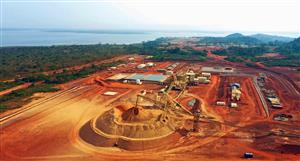
Background on the Bacchus Marsh Brown Coal Upgrade Project
The Bacchus Marsh Brown Coal Upgrade Project is located within the Bacchus Marsh Coalfield approximately 60km
north-west of Melbourne and a similar distance north of the Port of Geelong. The project area lies within Exploration
Licence EL 5294 and contains a large, historically mined deposit of brown coal. Small scale mining operations occur
within the project area at the Maddingley Mine under a separate mining licence owned and operated by a third party.
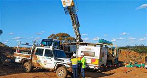
Figure 28: Project location. Figure 29: Drill hole locations. Picture 12: Mantle drilling operation.
Following a major drilling program carried out by Mantle in 2011/12, an Inferred Coal Resource of 1.6 billion tonnes,
reported in accordance with the JORC Code, was estimated. A total of 72 drill holes were used to estimate the
Inferred Coal Resource, including 15 cored drill holes completed by Mantle and 57 historical drill holes. The depth of
the Inferred Coal Resource extends from approximately 20m to 140m below surface.
Figure 30: Inferred Resource area. Figure 31: Schematic cross section (vertical exaggeration of x 10).
Coal Seam Tonnes
(Bt)
TM
(%)
ASH
(% db)
VM
(% db)
FC
(% db)
GDSE
(MJ/kg)
TS
(%.db)
Maddingley 1.6 52.9 10.4 47.2 42.2 24.5 3.4
Table 5: Bacchus Marsh JORC Compliant Inferred Coal Resource Estimate.
Statements in this report relating to the Bacchus Marsh Brown Coal Resource estimates are based on a report provided to the
Company by AMC Consultants Pty Ltd, dated August 2012: “Information in this report that relates to Coal Resource estimates
prepared by AMC Consultants Pty Ltd is based on information compiled by Ms K Zunica, who is a Member of the Australasian
Institute of Mining and Metallurgy and is a full time employee of AMC Consultants Pty Ltd. The estimates are based on exploration
data provided by Mantle Mining Corporation Ltd. Ms Zunica has sufficient experience relevant to the style of mineralisation and
type of deposit under consideration and to the activity which she is undertaking, to qualify as a Competent Person as defined in the
2004 Edition of the “Australasian Code for Reporting of Exploration Results, Mineral Resources and Ore Reserves”. Ms Zunica has
provided written consent to the inclusion in the report of the matters based on her information in the form and context in which it
appears.
Due to its high moisture content and propensity for self-heating, brown coal, or Low Rank Coal (LRC), is primarily
used as a fuel source for mine-mouth power stations. Very little product is exported due to the low energy content of
the coal and transportation costs. In order to overcome this market issue, Mantle has sought technology solutions and
has established a 50/50% joint venture at Bacchus Marsh with clean coal technology company Exergen Pty Ltd.
www.mantlemining.com Page 14 of 17
Exergen has developed a patented process which is seen as an “enabling technology” for a number of coal
conversion technologies such as coal to gas, coal to oil and coal to chemicals and fertilizers. These technologies
require a low-cost, low-emission “front end” LRC drying process in order to be technically and commercially viable.
The process, called Continuous Hydrothermal De-watering (CHTD), is
proven at pilot plant scale on Victorian and Indonesian coals and provides
an elegant solution which upgrades LRC in an energy efficient manner.
Importantly, upgrading LRC in this manner has significant environmental
benefits as a result of the reduction in carbon emissions that result from
the use of the upgraded coal when compared with using the raw coal. In
addition, the coal can be transported in slurry form, which makes it a very
safe product to handle.
Exergen’s CHTD autoclave consists of concentric pipes placed in a deep
mine shaft or bore-hole. This configuration allows the weight of the column
of coal-water slurry circulating through the autoclave to provide enough
pressure at the bottom to prevent boiling at a temperature of 300oC.
At this temperature a reaction takes place, causing changes to the
composition and structure of the LRC which subsequently allow a
significant portion of the coal moisture to be efficiently removed.
Figure 32: Exergen’s CHTD vertical autoclave concept diagram.
CHTD transforms low grade, high moisture
coals into a cleaner burning product with lower
carbon dioxide emissions.
CHTD is a highly efficient and low emission
technology because water is physically
separated from the coal in the liquid state,
rather than being removed through the highly
energy-intensive process of evaporation.
Exergen expects that its CHTD coal would be
used in next generation, state of the art power
stations being constructed in India. This type of
new power station emits between 30 and 40%
less carbon dioxide than Victoria’s existing coalfired
power stations in the Latrobe Valley.
Figure 33: CHTD process as applied to a typical Victorian LRC.
CHTD can be applied to a number of
commercialisation options:
Briquettes, that can be sold into the
existing bulk thermal coal market,
Pulverised fuel slurries, that can be
transported in pipelines or oil tankers,
Speciality slurries that can be used in
Direct Injection Coal Engines (DICE).
Figure 34: CHTD commercialisation options for a typical Victorian LRC resource.
www.mantlemining.com Page 15 of 17
Exergen’s major cornerstone investors include TATA Power, India’s largest private power utility, Leighton subsidiary
Thiess, the world’s largest supplier of outsourced mining services, Itochu, Japan’s third largest trading house with
extensive coal trading experience, and Sedgman, a global specialist provider of mineral engineering solutions.
Figure 35: Exergen Consortia Partners.
CHTD has been proven at Exergen’s pilot plant on a number of Victorian and Indonesian coals with moisture contents
ranging between 35% and 65%. Depending on requirements of overseas markets, Exergen expects to deliver final
products with moisture contents between 10% and 25%.
A bulk sample of Bacchus Marsh coal has been processed at the CHTD pilot plant and laboratory analysis has
confirmed that transformation of the Bacchus Marsh coal had successfully occurred on a continuous basis.
Pictures 13, 14 & 15: CHTD Pilot Plant processing Bacchus Marsh Run Of Mine (ROM) coal and representative briquettes.
A scoping study by the Bacchus Marsh coal joint-venture found that the project is economically viable and would
generate substantial local employment. The scope of work for the scoping study was for a Full Scale Plant (FSP)
capable of producing up to 20 Mtpa of CHTD processed product capable of being shipped to India. The study,
undertaken by Sedgman Ltd and Thiess, found that the project would require an initial capital investment of $2 billion,
delivering a positive Net Present Value of $1.4 billion and a mine life of more than 25 years.
Under the terms of the JVA, Exergen is now responsible for the development of a $50 - $70 million Pre Commercial
Demonstration Plant (PCDP) intended to confirm the viability of CHTD at commercial scale. The joint venture partners
plan to complete a bankable feasibility study on the project by the end of 2015. If that study is positive, and subject to
success of the pre-commercial demonstration project, production could start at Bacchus Marsh in 2018.
Table 6: Key project milestones
Exergen has announced plans for an amalgamation with listed entity Cape Range Ltd (ASX: CAG) which will result in
Exergen’s shareholders becoming the major shareholders of Cape Range. This transaction will provide Exergen with
an efficient and effective corporate structure on which to execute its strategy to become an internationally significant
coal company. A first step in this strategy is the funding and construction of the CHTD demonstration project.
Clear Pathway to Commercialisation
2012 2013 2014 2015 2016 2017 2018
JORC Resource Completed
Scoping Study Completed
Demo Design & Permits
Demo Construct & Tests
Pre-Feasibility Study
Bankable Feasibility Study
Commercial Construction
Commercial Operation
www.mantlemining.com Page 16 of 17
Background on the Trafford (Mt Mulligan) Coal & Gas Project
The Trafford Coal and Gas Project is located approximately 100km west of Cairns in north Queensland. The project
area contains the Mt Mulligan black coal deposit and historic underground mines.
Picture 16: Mount Mulligan mesa.
Figure 36: Trafford Coal project location. Picture 17: Historic Mount Mulligan mine portal.
Due to the high level of cultural significance
of the area, Mantle negotiated and finalised
an Indigenous Land Use Agreement (ILUA)
with the traditional custodians of the area;
the Djungan People.
An Ancillary Agreement (AA) and a Cultural
Heritage Management Plan (CHMP) have
also been executed.
Picture 18: Djungan People and Mantle after executing the ILUA.
Taken together, these three agreements provide for full protection of cultural heritage, mutual management decision
making for exploration activity, and staged compensation, employment and training packages.
Mantle’s initial exploration targets are potential extensions of the known coal deposit outside of a buffer zone agreed
with the Djungan as part of the ILUA negotiations. The intention at this point is to evaluate the potential for coal and
gas deposits that may exist within the licence area, but outside the buffer zone.
The company has commenced discussions with the relevant pastoral station holders in order to reach an access
agreement for initial low impact exploration activity. It is expected that initial exploration will be able to commence
immediately on conclusion of all agreement documentation and receipt of necessary approvals under the CHMP.
www.mantlemining.com Page 17 of 17


Add to My Watchlist
What is My Watchlist?