Thanks Safety First ...apparently like "Orinoco do Brasil Mineração Ltda" -I too was holding out important information, because I also found this report tonight.
Unfortunately no ...to the best of my knowledge ..this has never been released as an announcement -which is a bit of shame really -especially as I and other shareholders have been probably been helping to pay some of their wages as they prepared this report.
So here have I (and all of us) been struggling with outdated maps and plans from 2013 to try to get a clearer picture of what is going on in Cascavel (I'm sure they were having a good laugh) ...and these (expletive deleted) people have had this report published in the Brazilian Journal of Geology in Oct/Dec 2017. Let me see ...what was going on ...could the report have been helpful back then?
OH THAT'S RIGHT ...back then WE WERE BUSY TRYING TO GO BROKE!
So what is it? It is a 30 page integrated report using state of the art geology, geophysics and petrography (mineral chemistry) combined with fuzzy logic to determine mineralisation targets in Cascavel and Tintero.
I think this sums it up pretty well:
ABSTRACT:
The Faina Greenstone Belt is located in the southern sector of the Goiás Archean Block and has been investigated since the 18th century because of its gold deposits.
Recent studies have revealed the polymetallic potential of the belt, which is indicated by anomalous levels of Ag, Cu, Fe and Co in addition to Mn, Ba, Li, Ni, Cr and Zn. This study was developed based on a detailed analysis of two selected target sites, Cascavel and Tinteiro, and multiple data sets, such as airborne geophysics, geochemistry and geological information. These datasets were used to create a final prospectivity map using the fuzzy logic technique.
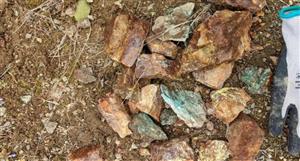
The gold mineralization of Cascavel target is inserted in an orogenic system and occurs in two overlapping quartz veins systems, called Mestre-Cascavel and Cuca, embedded in quartzite with an average thickness 50 cm and guidance N45º-60ºW/25ºSW with free coarse gold in grains 2-3 mm to 3 cm.
The prospectivity map created for this prospect generated four first-order favorable areas for mineralization and new medium-favorability foci. The Tinteiro area, derived from studies conducted by Orinoco do Brasil Mineração Ltda., shows polymetallic mineralization associated with an iron oxide-copper-gold ore deposit (IOCG) system posterior to Cascavel target mineralization.
Its prospectivity map generated 19 new target sites with the potential for Au, Cu and Ag mineralization, suggesting new directions for future prospecting programs.
KEYWORDS: Faina Greenstone Belt; aeromagnetometry; gamma spectrometry; gold mineralization; polymetallic mineralization; fuzzy logic.
So while all our financial dramas almost cost us the company, our wholly owned Brazilian company was sitting on report using the latest technological geophysics to deduce 4 first order favorable areas and 19 new target sites that are highly prospective for gold, copper and silver?
WHAT THE FREAK IS GOING ON? This report would have taken months to commission and put together ...and who knew about it ...Anglo perhaps?
Heads should roll ...Heads will roll AFAICT.
I have no idea what is going on ...but the words collusion, corruption and internal sabotage spring to mind.
So lets have a quick look at it:
As you guys have probably seen, we now have new target areas -some with new names: North Tintero, Central Tintero, South Tintero as well as Cascavel.
I will let some of these images (randomly selected) speak for themselves:


Figure 5: Main aeromagnetic products: (A) TMI; (B) ASA; (C) Dx; (D) Dy; and (E) Dz. The black outline indicates the main sites analyzed in this study: A - Cascavel, B - North Tinteiro, C - Central Tinteiro, D - Southeast Tinteiro and E - South Tinteiro.
Gamma Spectrometry Data
The gamma ray aerial survey shows the geochemical variations of potassium, uranium and thorium up to a depth of 30 cm from the Earth’s surface, and the main variations of these three radioelements translate into signatures that can be used to identify each type of rock (Dickson & Scott 1997). This geophysical method is a useful tool for geological mapping, and identification of hydrothermal alteration areas in different geological environments.
The processing of gamma spectrometry data was used to produce images of the K (%), eU (ppm) and eTh (ppm) channels, and a composite ternary RGB radiometric image (Figs. 6A-6D).

Figure 6: (A) K (%); (B) eU (ppm); (C) eTh (ppm) concentrations used to identify the hydrothermal alteration zones; and (D) RGB image, which is essential for the geologic mapping and the black outlines indicate the target sites (A - Cascavel, B - North Tinteiro, C - Central Tinteiro, D - Southeast Tinteiro and E - South Tinteiro).
Additionally, image of the Fk factor, known as parameter F, was obtained, and it indicates the enrichment of potassium relative to thorium as well as hydrothermal alteration zones associated with mineralization (Gnojek & Prichystal 1985). Fk is calculated as follows: Fk = K*eU/eTh.
Interpretation of Aeromagnetic Data
The analysis of the anomalous magnetic field was performed using linear transformations, such as the horizontal derivatives in x and y (Dx, Dy) and the vertical derivative (Dz), to generate the image of the analytic signal amplitude (ASA) (Roest et al. 1992). The ASA was used to identify a number of the main magnetic bodies in the area and was of great importance to this study because certain hydrothermal alterations in the Tinteiro site and along the greenstone are associated with magnetite, which was confirmed in the geologic mapping.

Figure 7: Map showing the first vertical derivative (Dz) of the TMI in the study area and identifying the main geologic structures interpreted based on the Dz, Dy, and RGB 453 image of the Landsat 7 ETM+ sensor. The boreholes conducted by the Orinoco do Brasil Mineração Ltda. are indicated by the green marker.

Figure 8: Geologic map of the study area at the 1:10,000 scale covering the Cascavel and Tinteiro target sites; the map was produced by integrating the geologic map created by Toledo et al. (2014) at the 1:25,000 scale, the geologic map from Orinoco do Brasil Mineração Ltda. and data obtained in this study. Boundaries of the hydrothermal alteration halos are also indicated.

Figure 10: (A) Description of the borehole CDP-04 showing mineralized layers. Photomicrography: a) S-C foliation marked by muscovite in quartz-muscovite schist; and b) deformed potassium feldspar, showing pressure shadows filled with biotite. The muscovite is older than the biotite. (B) Description of the borehole CDP-09 showing mineralized layers.

Figure 11: Distribution of the elements Au, Cu, Zn, Ni, Co, Cr, Pb and W (in ppm) along the boreholes CDP-04 and CDP-09, and possible correlations (red circles).
Mineral Exploration Vectors
By processing and interpreting the geophysical, geochemical and geological data available, the main exploration vectors were identified and subsequently used in the production of the final prospectivity map.
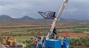
(I didn't even know we had a borehole TIN-1A)

Figure 14: Chemical analyses of the borehole TIN-1A, highlighting the layer intercepting the manganiferous breccia and showing anomalous concentrations of Ag, Ba, Pb and V in addition to Co, Cu, Mn, Ni, Zn and Li, which occur in the lithiophorite structure.
Geochemistry
The geochemical studies of the Tinteiro site reveal high polymetallic potential, which indicates an IOCG deposit (Swanepoel 2014). Many of the chemical elements, including Ag, Cu, Fe, Co, Ni, Zn, Mn, Li, Ba and V, show positive responses at all four sub-sites. These results have been obtained from the geochemical maps generated according to the rock and soil samples.
Skipping to the results:

Figure 16: Prospectivity map for the Cascavel site integrated with the soil grid, mineralized quartz veins associated with the Cascavel deposit, and the main lineaments identified from aeromagnetic images. The soil grid refinement over the area showing the highest favorability indicates an anomalous concentration of gold in this region. The concentration of the radioelement K (%) indicates that the region of highest favorability is associated with high K concentration.
The high-favorability regions are associated with feldspathic quartzite. The model shows that the Cascavel deposit is located on top of the favorable region.

Figure 17: Prospectivity map for the Tinteiro site: (A) North Tinteiro; and (B) Central Tinteiro. The integration of the prospectivity maps with the results from the chemical analyses on the rock and soil samples and the cores validated certain high-favorability zones. These zones are intersected by lineaments and associated with high magnetic amplitudes.

Figure 18: Prospectivity map for the Tinteiro site: (A) Southeast Tinteiro; and (B) South Tinteiro. The integration of the prospectivity maps with the results from the chemical analyses on the rock and soil samples and cores validate some high-favorability zones. These zones are intersected by lineaments and are associated with high magnetic amplitudes.
All of the prospectivity maps show high-favorability regions for mineralization. The main lithology associated with high favorability is metachert, which is apparent in the four Tinteiro sub-sites. North Tinteiro shows two main high-favorability regions: one in the southeast sector and the other one in the southwest sector. In the latter, a refined soil grid was used, which presented positive results for gold. In this sub-site, medium-favorability regions (0.71-0.80) occur in association with metapelites. In central Tinteiro, there are seven main high-favorability regions associated with metachert and metapelite. Boreholes TIN-04 and TIN-05 were obtained from one of these regions in the southwest region of the site, with TIN-04 showing positive results for gold and silver and TIN-05 only showing positive results for silver. In southeast Tinteiro, five high favorability regions were identified, with four associated with metachert and the fifth associated with manganiferous breccia. Boreholes TIN-1, TIN-1A, TIN-2 and TIN-3 cross this breccia layer and show anomalous concentrations for many elements, including silver, copper, cobalt, manganese, barium and lithium. In south Tinteiro, five favorable regions were identified in association with metachert and with quartzite (in the northern sector). The soil samples do not present good correlations with these areas because the positive results for gold are found across the entire sub-site.
VALIDATION AND EVALUATION OF THE BEST PREDICTORS
All of the prospectivity maps generated in this study show high-favorability areas, suggesting a new direction for exploration studies at the target sites. However, the question of whether the resulting model is reliable remains to be answered.
In Cascavel, four regions showing first-order favorability are identified in the prospectivity map. The Cascavel deposit is within the largest of these regions, where 18 rock samples from the gallery show anomalous gold concentrations (between 11.9 and 135.5 ppm) and other samples have visible gold. Within the Cascavel site, 44 cores were obtained, 27 of which reached mineralized layers in the high-favorability areas, compatible with the soil anomalous gold concentrations (Fig. 16). All of these data provide a high degree of confidence for the fuzzy logic results. The largest high-favorability region occurs at the intersection of structures (shear zones, faults, fractures, lineaments), including the intersection between NE-SW with E-W and NE-SW with NW-SE. The mineralized quartz veins of the Cascavel deposit and the Cuca mining site (north of Cascavel) are observed to be aligned NW-SE (Fig. 16), and this area coincides with the radioelement K (%) anomaly.
Tinteiro was not as thoroughly investigated as Cascavel; therefore, less data are available to validate the efficiency of the prospectivity maps. The results of the chemical rock and soil analyses occasionally coincide with regions of high favorability within all of the Tinteiro sub-sites. The results obtained from seven boreholes validated some favorable areas, three of which are in central Tinteiro and four of which are in southeast Tinteiro (Figs. 17 and 18). The ASA image reveals that all areas showing high favorability are associated with high magnetic amplitude anomalies. The high-favorability areas in all sub-sites were intersected by major lineaments aligned NE-SW, NW-SE and E-W or overlaying lineament intersections.
Therefore, the prospectivity maps reveal 19 main favorable regions in the Tinteiro site, thus suggesting a new direction in future drilling programs. In Cascavel, four new favorable sites and a number of additional locations with medium favorability (values ranging from 0.79 to 0.84) are observed, which also suggests new areas for follow up.
DISCUSSION AND CONCLUSIONS
A detailed study of all of the available data sets was undertaken to create prospectivity maps that can be used to identify the most important vectors for the resulting model. During this process, the main characteristics of the study area were identified and used to generate the final integrated map.
According to Groves et al. (1998) and Robert et al. (2007), orogenic deposits are characterized by their occurrence in quartz-carbonate veins, concentration along regional and secondary compressional-transpressional structures, strong lateral hydrothermal zonation proximal to distal alteration assemblages. The characteristics of the Cascavel deposit described here classify it as orogenic.
- Three main structural groups are identified in the study area based on the interpretation of airborne geophysical images and the RGB (453) image of the Landsat 7 ETM+ sensor. These structures are as follows: faults, shear zones and major lineaments aligned NW-SE, NE-SW and E-W. Apparently, all of the structures are related to mineralizations. However, the NE-SW lineaments are usually observed in areas where mineralization occurred in association with the intersection of structures;
- The mineralization and sedimentary deposits found at Cascavel and Tinteiro are different, with Cascavel found to be orogenic and Tinteiro found to be IOCG.
Williams et al. (2005) noted the following key characteristics of IOCG deposits:
Comparing these characteristics with those ones observed in Tinteiro, it is possible to classify the deposits as IOCG, although the association of mineralization and igneous intrusions has not been clearly identified in this study:
- Presence of Cu with or without Au as economic metals;
- Hydrothermal veins, breccias and/or replacement ore styles, characteristically in specific structural sites;
- Abundant magnetite and/or hematite;
- Iron oxides with lower concentrations of Ti compared with the oxides occurring in igneous rocks;
- Clear spatial association with igneous intrusions.
- The hydrothermal alteration halo in Cascavel is characterized according to its presentation of silicification and potassification in its most inner region. The mineralization is marked by the occurrence of free gold associated with quartz, green muscovite and siderite, thus forming a mineralized zone that is primarily hosted in feldspathic quartzites;
- The hydrothermal alteration halo in Tinteiro is characterized according to its presentation of a zone rich in arsenopyrite, which is weathered to form goethite, and muscovite, thus forming a mineralized zone when associated with hematite breccias and gossan. In manganiferous breccias, the mineralized zone is formed by hollandite, lithiophorite and muscovite. Both hollandite and lithiophorite present gold and silver in their structure. The hollandite is also a source of Ba and Mn, and the lithiophorite is a source of Li, Mn, Cu, Ni, Co and Zn. The mineralization is primarily hosted mainly in metacherts and also occurs in quartzites and metapelites;
- The boreholes in Cascavel show anomalous concentrations of Au, Ag, Cu, Zn, Ni, Co, Cr, Pb and W. However, Au is not correlated to any other element. The gold mineralization is hosted in quartz veins within feldspathic quartzites, whereas the other mineralizations are associated with dolomitic marble;
- Tinteiro indicates polymetallic potential and shows anomalous concentrations of Au, Ag, Cu, Fe, Co, Ni, Mn, Ba, Pb, Zn, Cr, Li and V that are primarily associated with manganiferous breccias;
- The prospectivity map for Cascavel identified four regions of high favorability and new medium-favorability focus with probabilities between 0.79 and 0.84;
- The prospectivity maps for Tinteiro identified 19 new high-favorability foci, thus suggesting a change in direction for subsequent sampling and coring phases.
23 new high regions showing favorability identified in the prospectivity map -in areas i didn't even know existed ...let alone the names of.
Whoever decided to not release this on the ASX was def using Fuzzy Logic.
Well there it is ...I'm flummoxed and exhausted. Too much fun for one day. Comments anyone?
SJB


Add to My Watchlist
What is My Watchlist?