There needs to be some clarification about the sampling technique in relation to the technology being used to record info....for the assays.....
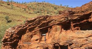
watso said it was soil samples for the top couple of inches ....I have copied and pasted below the soil sampling AND geochemistry technique used by Gondwana which was in the 31 oct 07 quarterly update as reported to the asx.....it invloves 20 to 25cm and also identifies through over burden for a couple of hundred metres...all new tecnology and it's good that Gondwana are utilising it....it allows a massive sampling to occur where it would previously be cost prohibitive for small explorers for 11,000 plus samples....pretty exciting capared to what I am seeing other companies do..... see below..cheers fatstocks.
the extract......
"MMI Soil Sampling
A comprehensive program of Mobile Metal Ion (MMI) soil sampling over a large number of the Company’s tenements was commenced during the quarter and will extend into the March quarter 2008. This MMI program is designed to identify gold mineralisation that other generations of explorers have missed and to assist in determining future RC drilling programs.
MMI exploration work is a comparatively recent method of high resolution soil geochemistry developed and patented by ex-CSIRO geologists from Western Australia.
Soil samples are taken over a grid pattern (for example -50m spaced lines, 20m sample intervals)in undisturbed environments 20 to 25cm below the true soil interface at a consistent depth. No metal touches the samples which are logged and stored in snap seal plastic bags. Samples are
submitted to one laboratory in one large batch to alleviate laboratory noise levels as MMI geochemistry involves assays for sub-ppb metal values using state of the art ICPMS machines after special preparation for analysis.
One direct benefit of this method is the ability to “see-through” several hundred metres of overburden. In addition to determining if there are mineral targets directly beneath the sampled locations the results also provide direct indications of the underlying rock types - in effect, subsurface geological mapping." ends.


Add to My Watchlist
What is My Watchlist?