
Plotting holes on google earth
[Cautions - Google earth coordinates may not be same as AVZ coords - looks good, care taken but may be some minor numerical transposition issues] see following post if image missing.


Some comments based on the above info which is not completely confirmed as accurate so DYOR.
Apart from 6900N and 7000N where additional holes have been drilled the drilling is mostly as planned - see original proposal.
Hole 28 will be interesting to see - likely to be quite deep and will give some indication of the pegmatite's depth continuity and extent.
As a rule of thumb DH pegmatite intersections for drilling between 6900 and 7400N are very likely to be in the 250+m range based on the depth of holes and reported drilling. Be surprising if they are less IMO.
Holes 18 and 19 will be interesting to see as well. If they are similar to 18-1 to 4 they could have some 250m or so of linear meter pegmatite. Previous indications suggested the pegmatite begins to thin to the SW.
Holes 14, 16 & 22-24 appear to have been drilled as diamond holes rather than RC. The further north holes 14 and 16 probably collared in pegmatite as holes 22-4 may have as well.
Hole 8 water hole with new pegmatite intersection in Carriere section a long way to the NE
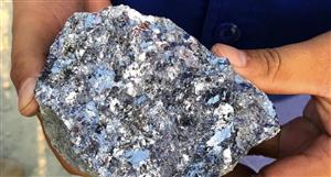
Assay's and visuals needed to confirm what is already suspected by many.
Ann: Manono Lithium Project drilling program, page-155
-
- There are more pages in this discussion • 26 more messages in this thread...


You’re viewing a single post only. To view the entire thread just sign in or Join Now (FREE)
Featured News
Add AVZ (ASX) to my watchlist
Currently unlisted public company.
The Watchlist
LU7
LITHIUM UNIVERSE LIMITED
Alex Hanly, CEO
Alex Hanly
CEO
SPONSORED BY The Market Online