robertkna
must be the same map! the map i have is titled : Woods Point Gold-field.
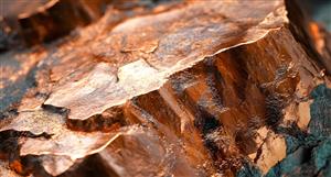
just to describe for others : dyke 6 is situated maybe 1.5 km. parallel & west of waverley dyke. it looks to be 500m long. it is in 2 sections which may mean it is buried for a short distance before resurfacing. although it re-surfaces as a black line indicating an auriferous band.
actually....robertkna....could dyke 40 also be the source of the alluvial gold along the length of Perkin's creek. dyke 40 is slightly north/west of Waverley & appears to be 4km. long.
also, on the head of dyke 40 i wonder why it swells in size (at the position where it says dyke 40)???


Add to My Watchlist
What is My Watchlist?
 (20min delay) (20min delay)
|
|||||
|
Last
1.4¢ |
Change
0.000(0.00%) |
Mkt cap ! $8.422M | |||
| Open | High | Low | Value | Volume |
| 0.0¢ | 0.0¢ | 0.0¢ | $0 | 0 |
Buyers (Bids)
| No. | Vol. | Price($) |
|---|---|---|
| 1 | 10000 | 1.4¢ |
Sellers (Offers)
| Price($) | Vol. | No. |
|---|---|---|
| 1.6¢ | 743408 | 2 |
View Market Depth
| Last trade - 16.21pm 18/07/2025 (20 minute delay) ? |
| MCO (ASX) Chart |
Day chart unavailable