Nearmap
SHARPER THAN THE BEST SATELLITE MAPS
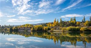
And frequently updated, too. Nearmap captures high-resolution aerial imagery across New Zealand multiple times per year. New aerial images are processed and streamed to the cloud within days. Get instant access to all current imagery and historical aerials, accurately georeferenced to show you truth over time.
View the incredible detail you've been missing. Satellite images are often blurred by weather or atmospheric conditions. Nearmap captures high definition aerial photos under the best possible conditions, so you can understand the critical details of your project or asset.
Eagle Technology partners with Nearmap to bring easily accessible imagery to our customers including those in Government, Local Government, Utilities, and Architecture, Engineering, and Construction sectors.
NEA Price at posting:
$2.21 Sentiment: Buy Disclosure: Held