Hole 205 is being drilled at the same location as 204, with the same hole dip as 203, targeting AP12/11/xx further to the west (Figure 1). It is evident that they are extremely constrained to where they are allowed to drill due to current permitting although satellite imagery indicates that this problem is soon to be alleviated.
Hole 201
did go below mineralisation or at least that is the interpretation put forward by Azure in Figures 2&3. Their cross sections imply the fault has moved the pegmatite, and therefore, the pegmatites are older than the fault. Otherwise, the vertical part of the fault should be mineralised as a conduit for the pegmatite to intrude into - but it's not. Therefore, pegmatites were there first, faulting has caused displacement, pegmatites have been moved, where did they go...?

Hole 205 should intersect broadly as below, however further to the west, potentially clipping a small fragment of what I expect is the downthrust AP12 pegmatite, followed by the AP11 and APxx (Figure 2), or what could be both AP11 if it has truncated (Figure 3).


Hole 205 targeting the western outcrop extent of AP12, to the west of previous drilling (Figure 4).

The theory of a third pegmatite at depth could be attributed to a poorly outcropping section of pegmatites further to the south-east (Figure 5). I expect most of the outcrop patterns to be predominantly from topographical controls and therefore the strike
should hopefullyin theory be larger than the outcrop under cover. If Azure are suggesting substantial million tonne figures, do they believe the same?

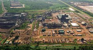
As to what the fault may do. One would assume it is mostly continuous through the project area if some of the GSWA mapped linear structures are to be believed (Figure 6). However inconclusive, need more data. It's very suggestive the nickel mineralization is structurally controlled. Also note, not entire tenement package on left image.