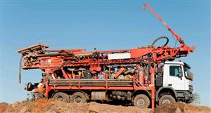
Why am I not surprised by the false posting of a well log supposedly from the Cofer Ranch Well drilled by Campbell’s Drilling Inc on 27-28 July 1984.
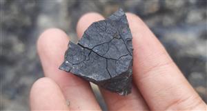
The actual record from this well, which is adjacent to the hot spring was submitted to the Arizona Water Department on 10 Aug 1984. This report indicates that water was initial found at 200 ft level, within a bentonite type clay (lithium bearing clay) and then allowed to continue to 280 ft. Which involved drilling through 40 ft of limestone that starting at 220 ft level to find a water resource of at least 25 gallons per minute within the zone 220 to 280 ft.
Some interesting facts about this drilling report given its close location near the hot spring artesian source are as follows:
• Amount of dry (lithium) clay above the initial water level is 165 ft. Remembering the spring location is a low point for this lithium resources and well is next to the spring.
• The top 20 ft of wet clay would have a very low or even no pumping capacity due to hydrate nature (adsorb water) of clays hence why they continued to drill through the 40 ft of limestone and seal 20ft of wet clay with cement around the 6-inch PVC casing pipe.
• No evidence was found of any gravel or allium materials between the carbonate layers (clay and limestone) to allow water the permutation through these zones.
• The region below the hot spring is capped with a thick layer of limestone which is consistent with this type of carbonate volcanic system that formed the big sandy basin.
• A further 20 ft of clay was found under the limestone potential indicating the fault line (Davidson 1973) was not interfaced at this bottom level and upper basin fill layer is still open.
It also very interesting to read and understand, Davidson (1973) appraisal of the Big Sandy Area to notice the fault relating to the Hot Cofer spring occurs in the volcanic rock of sycamore creek, arkosic gravel, and the lower basin fill zones. Which is below the exploration drilling or mining zones for this project.
Clearly, the well log you displayed is from other location especially when you deliberately exclude the reference marks for these records.
AZL General Discussion, page-22805


Add AZL (ASX) to my watchlist
 (20min delay) (20min delay)
|
|||||
|
Last
1.6¢ |
Change
0.000(0.00%) |
Mkt cap ! $71.58M | |||
| Open | High | Low | Value | Volume |
| 1.6¢ | 1.6¢ | 1.6¢ | $8.871K | 555.5K |
Buyers (Bids)
| No. | Vol. | Price($) |
|---|---|---|
| 45 | 12597869 | 1.5¢ |
Sellers (Offers)
| Price($) | Vol. | No. |
|---|---|---|
| 1.6¢ | 526376 | 4 |
View Market Depth
| Last trade - 16.10pm 04/10/2024 (20 minute delay) ? |
| AZL (ASX) Chart |