PACMAG METALS LIMITED
ABN 73 066 353 231
6 February 2007
ASX ANNOUNCEMENT
PACMAG SECURES WYOMING URANIUM DEPOSITS
KEY POINTS
• PacMag has secured exclusive rights to portions of the advanced Sundance uranium project in Wyoming USA, including major parts of the Oshoto uranium deposits.
• Historical drill intersections from the area acquired include; 3.8 metres (12.5 feet) @ 0.243% eU3O8, 3.5 metres (11.5 feet) @ 0.159% eU3O8, 6.2 metres (20.5 feet) @ 0.083% eU3O8 and 9.1 metres (30 feet) @ 0.056% eU3O8, with local vertical stacking of uranium roll fronts.
• Previous trial mining has demonstrated that the Oshoto uranium mineralisation is amenable to in-situ leaching. Wyoming is host to several former and currently operating uranium mines owned by companies such as Cameco, Rio Tinto and Cogema.
• Technical data covering the project, including a drilling database, is owned by PacMag, which will facilitate conversion of the previous resources and reserve estimates to JORC compliance.
• As previously foreshadowed, in order to focus on its advanced copper-molybdenum assets, PacMag is progressing negotiations regarding the possible divestment of the Company’s uranium portfolio, including this Wyoming uranium project. The consideration for any divestment will include a substantial number of ASX listed shares, the majority of which the Company would intend to distribute to PacMag shareholders in-specie, subject to shareholder approval. The Company will release further details on the divestment should all pre-conditions be met, on execution of binding agreements.
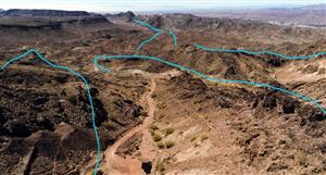
The Directors of PacMag Metals Ltd ("PacMag") are very pleased to report that the Company has secured the uranium mineral rights to in excess of 1000 acres of freehold land covering parts of the Sundance uranium project, including major portions of the Oshoto uranium deposits, and a further 1500 acres of state mineral leases covering along strike exploration potential in the north east Powder River Basin in Wyoming USA (Figure 1). Wyoming is host to several former and currently operating uranium mines owned by companies such as Cameco, Rio Tinto and Cogema.
Discovery History
In 1970, a joint venture between Nuclear Dynamics Inc and Bethlehem Steel Corporation ("NuBeth JV") commenced exploration over the Sundance project area and in the ensuing eight year program discovered several substantial zones of uranium mineralisation, including the Oshoto deposits, associated with an extensive system of roll fronts. An in-situ leach pilot plant was also constructed and successfully operated by the joint venture (which was later joined by Pacific Power and Light) for about eighteen months, however full scale commercial production, although planned, did not proceed due to the prevailing low uranium prices.
The Sundance district hosts a significant amount of uranium mineralisation over a large area (35 kilometres by 8 kilometres). The roll front uranium mineralisation is hosted in several discrete deposits, and along the oxidation-reduction interfaces throughout the area. PacMag owns technical data covering the full extents of the roll front systems, whilst PacMag’s mineral rights, held through its wholly owned USA subsidiary Strata Energy Inc. comprise ~1000 acres of freehold land covering important parts of two of the Oshoto deposits, and a further 1500 acres of state mining leases covering portions of the projections of the roll fronts south of the deposits.
PacMag Metals Limited
Level 2, 33 Ord Street, West Perth, Western Australia 6005
PO Box 1569, West Perth, Western Australia 6872
Tel: (+61-8) 9481 2997 Fax: (+61-8) 9321 0070
- 2 -
Uranium Deposits and Exploration Potential
The NuBeth JV drilled more than 5,000 exploration and development holes, totalling more than 912,000 metres (2.9 million feet), in the vicinity of the Sundance project. The program was very successful in discovering and defining a new uranium district that has been estimated to contain significant uranium mineralisation at grades in the range of 0.05% U3O8. PacMag, through its wholly owned subsidiary Strata Energy Inc, controls key properties hosting a portion of the defined mineralisation, as well as properties south of the mineral deposits, in an area that has good exploration potential. Better uranium intersections from ground held by PacMag are listed in Table 1 and include; 3.8 metres (12.5 feet) @ 0.243% eU3O8, 3.5 metres (11.5 feet) @ 0.159% eU3O8, 6.2 metres (20.5 feet) @ 0.083% eU3O8 and 9.1 metres (30 feet) @ 0.056% eU3O8.
The deposits now owned by PacMag vary in thickness and dimension, the largest accumulation is approximately 700 metres x 600 metres as stacked roll-fronts varying in thickness from less than 1 metre to 10 metres, averaging greater than approximately 3 metres. The next largest zone has mineralisation defined over 1.3 kilometres in length and is approximately 150 metres in width and averages approximately 2 metres in thickness. Mineralisation in both deposits shows excellent continuity as sub-horizontal zones.
Geology
The Sundance project is situated on the northwest flank of the Black Hills uplift and the eastern flank of the Powder River Basin of northeast Wyoming. The project area is underlain by a very thick sequence of marine and continental sedimentary rocks. The principal host for uranium deposits at the Sundance project is the Lance Formation, of upper Cretaceous age. It consists of fluvial channel sandstones, inter-channel mudstones, claystones, and sandstones. The sandstones are generally fine-grained, friable, and occur in beds up to 7.6 metres (25 feet) thick, and are quartzose to feldspathic in composition.
At Oshoto there are multiple roll front systems that are “stacked” above each other, but in separate sandstone units. This positioning of these geochemical cells, generally one atop another, has created thick zones of uranium mineralisation (in the range of 0.05% U3O8) that were the subject of the pilot plant development program undertaken by the NuBeth joint venture.
Location and Infrastructure
Access to the Sundance project area is excellent. A major interstate highway connecting Rapid City, South Dakota and Gillette, Wyoming is located approximately 25 miles (40 kilometres) south of the main area of interest, and the project area is crossed by numerous maintained gravel roads. A main line of the Burlington Northern Santa Fe Railroad parallels the interstate highway and connects the towns of Gillette and Moorcroft with Alliance, Nebraska, a major rail terminal.
The terrain in the Sundance project area is gentle; elevations are in the range of 4,400 feet (1,341 metres) above sea level, with rolling hills covered by grasses and sagebrush dominating the landscape. Economic activities in the immediate project area include oil production, stock raising, and hay and wheat farming.
Conclusions
The Sundance project hosts significant uranium mineralisation, and the Company’s property holdings cover areas of potential for the discovery of additional uranium zones. The uranium mineral deposits in the area of Oshoto, where PacMag’s claims are situated, are amenable to in situ leaching, as demonstrated by the results of the pilot plant program undertaken by the NuBeth JV in the late 1970’s. Technical data covering the project including drilling database is owned by PacMag, which will facilitate conversion of the previous resources and reserve estimates to JORC compliance.
The Company is continuing to negotiate with selected parties with a view to increasing its landholdings in the Sundance area.
- 3 -
Table 1: Sundance Project Significant Uranium Results from Previous Drilling
Hole ID
East Local (metres)
North Local (metres)
From (feet)
To (feet)
Interval (metres)
Interval (feet)
Grade
(% eU3O8)
542R
15,621
94,582
478.5
483
1.4
4.5
0.055
542R
and
494.5
496
0.5
1.5
0.055
542R
and
509
520.5
3.5
11.5
0.072
SP-1R
15,778
91,657
434.5
466
9.6
31.5
0.049
SP-313V
15,689
91,518
452.5
467
4.4
14.5
0.048
SP-404R
15,712
93,163
412.5
416
1.1
3.5
0.251
SP-405R
15,703
93,083
441
444.5
1.1
3.5
0.164
SP-465R
15,479
95,167
445.5
458
3.8
12.5
0.243
SP-469R
15,480
95,180
435.5
437
0.5
1.5
0.08
SP-469R
and
449.5
455
1.7
5.5
0.118
SP-481R
15,764
91,600
432
439.5
2.3
7.5
0.073
SP-481R
and
454.5
470.5
4.9
16
0.048
SP-486R
15,810
91,629
430
436
1.8
6
0.038
SP-486R
and
439.5
450.5
3.4
11
0.058
SP-487R
15,831
91,646
404
408.5
1.4
4.5
0.071
SP-487R
and
426
446.5
6.2
20.5
0.035
SP-490R
15,475
95,152
442
450.5
2.6
8.5
0.181
SP-513R
15,671
91,581
442.5
450.5
2.4
8
0.125
SP-513R
and
473
477.5
1.4
4.5
0.101
SP-513R
and
486
491.5
1.7
5.5
0.063
SP-594R
15,752
93,266
403
408
1.5
5
0.217
SP-603R
15,478
95,164
443
454.5
3.5
11.5
0.159
SP-623R
15,740
91,384
425
436
3.4
11
0.121
SP-628R
15,757
91,516
378.5
382
1.1
3.5
0.079
SP-628R
and
424.5
445
6.2
20.5
0.083
SP-655R
15,495
94,394
455
456.5
0.5
1.5
0.434
SP-668R
15,723
91,452
375.5
380.5
1.5
5
0.034
SP-668R
and
437
464
8.2
27
0.057
SP-684
15,484
94,417
573.5
600
8.1
26.5
0.036
SP-694R
15,669
91,549
451.5
457
1.7
5.5
0.02
SP-694R
and
477
488.5
3.5
11.5
0.083
SP-6R
15,747
91,656
412
414
0.6
2
0.064
SP-6R
and
436.5
443
2.0
6.5
0.031
SP-6R
and
454.5
480
7.8
25.5
0.039
SP-720R
15,539
94,495
566.5
575
2.6
8.5
0.1087
SP-758R
15,760
91,521
417.5
447.5
9.1
30
0.056
SP-873R
15,807
91,390
384.5
395
3.2
10.5
0.087
SP-876R
15,779
91,399
443.5
451.5
2.4
8
0.083
SP-876R
and
458.5
461
0.8
2.5
0.037
All assays are reported as eU3O8 which is equivalent U3O8 grade based on down-hole gamma logging, disequilibrium does exist within the system but is generally restricted to the zone above the water table, a conversion factor has been applied based on comparative studies of drill core assays and down-hole logging to account for any disequilibrium. A least one drill intersection down-hole must meet the cut-off based on grade- thickness interval of greater than 0.20% eU3O8 metres (0.65% eU3O8 feet), with minimum down-hole interval of (0.5 metres) 1.5 feet. All holes are vertical, mineralisation is sub-horizontal and true widths of mineralisation are estimated to be close to stated intersection intervals. Grid is local Sundance grid in metres, hole locations have not yet been verified in the field however sufficient topographic and map reference details exist to provide satisfactory evidence of drill hole locations. Data source Report Raymundo J. Chico, Inc., 1978 Report on “Total Uranium Resources in Pounds of eU3O8 as of July 31, 1978”.
- 4 -
URANIUM PORTFOLIO
The Sundance uranium project in Wyoming is part of a larger portfolio of uranium tenements that the company has assembled over the past 12 months. PacMag’s existing uranium portfolio includes nine wholly owned licences and applications covering known uranium occurrences in South Australia and uranium endowed channels in the northern portion of the Yilgarn Craton located in Western Australia, and joint venture interests.
At the Olary Joint Venture in South Australia, reconnaissance mapping with accompanying rock chip sampling has defined a zone of strong uranium results on the northern tenement E2939 as recently reported to the ASX on the 11th October 2006. The new area sampled is 650 metres south (across a soil plain) from the Domenic prospect, where previous rock chip sampling returned up to 2.2% U3O8 from a small open pit worked for feldspar. A total of six new rock chip samples were collected with better results including; 0.73% U3O8, 0.31% U3O8, 0.30%U3O8 and 0.29% U3O8. The high grade samples are quartz veined hematite rock, albitite and gneisses.
The target in Western Australia is calcrete-hosted uranium mineralisation such as that at the Yeelirie deposit containing published resources of 35Mt @ 0.16% U3O8 (not owned by the Company). Tenements were selected using satellite imagery, airborne geophysical data and geology targeting areas along strike of known calcrete uranium deposits where shallow soil cover capable is capable of masking surficial radiometric anomalies. The Nelson Well project covers an additional 16kilometres of prospective untested calcrete channel to the south and east of the Cogla Downs deposit, where previous drilling returned up to 0.44m @ 0.03 % eU3O8. Similar targets exist on the other seven Western Australia tenements where previous surface sampling has returned results up to 0.08% U3O8.
For further details regarding the Company and its project portfolio, please refer to the PacMag website at www.pacmag.com.au.
ABOUT PACMAG
PacMag is an Australian-based exploration company focused on its advanced copper-molybdenum-gold assets at Ann Mason in the USA and Blue Rose, located in South Australia. Ann Mason boasts a mineral resource of 810 million tonnes @ 0.4% copper, 0.004% molybdenum (7.1 billion pounds of contained copper metal). A scoping study completed in early December 2006 indicates the project has the potential to provide a very significant financial return (NPV8 of US$1.7 billion based on metal prices of $2.24/lb copper and $9.50/lb molybdenum).
Michael Clifford For further information please contact:
Director Michael Clifford/Mike Joyce
(08) 9481 2997
The information in this ASX Release that relates to Exploration Results, Minerals Resources or Ore Reserves, as those terms are as defined in the 2004 Edition of the "Australasian Code for Reporting of Exploration Results, Mineral Resources and Ore Reserve", is based on information compiled by Mr Michael Clifford and Mr Rodney Michael Joyce, who are Members of the Australian Institute of Geoscientists and Australian Institute of Mining and Metallurgy respectively. Mr Michael Clifford and Mr Rodney Michael Joyce have sufficient experience which is relevant to the style of mineralisation and type of deposit under consideration and to the activity which they are undertaking to qualify as a Competent Person as defined in the 2004 Edition of the "Australasian Code for Reporting of Exploration Results, Mineral Resources and Ore Reserve". Messrs Joyce and Clifford consent to the inclusion in this ASX Release of the matters based on his information in the form and context in which it appears.


Add to My Watchlist
What is My Watchlist?