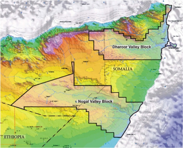
The Nogal Valley and Dharoor Valley Blocks situated in northern Somalia cover the Nogal Basin and the Darin Basin, respectively.
Combined, the two blocks cover a very large area, with the Nogal Valley Block extending over approximately 12,849,479 acres, which encompasses the Nogal Basin. The Dharoor Valley Block extends over an area of 7,166,056 acres, encompassing the entire Darin Basin. These areas are very large and, with only 5 wells drilled, the area remains one of the least explored areas in North Africa.
The Nogal Basin covered by the Nogal Valley Block has been identified as having reservoir, source rock and trap potential. International oil and gas companies conducted exploration in the late 1980's in the region. During this exploration phase, a grid of 2D seismic was shot perpendicular to the axis of the rift system in the Nogal Basin. Based on interpreted maps this data shows a number of large, closed, fault-controlled structures.
In addition, surface geology identified a number of oil seeps along the main basin-bounding faults.Several wells drilled on the identified structures encountered numerous oil shows, however, the wells Nogal-1 and Kalis-1 did not reach the main exploration target.
The limited information indicates that reservoir quality rocks are present within the Nogal Basin. Of the five wells drilled in the Nogal Basin, images of partial well logs are available for two wells (Nogal 1 and Kalis-1). The drilling reports for these two wells indicated that the Jurassic sandstone targets were not reached but that oil shows were found in some of the shallower sandstones. Nogal --1 was drilled to a depth of 10,736 feet in 1990. Kalis-1 was drilled to at least a depth of 5100 feet in 1990 according to log images. The original plan for Kalis-1 was to drill it to a depth of 14,850 feet.
Surface seeps of oil, as well as oil shows reported in several exploration wells drilled by previous operators in the area, indicate that the source rocks have generated hydrocarbons and that they have migrated through the system. There is not enough data yet to determine if trap formation predates hydrocarbon migration, however.
The indications from the limited number of wells drilled in the basin are that the basin appears to be oil-prone.
RRS Price at posting:
0.0¢ Sentiment: Buy Disclosure: Held