***Add to this thread if you have greater accuracy or have tracked down other exploration leases****
A bit off topic but hopefully this thread helps everyone find exactly where these deposits are on Google Earth. Just input the Latitude and Longitude coordinates into Google Earth.
Im doing Beebyn and Western Creek as well at the moment. A little bit lower accuracy however than the following. Anyways the following is a start. Yerecoin should be no issue at all.
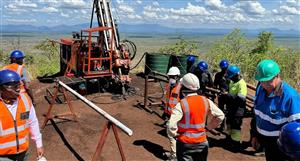
Compare the following to Giralia's own imagery in its presentations.
#Mt Webber (high accuracy):
Main resource
Latitude: 21?31'46.78"S
Longitude: 119?18'32.42"E
#Atlas Iron Mt Webber (high accuracy)
Main resource
Latitude: 21?32'21.47"S
Longitude: 119?17'21.00"E
#McPhee Creek (high accuracy)
Crescent Moon Mesa
Latitude: 21?35'3.98"S
Longitude: 120? 8'32.35"E
Main Range Southern Testing
Latitude: 21?35'15.29"S
Longitude: 120? 6'30.89"E
Main Range Northern Testing
Latitude: 21?33'28.68"S
Longitude: 120? 8'11.35"E


Add to My Watchlist
What is My Watchlist?