I know it has been said many times but it's important to look at what we have as well as what we have coming up with the drill at PPL 267....
PPL 265
PPL 265 is adjacent to the Indonesian border on low-lying, grassland and forested terrain, southwest of the Fly River.
The licence covers 16,174 km2 or about 3.9 million acres and is located on the Morehead subbasin of the Fly Platform on the Papuan Basin.
8 identified leads.
Foreland gas and oil play in Morehead Graben.
Gas shows in Mata-1.
2009 aerogravity and magnetic survey delineates likely source areas.
Late 2010 seismic program to firm drilling target for 2011.
PPL 266
This licence covers 8,173 km2 or about 2 million acres and is generally flat and heavily wooded.
There is an extensive network of rivers including the Fly and Strickland rivers as well as Lake Murray.
The river port of Aiambak and numerous logging roads provide improved access for exploration.
1 drillable prospect.
16 leads defined by seismic.
Northeast corner of block high graded due to recent gas discoveries on trend at Douglas-1 and Puk Puk-1
Previous wells drilled by Conoco intersected hydrocarbons in Juha Member (Ieru Formation) sandstones, but intersected 30 m of water-saturated reservoir in the second, down-dip well.
Seismic was acquired in conjunction with Talisman Niugini in northeastern PPL 266 during 1Q 2010.
New regional aero-gravity data suggests likely hydrocarbon migration pathways into PPL 266.
PPL 267 The licence covers approximately 7,695 km2 or about 1.9 million acres.
The terrain is flat and heavily forested and is traversed by a network of logging roads.
The logging towns of Kamusi and Panakawa provide good bases for logistic support during exploration programs.
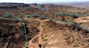
100 km trend of hydrocarbon seeps identified.
35 API oil from Panakawa seep identifies new oil play in foreland.
Panakawa Prospect, surface seep flowing at 5 bbls/ day.
2008 seismic acquired over Panakawa Prospect confirmed a drilling target for 2Q 2010.
Rig site preparation and logistic movements underway
Rig contract with Australian Drilling Services being finalised.
PPL 268
PPL 268 is bound to the west by the Fly River which here forms the border with Indonesia.
This licence covers 3,751 km2 and lies south of the Elevala, Ketu and Stanley discoveries.
The presence of logging roads provides greater access to the area.
Potential reservoir targets are the Alene Member (Ieru Formation) and the Toro Formation sandstones.
Sparse seismic control.
18 leads identified.
Southern margin of Cecilia Trough gas kitchen.
Reservoir potential upgraded by recent Puk Puk-1 and Douglas-1 gas discoveries on trend.
Seismic program and well planned for 2010.
Commercial farmout terms with whollyowned subsidiary of Talisman Energy Inc.
PPL 269
PPL 269 occupies an area of 8,995km2 in the Western Province straddling both foreland and foldbelt structural terranes. South of the foldbelt elevations vary from 600m in the Tarim area to 50m in the southern part of the permit.
Kiunga has an international port linked to Tabubil and the Ok Tedi Mine by a well-maintained road that runs through western PPL 269.
This licence has 5 drillable prospects and adjacent licences contain major wet gas discoveries including Hides (9.6 TCF GIIP), Juha (1.5 TCF GIIP) and Pnyang (1.2 TCF GIIP).
34 leads identified.
Oil potential in west and wet gas potential throughout.
The Stanley Gas Development may extend into PPL 269.
Seismic and well in 2010.
Commercial farm out terms with a wholly-owned subsidiary of Talisman Energy Inc. PPL 277
The licence covers approximately 8,022 km2 or about 2 million acres and is located in the central Highlands of PNG.
The majority of the licence is in the Papuan Foldbelt which is high mountainous terrain. The licence lies immediately north of the Kutubu, Moran and Gobe/SE Gobe Oil Fields.
13 leads identified.
Oil and gas condensate potential.
Prospectivity in the licence is dependent upon the development of a distal Toro Formation reservoir.
2008 fieldwork identified new seeps at the SE Wage Lead.
Six petroleum prospecting licences spanning 52,000 km2
Two farmed out to Talisman under favourable conditions.
Panakawa prospect alone is Mean 202 mmbbl and P90 24 mmbbl
Following Panakawa is a follow up drill possible......
In addition, a new lead has been delineated approximately 10 km from the Panakawa drilling location. Mapping suggests that areal closure of the Panakawa North Lead is approximately 60% of that mapped at Panakawa.. This lead provides a potential follow up drilling opportunity for NGE in a location accessible via existing logging tracks.
Honestly why would you sell ????
NGE Price at posting:
19.5¢ Sentiment: Buy Disclosure: Held
A personalised tool to help users track selected stocks. Delivering real-time notifications on price updates, announcements, and performance stats on each to help make informed investment decisions.


 (20min delay)