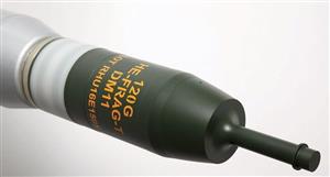
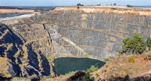
ASX Announcement 5 July 2018 Columbus Marsh Lithium Brine Project Adds Another Brine Zone Caeneus Minerals Ltd (“Caeneus” or “the Company”) is pleased to provide the following update regarding the Company’s drilling activities at its 100% owned Columbus Marsh Lithium Brine Project located in Nevada, USA. Second Lithium Brine Discovery at Columbus Marsh The Company is pleased to announce the successful completion of the final assay processing from the initial exploratory drilling program at its Columbus Marsh Project. The completed drilling data has identified a second lithium-enriched brine zone and allowed the Company to develop a full profile of the lithium brines discovered within the shallow aquifers at the Company’s property in Nevada. Highlights: • Discovery of the Mid Zone lithium-enriched brine zone beneath the previously announced Upper Zone discovery level. • Three distinct lithium-enriched zones have now been confirmed at the Project. • The latest discovered Middle Zone hosts a brine aquifer containing anomalous lithium concentrations up to 42.1 mg/l (182 ppm LCE) over a thickness of 138.46 meters (450 feet). • Highly anomalous Lithium within basin sediments from surface to 400 meters (1,320 feet) depth, of between 296 ppm Li and 1000 ppm Li (1,575 – 5,323 ppm LCE), with an average of 566.62 ppm (3,016.13 ppm LCE). • Given the significance of the discovery at Columbus Marsh, the Company is planning a follow-up drilling program to further test and delineate these lithium deposits. Columbus Marsh: In September 2017, the Company announced the discovery of highly anomalous concentrations of lithium brines within a shallow aquifer at the Columbus Marsh Project. Lithium bearing brines were intersected at a depth of 79.25 meters (260 feet) and continued to a depth of 103.63 meters (340 feet) resulting in a width of the aquifer of 24.38 meters (80 feet). Assay of the brine returned a high of 95.9 mg/l lithium (420.6ppm Li2CO3 equivalent or LCE*) with a minimum assay of the same brine returning 56.3mg/l lithium (258.5ppm LCE*). The brine also assayed up to 3,670mg/l potassium and 1,100mg/l boron, indicating strong potential for economic concentrations of multiple commodities. The brine was confined in the aquifer hosted by a sequence of clay, salt and tuff. It is expected that the tuff would be relatively permeable, similar to the lithium producing tuff aquifer at the Clayton Valley operations. (The Columbus Marsh property is situated 40 kilometres northwest of the Clayton Valley lithium brine operations). The Columbus Marsh maximum assay is almost 50% higher in concentration than lithium brines previously processed at Searles Lake, California (65ppm lithium). The initial exploratory drill hole was drilled near the centre of the Company’s leases which cover an area of 3,280 acres (1,327.37 hectares), indicating potential for considerable volumes of lithium-rich brine. Drilling of this initial hole has been successfully completed to the target depth of 400 metres (1320 feet). Progress on this hole was hampered by wet and unfavourable weather conditions at the beginning of the drill program and by difficult ground conditions characterized by unconsolidated sediments in the stratigraphic sequence beneath the basin surface. Drilling, sampling and laboratory analysis has identified three distinct lithium-bearing zones in the subsurface of the Columbus Marsh claims. Drilling at Columbus Salt Marsh, September 2017 Upper Zone. The Upper Zone is, as described in the September announcement, a significant new lithium deposit discovery. Lithium-rich brine occurs within a complex sequence of clay, salt and carbonate sediments. Subsequent laboratory analysis of drill cuttings from this zone shows anomalous lithium in sediments, averaging 560 ppm (1,669.3 ppm LCE) and ranging from 310 ppm to 930 ppm (1,650.1 - 4,950.4 ppm LCE). Middle Zone. The Middle Zone is a 138.46 metre (450 feet) thick, porous clay formation that is host to a lithium-bearing, high-density brine that is distinctly different from the Upper Zone brine. Recently discovered lithium concentrations in the Middle Zone average 37mg/l and range from a low of 25.8 mg/l (122.6 ppm LCE) to a high of 42.1 mg/l (182.97 ppm LCE). Water flows in this zone were measured up to 208.45 litres (55 gallons) per minute. Anomalous lithium concentrations are present in the formation drill cuttings ranging from 296 ppm (1,575 ppm LCE) to 1,000 ppm (5,323 ppm LCE) lithium and average 602 ppm (3,204.45 ppm LCE) over the entire 450-foot thick Middle Zone. Lower Zone. Below a depth of 255.38 metres (830 feet) the drill intersected soft, saturated black clay in the so-called Lower Zone where air and drilling fluid circulation was lost. The drill hole was subsequently advanced to the target depth by employing conventional mud rotary drilling techniques. This aquifer zone hosts saline groundwater which contains comparatively low but anomalous lithium concentrations. Brine samples collected from the interval between 255.38 metres (830 feet) and 310.77 metres (1010 feet) contained lithium concentrations ranging from a low of 6.0 mg/l to a high of 13.0 mg/l. The drillhole was not accessible below this depth. Drill cuttings from this zone show anomalous lithium concentrations ranging from 480 ppm to 610 ppm (2,555 to 3,247 ppm LCE) with an average of 537 ppm (2,858.5 ppm LCE) through the entire Lower Zone. * Note: Lithium concentration is converted to Li2CO3 or Lithium Carbonate Equivalent (LCE) by multiplying by 5.323. LCE conversions between mg/l and ppm are compensated for brine specific gravity. For and on behalf of the Board Johnathon Busing Company Secretary Competent Person Statement The information in this announcement that relates to Exploration Results, Mineral Resources or Ore Reserves is based on information compiled by Mr. Robert Allender who is a Certified Professional Geologist (CPG) and Member of the American Institute of Professional Geologists. Mr. Allender is principal consultant with Eagle Global Resources and is independent of Caeneus Minerals. Mr Allender has sufficient experience which is relevant to the style and type of deposit under consideration and to the activity which he is undertaking to qualify as a Competent Person as defined in the 2012 edition of the Joint Ore Reserves Committee (JORC) Australasian Code for Reporting of Exploration Results, Minerals Resources and Ore Reserves. Mr Allender consents to the inclusion in the announcement of the matters based on his information in the form and context in which it appears. Appendix 1: Caeneus Minerals Ltd, Columbus Marsh Project – RC Drilling - JORC Code 2012 Section 1: Sampling Techniques and Data Criteria JORC Code explanation Commentary Sampling techniques • Nature and quality of sampling (eg cut channels, random chips, or specific specialised industry standard measurement tools appropriate to the minerals under investigation, such as down hole gamma sondes, or handheld XRF instruments, etc). These examples should not be taken as limiting the broad meaning of sampling. • Include reference to measures taken to ensure sample representivity and the appropriate calibration of any measurement tools or systems used. • Aspects of the determination of mineralisation that are Material to the Public Report. • In cases where ‘industry standard’ work has been done this would be relatively simple (eg ‘reverse circulation drilling was used to obtain 1 m samples from which 3 kg was pulverised to produce a 30 g charge for fire assay’). In other cases more explanation may be required, such as where there is coarse gold that has inherent sampling problems. Unusual commodities or mineralisation types (eg submarine nodules) may warrant disclosure of detailed information. • - - Water samples were collected at roughly 20’ intervals. Standard methods for the examination of water and wastewater, online edition. Methods for determination of organic compounds in drinking water, EPA-600/4-79-020 and test methods for evaluation of solid waste, physical/chemical methods (SW846) third edition. Samples analysed by methods EPA 300.0, EPA 300.1 and EPA method 9223B. Water samples were analyzed by method EPA 200.7 for trace metals (by ICP-OES); EPA 300.0 for anions (chloride and sulfate); and for general chemistry by SM 2710F, SM 2340B; SM 2320B; SM 2540C; SM 2510B Drilling techniques • Drill type (eg core, reverse circulation, open-hole hammer, rotary air blast, auger, Bangka, sonic, etc) and details (eg core diameter, triple or standard tube, depth of diamond tails, face- sampling bit or other type, whether core is oriented and if so, by what method, etc). • Reverse circulation dual tube buggy mounted air drill. Rig pipe is 4 inch matrix with 2.125 inch inner tube in 10 foot lengths for portability. Bottom hole assembly was a journal bearing soft gormatiin bored and skirted tricone bit attached to a matrix face sampling style bladder sub. Drill sample recovery • Method of recording and assessing core and chip sample recoveries and results assessed. • Measures taken to maximise sample recovery and ensure representative nature of the samples. • Whether a relationship exists between sample recovery and grade and whether sample bias may have occurred due to preferential loss/gain of fine/coarse material. • Samples of chips were taken at 5-foot intervals, while water samples were taken at 20 foot intervals. Chips were bagged and chip tray was filled with each interval to match bag. Volumes of recovery were not calculated. • Heavy viscous quik gel bentonite and ez mud polymer were constantly pumped down backside of bore hole from surface through 80 feet of casing to minimize sample contamination from upper zones in borehole. • Bore hole brine samples were taken from air cyclone during drilling process. Drill progress was not halted for sampling as hole collapse and or sluffing of upper zone could occur with resultant contamination and or stuck drill string. Once a rod was drilled, the rig circulated with air for a sufficient time as to remove rig-water and other contaminants (chips) from the formation waters before a sample was taken. • When experiencing low volumes of chip return, foam product was pumped downhole to help bring chips to surface. • Minor chip sample bias when drilling unconsolidated silts and clays. Fines stay suspended within rig water/formation waters, and do not typically collect in the bottom of the sample bucket. Fine sieves (200 mesh) were routinely used to check for fines for logging purposes. Logging • Whether core and chip samples have been geologically and geotechnically logged to a level of detail to support appropriate Mineral Resource estimation, mining studies and metallurgical studies. • Reverse circulation drill chips were geologically logged. • Qualitative descriptions of lithology, colour, texture, grain size, alteration, mineral/grain modal percentages, hardness, rounding, Criteria JORC Code explanation Commentary • Whether logging is qualitative or quantitative in nature. Core (or costean, channel, etc) photography. • The total length and percentage of the relevant intersections logged. sorting, etc., are recorded for each chip sample interval. • Drillhole CSM17-01 was logged in its entirety from the surface to a total depth of 400 metres. Sub- sampling techniques and sample preparation • If core, whether cut or sawn and whether quarter, half or all core taken. • If non-core, whether riffled, tube sampled, rotary split, etc and whether sampled wet or dry. • For all sample types, the nature, quality and appropriateness of the sample preparation technique. • Quality control procedures adopted for all sub- sampling stages to maximise representivity of samples. • Measures taken to ensure that the sampling is representative of the in situ material collected, including for instance results for field duplicate/second-half sampling. • Whether sample sizes are appropriate to the grain size of the material being sampled. • All samples were taken from cyclone through wet rotating splitter as injection water and chemicals were utilized during entire hole. • Chip sample buckets washed thoroughly between each 5-foot interval. • Water samples were caught in a 5-gallon plastic pail under the cyclone, once sufficient circulation had removed cuttings and other sources of contamination. The buckets were washed with distilled water between each sample. Flow rates were calculated using a stop watch. Samples were metered immediately upon surfacing within the pail. • Water samples intended for lab analysis were taken every 20 feet. Once field metered, they were left for 10 to 15 minutes to settle out sediments to further reduce contamination. Sample bottles were provided by WETLAB of Sparks, Nevada, of whom analyzed the samples. Bottles A, and B were taken for each individual sample. A was for general chemistry, B for metals chemistry. Once bottles were filled the “B” bottle was preserved with 0.5 ml of HNO3. Bottles were kept in a cooler on site, until brought to a refrigerator to be kept at 4oC. All samples were delivered to the lab within the 7- day holding period required for accurate TDS results. • Distilled blanks were 10% of analyzed water samples, while water duplicates are ~7% of total analyzed samples. Quality of assay data and laboratory tests • The nature, quality and appropriateness of the assaying and laboratory procedures used and whether the technique is considered partial or total. • For geophysical tools, spectrometers, handheld XRF instruments, etc, the parameters used in determining the analysis including instrument make and model, reading times, calibrations factors applied and their derivation, etc. • Nature of quality control procedures adopted (eg standards, blanks, duplicates, external laboratory checks) and whether acceptable levels of accuracy (ie lack of bias) and precision have been established. • Formation water samples were taken every 20 feet and field parameters were taken with a YSI 556 MPS meter. This meter was calibrated on June 12, 2017 by Silverstate Analytical Laboratories in Las Vegas, Nevada. A daily calibration check was done by testing the rig water, to ensure nearly identical values to previous days were maintained. • Field duplicates of chip samples are 5% of the total to be analyzed. • Distilled blanks were 10% of analyzed water samples, while water duplicates are ~7% of total analyzed samples. • At this early point in exploration, WETLAB’s QAQC protocols for assay data were largely relied upon. Verification of sampling and assaying • The verification of significant intersections by either independent or alternative company personnel. • The use of twinned holes. • Documentation of primary data, data entry procedures, data verification, data storage (physical and electronic) protocols. • Discuss any adjustment to assay data. • Not applicable • Not applicable at early stage of exploration. • Sample data was collected in the field, and data entry / validation will be done in the office by appropriate geological personnel. • No assay data adjustments have been done. Location of data points • Accuracy and quality of surveys used to locate drill holes (collar and down-hole surveys), trenches, mine workings and other locations used in Mineral Resource estimation. • Specification of the grid system used. • Quality and adequacy of topographic control. • A handheld Garmin GPSMap 62Cs unit on coordinate system UTM NAD 83, Zone 11 was used to survey in drill collars. This had an accuracy of +/- 9 feet. Data spacing • Data spacing for reporting of Exploration Results. • Whether the data spacing and distribution is sufficient to establish the degree of geological and grade continuity appropriate for the Mineral • Water samples were collected every 20 feet downhole where present. It is too early to determine if a resource or reserve is present. Criteria JORC Code explanation Commentary and distribution Resource and Ore Reserve estimation procedure(s) and classifications applied. • Whether sample compositing has been applied. Samples were not composited. Orientation of data in relation to geological structure • Whether the orientation of sampling achieves unbiased sampling of possible structures and the extent to which this is known, considering the deposit type. • If the relationship between the drilling orientation and the orientation of key mineralised structures is considered to have introduced a sampling bias, this should be assessed and reported if material. • Not applicable, as the presence of structures in the subsurface was not determined. Sample security • The measures taken to ensure sample security. • Water samples always held by company geologist until delivery to laboratory. Audits or reviews • The results of any audits or reviews of sampling techniques and data. • No audits have been completed to date, but both in-house and laboratory QAQC data will be monitored in a batch by batch basis. All protocols have been internally reviewed. Section 2: Reporting of Exploration Results Criteria JORC Code explanation Commentary Mineral tenement and land tenure status • Type, reference name/number, location and ownership including agreements or material issues with third parties such as joint ventures, partnerships, overriding royalties, native title interests, historical sites, wilderness or national park and environmental settings. • The security of the tenure held at the time of reporting along with any known impediments to obtaining a licence to operate in the area. • A group of placer claims held under option by Caeneus Minerals Ltd (CSM1-6, CSM27-36, CSM e1-e3, CSM1W & 5W; refer to last quarterly report for claims list and details). • The tenure is secure and in good standing at the time of writing. Exploration done by other parties • Acknowledgment and appraisal of exploration by other parties. • There has been very little recent sampling of aquifers or brines at depth within Columbus Valley. Geology • Deposit type, geological setting and style of mineralisation. • Caeneus Minerals Ltd is exploring for lithium bearing brines within Columbus Valley, which is a restricted, evaporitic, pull-apart basin in west-central Nevada. Drill hole Information • A summary of all information material to the understanding of the exploration results including a tabulation of the following information for all Material drill holes: o easting and northing of the drill hole collar o elevation or RL (Reduced Level – elevation above sea level in metres) of the drill hole collar o dip and azimuth of the hole o down hole length and interception depth o hole length. • If the exclusion of this information is justified on the basis that the information is not Material and this exclusion does not detract from the understanding of the report, the Competent Person should clearly explain why this is the case. • Appropriate information has been included in the report. • Drill hole collars were surveyed in with a Garmin GPS Map 62Cs, which had an accuracy of +/- 9 feet. • Coordinates were taken in UTM NAD 83, Zone 11. • Drill hole CSM17-01 collar location: Easting: 415,818mE; Northing: 4,216,801mN; Elevation: 4,519 fts ; Depth: 1320 ft • Hole dips were -90o; negating azimuth Data aggregation methods • In reporting Exploration Results, weighting averaging techniques, maximum and/or minimum grade truncations (eg cutting of high grades) and cut-off grades are usually Material and should be stated. • Where aggregate intercepts • All results listed are as obtained. No cut-offs were used and no aggregation of values. • No data aggregate methods were applied to the results. Criteria JORC Code explanation Commentary incorporate short lengths of high grade results and longer lengths of low grade results, the procedure used for such aggregation should be stated and some typical examples of such aggregations should be shown in detail. • The assumptions used for any reporting of metal equivalent values should be clearly stated. Relationship between mineralisation widths and intercept lengths • These relationships are particularly important in the reporting of Exploration Results. • If the geometry of the mineralisation with respect to the drill hole angle is known, its nature should be reported. • If it is not known and only the down hole lengths are reported, there should be a clear statement to this effect (eg ‘down hole length, true width not known’). • No drilling was completed to enable any relationship between mineralisation width and intercept lengths. • Drilling was completely exploratory, with intension of correlating geophysical data to rock chips, and water salinities for further exploration. Diagrams • Appropriate maps and sections (with scales) and tabulations of intercepts should be included for any significant discovery being reported These should include, but not be limited to a plan view of drill hole collar locations and appropriate sectional views. • Appropriate diagrams are included in the report. • Comprehensive reporting of all results Balanced reporting • Where comprehensive reporting of all Exploration Results is not practicable, representative reporting of both low and high grades and/or widths should be practiced to avoid misleading reporting of Exploration Results. • All sample results are reported where significant. Other substantive exploration data • Other exploration data, if meaningful and material, should be reported including (but not limited to): geological observations; geophysical survey results; geochemical survey results; bulk samples – size and method of treatment; metallurgical test results; bulk density, groundwater, geotechnical and rock characteristics; potential deleterious or contaminating substances. • No other relevant data has been reported. Further work • The nature and scale of planned further work (eg tests for lateral extensions or depth extensions or large-scale step-out drilling). • Diagrams clearly highlighting the areas of possible extensions, including the main geological interpretations and future drilling areas, provided this information is not commercially sensitive. • Appropriate information has been included in the report.
ASX Announcement 5 July 2018 Columbus Marsh Lithium Brine...


Add to My Watchlist
What is My Watchlist?
 (20min delay) (20min delay)
|
|||||
|
Last
0.1¢ |
Change
0.000(0.00%) |
Mkt cap ! $6.197M | |||
| Open | High | Low | Value | Volume |
| 0.1¢ | 0.1¢ | 0.1¢ | $5 | 4.907K |
| MTL (ASX) Chart |