N.T -Wet Season is looming -One to watch.
Australian Chart Summary
Wednesday - Latest
A broad region of low pressure is triggering widespread showers and thunderstorms over WA, SA, VIC and NSW. A large cold front is producing a gusty cool change to SA, VIC and southern NSW. High pressure is the southwest and northeast is bringing settled weather.
Thursday 22:00 EDT
A broad trough will move into northern QLD, the NT and WA, triggering showers and thunderstorms. A large high pressure system in the south should bring a sunny day to most of SA, VIC and NSW. Cooler southerly winds may bring a few showers to northern NSW and southeast QLD.
Friday 22:00 EDT
A low pressure trough in the north and west will produce thunderstorms. Another trough over QLD will also generate storms, mainly about central and eastern parts. A cold front will cross TAS, bringing showers. High pressure looks to bring a settled day across SA and NSW.
Saturday 22:00 EDT
A low pressure trough in the west will deepen and generate heavy showers and storms. Another trough over QLD will also trigger thunderstorms, some heavy. Onshore winds along the QLD coast will cause a few showers. High pressure will bring a sunny day to SA, VIC and NSW.
Sunday 22:00 EDT
A low pressure trough across WA could produce showers and thunderstorms, some intense inland. Another trough over QLD should generate showers and storms, mainly north. Onshore winds may bring showers to northern QLD. A weak high should lead to settled conditions in the southeast.
Monday 22:00 EDT
A trough could produce thunderstorms over eastern parts of the NT, western QLD and northwest NSW. Another trough in the west and south look to trigger thunderstorms, while pushing warm air over western NSW and VIC. Onshore winds may bring a few showers to coastal QLD.
Tuesday -Hope thats Not the bloody monsoonal trough forming -any one have any idea of the grounds elevation, hoping access off Stuart High Way & Driil pads are elevated enough relative to the surrounding to enable sufficient run off & access for the rig to complete their program- certainly cutting it a bit fine given the stated one month duration time, was hoping the CLC would have completed their heritage survey earlier than they did -apparently they have a big project surveying the Gas pipe line that runs along the Tanami Road & are snowed under.
gltah - salt
- Forums
- ASX - By Stock
- Ann: DRILLING CONTRACTOR APPOINTED, DRILLING TO COMMENCE
N.T -Wet Season is looming -One to watch.Australian Chart...
-
- There are more pages in this discussion • 21 more messages in this thread...
You’re viewing a single post only. To view the entire thread just sign in or Join Now (FREE)
Featured News
Add GLA (ASX) to my watchlist
 (20min delay) (20min delay)
|
|||||
|
Last
1.7¢ |
Change
-0.001(5.56%) |
Mkt cap ! $12.89M | |||
| Open | High | Low | Value | Volume |
| 1.8¢ | 1.8¢ | 1.4¢ | $16.16K | 966.7K |
Buyers (Bids)
| No. | Vol. | Price($) |
|---|---|---|
| 1 | 344700 | 1.7¢ |
Sellers (Offers)
| Price($) | Vol. | No. |
|---|---|---|
| 1.8¢ | 50000 | 1 |
View Market Depth
| No. | Vol. | Price($) |
|---|---|---|
| 1 | 344700 | 0.017 |
| 1 | 671868 | 0.016 |
| 1 | 200000 | 0.014 |
| 3 | 485333 | 0.012 |
| 3 | 349900 | 0.010 |
| Price($) | Vol. | No. |
|---|---|---|
| 0.018 | 50000 | 1 |
| 0.020 | 548206 | 2 |
| 0.022 | 409947 | 2 |
| 0.023 | 150000 | 1 |
| 0.024 | 200000 | 1 |
| Last trade - 15.54pm 21/06/2024 (20 minute delay) ? |
Featured News
| GLA (ASX) Chart |
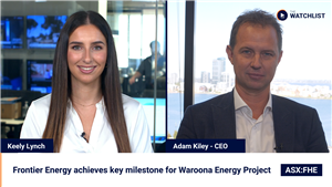
The Watchlist
FHE
FRONTIER ENERGY LIMITED
Adam Kiley, CEO
Adam Kiley
CEO
SPONSORED BY The Market Online


