Best way of determining elevations is to throw away Google maps and look at a contour map like this:
Here you can see that "Thunder Ridge" is actually a short spur sloping downward to the NNE. It is almost perpendicular to the drilled out LB main ridge. That short track out to a planned drill hole may not actually exist yet as it is not on earlier maps of the area. It is/will be cut for access to the drill hole [yellow] already planned for out there.
The track junction, about 50 metres East of hole MDPD-011, is about 1590 metres elevation AMSL. The planned drill hole at the end of the track will begin at about 1540 metres AMSL. The track is/will be about 200 metres long. So in 200 metres the road drops 50 metres [or 165 feet]. The average gradient of the road [and the spur] is 1 in 4 down from the junction to the planned hole. You might need a tracked vehicle to travel down the hill. Immediately to the West of the road is a small watercourse, according to the contours.
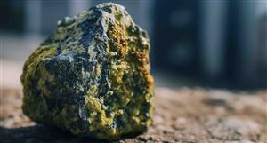
Mineralised out there? I have no opinion.
While I'm here, could I also point out respectfully that it is San Simon. San is the male form of 'Saint'. Female saints are "Santa", as in Santa Rosa. Sam Simon is somebody else.