Last year they put in some 40Kms out to Mawson in 5 days (one pass of sentinel 5 days not there then there for the access). Then Caird Shackleton cutoff to main access another 20 Kms. Surprised me at the time but at last year's AGM talked to the site geo - flat, limited vegetation makes it relatively easy and quick. Maybe a little patch up from the rains and 20Ks out to Perce only issue might be sand and dunes.
Other than having to deal with Lake Mackay prospective geology goes onto AMN ground. They have a strong magnetic high that looks similar to Sambahr and Urmia on WA1 ground. Probably a BIF of Reynolds Range age (1770 My) though the proximity of Sambahr to Luni has raised the possible connection with carbonatite (
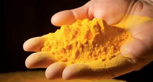
@ozblue). One vague possibility is they are Iron ore Apatite bodies like Kiruna where low level REEs become economic as a by product of Iron ore mining
(e.g. Per Geijer)I had registered Tali's interest in WA1 from the 'vending' of the tenements. Rare to get so well rewarded but one of the reasons most are in the casino of the stock market. Family connections AMN/WA1...
======================
Haven't done too much in the south part of the west Arunta until recently when I started following RCR's evolving IOCG and Luni look alike gravity.
Much more in the north though pretty cursory until more recently. FWIW here's something to add to your overloaded bra
@JandJ@Wack commented about the pending ENR tenements north of Aileron last year and this led me to look at the geology to the north.
This post covers aspects of that and has a link to my first post replying to
@Wack.
Stitched geology maps and rough interp.

Slight update to the map in the post to show location of LYN and CUF area of interest.
My initial impression was the basinal sediments north of the "Rift"/'Graben' [ Hidden Basin Beds(HBB), Murraba Basin MB), and Canning Basin] were likely to put cover over the basement that would be too thick to explore through. Further the age was probably too young especially for the MB (c1100Mya) and CB sediments.
The HBB beds are the subject of debate as to where they fit into the stratigraphic sequence. If the 1570-1590 age is correct then that date corresponds with the Chewings Orogeny and is similar to the age of the single point in ENR's drill hole EAL1. Perhaps the same age but very different beast to the granitic intrusive at Hoschke. Satellite imagery of the outcropping sediments shows well bedded units and local impressive folding.
Recently I began looking at the LYN/CUF area and was surprised to see BHP (1983) drilled shallow holes into ga**bbro and diorite which are the hosts for some of the magnetic anomalies, other holes are into metasediments which may be HBB related.
There is no outcrop mapped (1970s vintage) or any obvious on satellite (GE/ESRI) in the area of the magnetic targets of LYN/CUF that I could spot. To the west is a prominent ridge mapped as CB sediments.

Perhaps there is a raised basement block in the area. If so the magnetics are a bit different to the Aileron area.

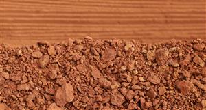
Most of the magnetics are muted and perhaps under some cover. The stronger highs are locally covered by <10m of sand/silcrete residuals.
They will find out what is going on with the upcoming drill programs.
One possibility is an irregular basement topography with variable cover. At worst like atolls in the Pacific Ocean is an analogy I have used before. As long as much of it is only 50-100m thick (or less) there shouldn't be much problem to explore with AC/RC.
[Newmont followed up a GSWA Au in soils anomaly to the east but couldn't get through the overlying sediments. Also access was problematic there needing helicopter support at the time.]
50 plus year sectional interpretation for the Stansmore 1:250K geology sheet.
May not need a raised block if the basement HBB contact is dipping south then the basement would daylight to the north. Consistent with BHP's 1983 test holes for diamonds.
 @Black Cat
 has posted some useful info on LYN.
====================
I have mentioned this publication before Joly et al 2013. Worth a read for the ENR/WA1 to IOCG area to the south (effectively the NE corner of the GSWA's Mt Webb 250K geology sheet.).
===============
Can't resist a comment about the benefit of having a deposit on your side of the Fenceline.
The MC difference shows how important it is.
Being first mover is another plus, as I suspect something similar to Luni will not get the same valuation by the market. Definitely an increase but 20c to $20 (and who knows where from there) is IMO unlikely.
SOI also impacts.
Very happy to see the concept tested and proven wrong.
Perce dripping copper, REE and Au.....please.


 (20min delay)