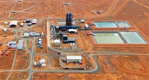
Ground Gravity Survey, Beadell Project (WA)
The directors of Scimitar Resources Limited (ASX Code: SIM) are pleased to announce the
commencement of a ground based gravity survey at the company’s 80% owned Beadell Project in
the eastern Pilbara region of Western Australia.
The survey, covering 10km2 is being conducted by Haines Surveys, and is targeting two significant
EM anomalies. It will comprise 1120 gravity stations, on 200m line spacings with gravity readings
taken at 50m stations along the lines
The Beadell Project covers 468 km2 in the south-east of the Rudall Complex, some 450 km east of
Newman in Western Australia. The project comprises two granted exploration licences and two
exploration licence applications. The Rudall Complex is a belt of metamorphic and igneous rocks
that are comprised of various types of gneiss, metasedimentary and mafic-metavolcanic rocks, plus
ultramafic, mafic and felsic intrusive rocks.
The Late Proterozoic unconformity between the Rudall Metamorphic Basement and younger
sandstones is considered prospective for PGE, copper, gold and uranium mineralisation, similar to
the unconformity related Kintyre uranium deposit at the western end of the Rudall Complex. It is
also similar to the Mt Cotton Base metal and uranium occurrence, located 5 km to the west of
Scimitar’s licences.
Regional mapping and sampling programs undertaken by Scimitar and were then followed up by a
heliborne electromagnetic (HoistEM) survey. This identified the two significant EM anomalies which
are the targets of the current survey. Located within the Connaughton Syncline, 10 km to the east
of Mt Cotton, both of the EM anomalies are of significant size and are present to a depth of 200m
below the ground surface.
Scimitar is also currently undertaking a TEMPEST airborne electromagnetic survey over the parts
of the Connaughton Syncline within its licence area. The survey, comprising 412 line kilometres is
being undertaken by Fugro Airborne Surveys and will be completed on 200 metre line spacings.
This program is being conducted and funded within a much larger survey initiated by Geoscience
Australia as part of the Federal Government’s Onshore Energy Security Program (OESP). This
government EM program will cover the entire Patterson Province on one to two kilometre line
spacings and is aimed to provide data that will be of use in the assessment and potential discovery
of onshore energy resources, such as uranium.
Scimitar’s infill TEMPEST EM program and the ground gravity survey will assist the Company’s
understanding of the targets and assist in targeting future ground based exploration and drilling
programs within the Beadell Project
SIM
scimitar resources limited
Ground Gravity Survey, Beadell Project (WA)The directors of...


Add to My Watchlist
What is My Watchlist?