Okay where to begin...Apologies in advance as this is going to be a long post.
On review of the point I was going to make looks like
@horizon3 already kind of did it on the "Antimony exploration gains momentum at Windfall - Amended" thread. I don't think our numbers are dusters by any means, but they do appear all over the place which imo is consistant with other Antimony deposits i've looked at.
Disclaimer this is not a cross promotion by any means.
I have 5 companies in my Antimony watchlist, one is Summit, the others are Nagambie Resources (NAG), Great Northern Minerals (GNM), Southern Cross Gold (SXG), and Red River Resources (RVR). RVR is the owner of the Hillgrove mine near Armidale NSW (Not to be confused with Armadale WA) and currently isn't operating due to being liquidated. Thats a whole story in management making bad descisions in itself worth reading about.
Mr King even mentioned in one interview that Hillgrove is on the market at the moment. Given their existing processing plant infrastructure and reasonable proximity to both Windfall and Magwood it would be a nice play to take on if we get up and going but thats a whole speculation angle in itself and for another time and has nothing to do with the point I wanted to make.
Antimony exploration gains momentum at Windfall - Amended - Published 24/1/23.
"However, northeast of Munga Creek, some occurrences exhibited aneast-west orientation. All are vein-type occurrences of quartz and stibnite (ranging between20 – 60% Sb2S3) with breccia features commonly observed"
My interpretation of how this reads is that the outcropping mineralisation that they actually saw was estimated at 1/5th to 3/5ths Snibnite.
"Several outcrops of quartz breccia, up to three meters wide and 350 meters inlength, were identified."
I am not a geo, just a mere knuckle dragging auto repairer but I have spent considerable time over the years hiking up and down the dividing range, in various state forest and national parks. My time spent this far south wasn't that much but I have spent a fair bit more northerly around Dorrigo area, and much further north west around the Drake area and my non geo eyes remember seeing rock outcrops that had this strange greyish crystalish component in them veins similar to whats described in this annoucement. The point I make here is, in my own opinion, the rocks are definitely there, but the grading/quality might be hit and miss.
The results in the announcement yesterday are rock chips and soil samples. The table at the end of yesterdays announcement goes into detail of the methodology used to generate a chip sample.
Sampling Technique - Nature and quality of sampling - "Material from outcropping quartz veins waschipped with a mallet for investigation. Severalsubsamples within a metre of the parent samplewere combined to form a lab sample."
Sampling Technique - Include reference to measures taken toensure sample representivity and theappropriate calibration of any measurementtools or systems used - "Each sample is a composite of the initial samplelocation and several adjacent subsamplelocations (generally within 1m of the parentlocation)"
Drill Sample Recovery - Whether a relationship exists betweensample recovery and grade and whethersample bias may have occurred due topreferential loss/gain of fine/coarse material -"The rock chips were taken where mineralisationor other features of interest were identified.Rock chips are inherently biased towards thepresence of mineralisation."
So the take away from this is these results yesterday are in all honesty, just a selection of random chips sampled in a tight radius from a random outcrop of rock sticking out of the ground, guestimated to be 20-60% Snibnite by volume based on visuals.
Which brings me to the examples from the other companies I mentioned earlier.
Example 1 - Drilling results from RVR dated 4/1/21.
The drill samples were horizontal drills each for around 120-200m. Intersected various ranges of Antimony many many small hits at less than 1% but a handfull more at more than 5%. Their report also states it as 'Sb' which might be a misnomer, as it would not be pure Antimony it would most likely be Snibnite, which as
@horizon3 pointed out is 71-something% Sb in its purest form.
Example 2 - Drilling results from NAG dated 16/11/22.
Multiple intersections, but a much higher reported 'Sb' mineralisation. Due to the way these guys reports are writen, they don't have low % hits in the drilling table.
Also check out the drill results 25/8/22, those have more reported numbers. Again, mostly less than 2% but some standout intersections of 30,50,60%. Also in this report is a photograph showing Sb mineralisation within a quartz host. I have seen this style mineralisation myself when I have been out hiking.
Example 3 - Drilling results from SXG dated 1/6/23.
It is important to note that these guys are a big underground operation and that Antimony stops occuring alongside gold at a certain level below ground (can't remember how deep, was a long time ago I learnt about that). Theyve been doing extention drilling for some time and this announcement has a metre by metre breakdown of the Sb% assayed in the core over nearly 400m. The reported % swings around all over the place long periods of no Sb mineralisation, short periods of low less than 1% mineralisation, then tiny hits of 13-15% mineralisation.
I couldnt be bothered to find an example for GNM but the drill results ive read from them before have been sporatic levels of Sb as well.
So the whole point I am making is that, bearing in mind that all these companies I have mentioned are targeting Gold, with a side of Antimony on the side, have in their drill cores found the Sb mineralisation to be sporatic.
The results yesterday confirmed from random chunks of rocks on the surface, peak numbers of about 8.5%. In the assay table on page 3 you see that the average across the 12 rock chips comes in at 2.2%.
Thats on the surface. What numbers would we find if say we dropped a 10m vertical drill hole?
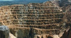
This entire district has had mining all over it at various times over the last 100 years. Its important to note that it has never had modern exploration or any recent drilling. Last diamond drilling was in the 60s. When it was mined previously it was mined by hand, in pits and shafts. Makes you wonder how much is really there.
https://nla.gov.au/nla.obj-1540905954/view?sectionId=nla.obj-1722428852&partId=nla.obj-1541196604#page/n62/mode/1up
That historic newspaper article covers the Munga Creek mine as referenced in an early Summit announcement.
Also a note for anyone genuinely interested, its worth considering the historic owner of this tenement before us was a company called Anchor minerals (AHR). They had both Windfall and ALSO Magwood, however under a different but never ended up pursuing them as they had another Antimony resource they were focusing on in the area that they even ended up generating a JORC resource on but they ended up being taken over and to the best of my understanding the tenement is still there in limbo until 2025. Its worthwhile looking them up and looking at their grades from Cattle Creek.
At any rate, the fellas at SUM obviously see upside in it or else they wouldnt have taken it on.So the whole point I am making is, that I believe our results are in fact comparible to other hits of Antimony made by other miners/explorers, and that yesterdays sell off was the result of narrow minded thinking and in conjunction with how the ASX generally copped a thrashing all day.
So in summary, I think our results are in line with results from other producers/explorers, and chip samples seem to be in line with historic chip samples taken by Anchor further north at Cattle Creek.
I am not a geologist. This is not financial advice. This is just sharing some of my own observations over the past 12 months or so ive been looking into this. Thanks for reading. This took a damn long time to write up.
Regards, OP.


 (20min delay)
