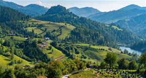
The Lidar images of the outcropping pegs but hidden by vegetation are the next news item I expect.
Then the geos can map and examine the whole strike of the peg and determine the zoning along strike and within the peg cross section.
Drilling is needed to determine dip and extent at depth, but from the excavations we have seen the pegs are thick.
If there is a few percent Nb along the whole peg with strike of (say) 1 km with some ultra high grade zones of ~40% then its a discovery for me.
And from what we have seen of the extent of surface mining by the locals, the high grade zones are tens or hundreds of m. in extent. See Sandro's images.
Anyway everyone should make his/her own judgement - it is a unique opportunity. Maybe a once in a decade - maybe not !! DYOR.
The Lidar images of the outcropping pegs but hidden by...


Add SUM (ASX) to my watchlist
 (20min delay) (20min delay)
|
|||||
|
Last
19.0¢ |
Change
0.000(0.00%) |
Mkt cap ! $16.11M | |||
| Open | High | Low | Value | Volume |
| 20.0¢ | 20.0¢ | 18.0¢ | $130.3K | 678.3K |
Buyers (Bids)
| No. | Vol. | Price($) |
|---|---|---|
| 4 | 35400 | 18.5¢ |
Sellers (Offers)
| Price($) | Vol. | No. |
|---|---|---|
| 19.5¢ | 20000 | 1 |
View Market Depth
| Last trade - 15.43pm 09/10/2024 (20 minute delay) ? |
| SUM (ASX) Chart |