
While there is a lot of activity on the Market there has been a decent drop of rain at Luni and some activities for access/site prep plus perhaps some drilling that hasn't been impacted too much by a good drenching.
Drilling and site prep at East Luni for the last 10 days. Note rain/moisture tends to create artifacts from satellite imagery at this resolution so DYOR.
source timelapse
======================
West Luni preparations continued
Google earth interpretation. I haven't tried to add site prep yet. Mostly 160m centers where visible.
Suspect they put in the south baseline during this period as well as adding and extending some lines (thin white).
Checked if the gap (??) was real and couldn't find anything obvious.
Some "rain artifacts" in the NE which may or may not be drill related. Suspect not.
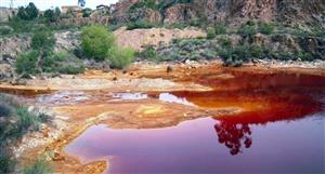
Source timelapse false colour shows lake fill and low area infill.
===============
Boundary issues with geophysics make them of limited use from data I have.
Gravity
ENR Falcon gravity stops at property margin and the only available (?) WA1 detail gravity doesn't extend west.
Combination of more regional gravity and Falcon to the north.
Some broad features in the western Luni area. The small arcuate structure south of the access prep area may be related to BIF/Sambhar feature.
====
Magnetics
ENR use magnetic lows as part of their current exploration strategy which may explain the pattern for the access.
Obviously the boundary area immediately south of Emily is going to be a target as ENR drilling shows mineralised carbonatite open to the south from their discovery hole #98 to the WA1 tenure.
There is a decent size carbonatite that has limited distinctive geophysical features...
More geophysics or just use aircore for first pass testing - probably an approach being considered by both WA1 (4x1.5 Km to test) and ENR.
Long field season ahead.
====================


Add to My Watchlist
What is My Watchlist?
 (20min delay) (20min delay)
|
|||||
|
Last
$13.96 |
Change
-0.050(0.36%) |
Mkt cap ! $945.3M | |||
| Open | High | Low | Value | Volume |
| $14.01 | $14.17 | $13.60 | $1.516M | 109.7K |
Buyers (Bids)
| No. | Vol. | Price($) |
|---|---|---|
| 1 | 544 | $13.94 |
Sellers (Offers)
| Price($) | Vol. | No. |
|---|---|---|
| $13.97 | 794 | 1 |
View Market Depth
| Last trade - 16.10pm 13/06/2025 (20 minute delay) ? |
| WA1 (ASX) Chart |