
This was another post (12226395) dated on 21/8/2013. Another good information for the newbies.
-----------------------------------------------------------------------------------------------------------------------
We all know that "there is evidence from fluid inclusion work that gas/condensate has been generated in the Kidson sub basin, so with that enormous salt top seal,".
Yes that's correct. There is a lot of evidence for that and that's why the major O&G companies are showing themselves in Canning atm. The oil shows of Goldwyer formation have been found all around at the northern parts of the basin.
But where could we found the commercial reservoirs? Or where is it coming from and where could it be trapped properly in large amounts with the right porosity?
My idea has been always this;
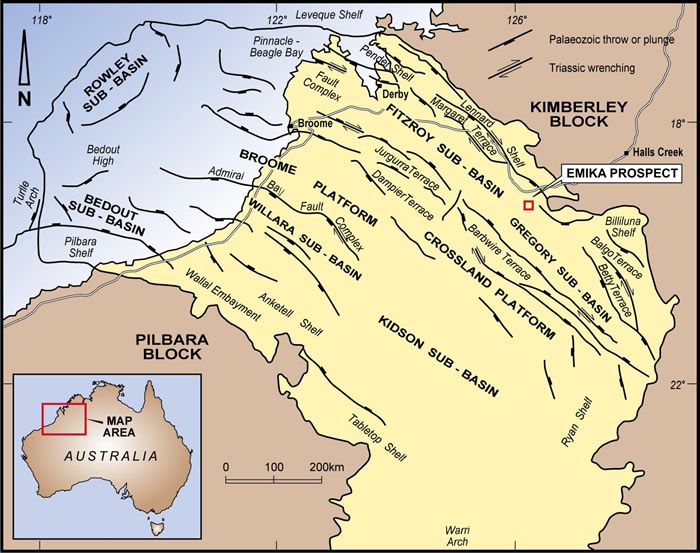
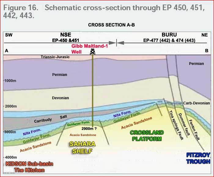
Some of the oil which was generated in the Kidson sub-basin migrated to north-west from south-east direction. It was not trapped in anywhere on the Broome Platform and the adjacent terraces as the trend of major faulting in this large area is also north-west to south east. See the major faulting trend int this map now.
And also please notice that there is no major faulting on Kidson sub-basin. (however there is something else on that area which I am going to explain below)
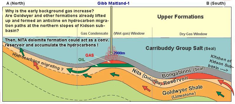
The migration easily happened through the channels in between major faults (most probably through Nita formation) towards the north-west from south-east direction.
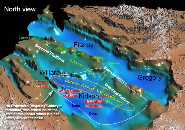
That's why some oil shows can be found in wells even far north-west Cyrene-1 well and all along that area close to the terraces.
You can see the major faulting on the the maps and also on this graphic.
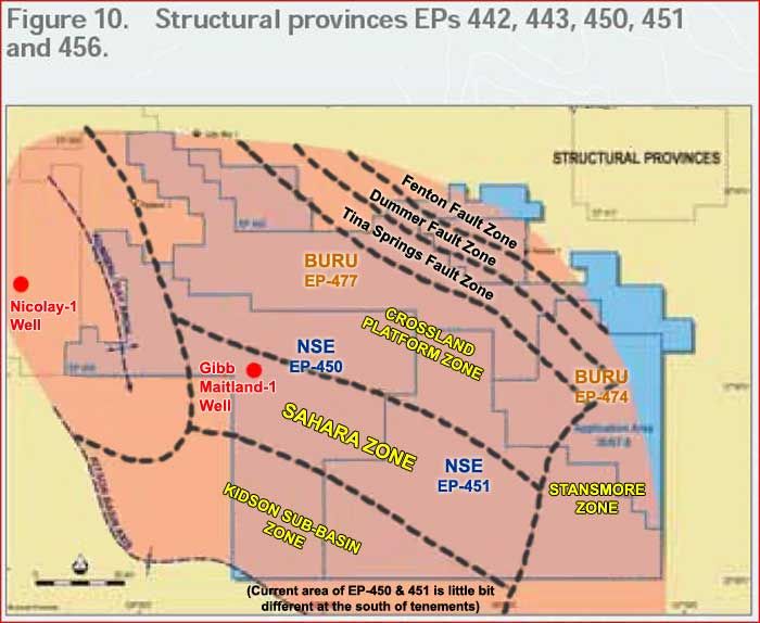
However Kidson sub-basin exposed to major compression in nort-east and south-west direction and it created major folding in the Sahara Shelf Zone and some on Crossland Platform Zone. I explained this before on some of my posts with the geological evidences.
Especially Sahara Shelf should have been acted as a trap zone by those large anticlines.
The foldings and the anticlines created by that foldings are so nice and large, each one of them could easily trap hundreds of billions of barrel oil. If you look at the structures of Sahara Shelf you can understand that.
I still believe the conventional prospect shown on Gibb Maitland location (remember our posts about it) might have around 250m barrel of oil. It has to be tested. And there are a few more of them.
This was another post (12226395) dated on 21/8/2013. Another...
-
- There are more pages in this discussion • 7 more messages in this thread...


You’re viewing a single post only. To view the entire thread just sign in or Join Now (FREE)