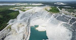
THR's report of 28th May on the commencement of uranium exploration at Bundey River, has caused me to return to my 1966 aerial geophysics maps of the area. Close examination of the 1000 ft high [very low] maps really does cause me excitement. John Young's words" ..test for roll front style mineralisationin the palaeo-channels identified and modelled from the airborne EM survey completed January 2008" made me very keen to have him release some of this data to us. It would be much better defined than my old style data.
However, I still have my old maps based on much older technology, and the palaeo-channels are very easily identifiable. Looking at the scale of these structures, they offer the prospect of VERY significant uranium ore tonnages if we are successful.
This and Thor's other uranium areas could be a company transformer as was Olympic Dam to Western Mining on a much larger scale. Conix
As a passing comment, the geophysicsal used by our crew were the same as was used to identify Ranger [east of Darwin] and Olympic Dam [cental northwest south Aus].
THR Price at posting:
0.0¢ Sentiment: Buy Disclosure: Held
A personalised tool to help users track selected stocks. Delivering real-time notifications on price updates, announcements, and performance stats on each to help make informed investment decisions.


 (20min delay)