From Proactive Investors:
Thursday, August 19, 2010
----------------------------
Central Petroleum spuds Johnstone West-1 well
---------------------------------------------
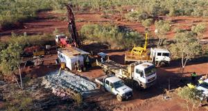
"Perth-based Central Petroleum (ASX: CTP) has reported that the Johnstone West-1 (EP115) wildcat oil well (JW-1), the second well in a planned 3-4 well programme for 2010, spudded this morning at 0130 CST.
Central holds a 90 per cent stake in the well.
The company also plans to initiate a stratigraphic drilling programme for coal in the Pedirka Basin shortly.
Based on estimates, the Johnstone West-1 well may host up to 500 MMbbl oil at high-P01 estimate and up to 400 MMbbl oil at P10 estimate UOIIP in multiple target zones.
A fully risked mean of 32 MMbbl UOIIP has been calculated. The Horn Valley Siltstone and Stairway Sandstone formation shale unit are both thought to be present in the JW-1 structure and are also of interest to Central.
If present, the company said these shales will be cored and analysed for potential shale gas and or shale oil potential, although there are no immediate plans for horizontal drilling or fraccing these horizons in the current 2010 drilling campaign.
Central is Operator and holds a 90% interest in EP 115, through wholly-owned subsidiary Frontier Oil and Gas and Trident Energy Limited conditionally holds a 10% interest in the permit. JW-1 is located at Latitude 23 deg 39 minutes and 21.86 seconds South, Longitude 129 degrees 56 minutes and 39.124 seconds East.
In addition, preliminary advice has been received by the company that there is little chance of significant coal seam gas (CSG) resources in or about the 5 well CSG programme completed in May 2010.
The company said the results of CSG wells drilled to date in the Pedirka Basin have been disappointing. A more detailed report is under preparation by Netherlands Sewell and Associates but their preliminary advice is "not encouraging".
The companys said, "although the deeper coals encountered in Blamore 1 drilled in 2008 showed evidence of gas saturation and permeability, they are generally considered too deep for commercial exploitation but this can not be ruled out as the coals are very thick and modern horizontal drilling techniques may have potential in future programmes."
The company believes that in the Pedirka Basin, there may be more potential in underground coal gasification (UCG), mining coal and gasifying on the surface with conversion to liquids (CTL) and perhaps very large scale mining and beneficiation prior to export compared to CSG development.
A four well stratigraphic programme to potentially expand the known distribution and thickness of coal is planned to commence in 4-8 weeks in Centrals wholly owned subsidiary Company, Merlin Coal Pty Ltds Mining Act permits in the Pedirka Basin.
Previous independent reports have estimated the total tonnage of coal above 1,000m as being 635 billion tonnes (low estimate) to 865 billion tonnes (high estimate) within Centrals wholly owned subsidiary, Merlin Coal Pty Ltds mineral leases and 1,110 billion tonnes (low estimate) to 1,385 billion tonnes (high estimate) above 1,000m in the same category in Centrals petroleum leases in the same area in the JORC Exploration Target category.
..... and wait, there's more, ......
Current Operations:EXPLORATION
-------------------------------
The Companys operating portfolio of some 235,000 km2 includes most of the available prospective acreage in Central Australia, including the Pedirka and Amadeus Basins.
The Pedirka Basin is contiguous with the well known producing Cooper Basin, and in most part shares similar geological objectives. Seismic data over the area have been reprocessed and the Company has identified a number of prospects of which two (the Avalon and Blamore Prospects) are considered mature for drilling. This particular area has not previously been tested, but is considered to be oil prone as a result of the very substantial residual oil legs observed in peripheral wells such as Colson-1 and Poolawanna-1, the latter of which flowed oil to surface.
The Avalon and Blamore Prospects are very significant structures, cited by the Independent Geologist Mulready Consultants to together host potentially recoverable prospective resources of ca 120 million barrels at the best estimate (P50) level, while the seismic response and detailed spectral frequency response analysis over these features exhibits moderate to strongly anomalous characteristics which are indicative of the presence of hydrocarbons.
Recent reports comment on the potentially recoverable prospective resources in CBM ranging from P90-25 TCFG to P10-50 TCFG in the extensive Pedirka coal measures covered by Centrals permits here.
The Amadeus Basin is a proven hydrocarbon province, with the Mereenie (oil and gas) and the Palm Valley (gas) Fields currently in production. This basin is under explored by any measure, having had an average of only 1 exploration well drilled per 5,000 km2. Even so, the success rate of over 4 million boe discovered on average for each exploration well is twice that of the Perth or Cooper Basins, and many times that of the Surat Basin. It is important to recognize that the structures in the Amadeus, while being testable by relatively shallow wells of less than 2,000 m, appear to be numerous and some as cited by the Independent Geologist are very large indeed.
The company has identified four prospects to be considered for drilling after some key additional seismic data have been acquired, namely Johnstone (oil), Mt. Kitty (gas), Ooraminna (gas appraisal) and Waterhouse (gas appraisal). These latter appraisals have previously been drilled. Ooraminna-1 was the first well drilled in the basin (1963), flowed gas to surface but was not followed up with appraisal. Previous Waterhouse wells have not penetrated the principal objective formation, although one produced minor gas to surface.
An additional dimension to the exploration play in the eastern Amadeus is provided by the well Magee-1, which flowed helium at a concentration of 6.3%. The Mt. Kitty Prospect will test the same formation, the Heavitree Quartzite reservoir sealed by salt, and any gas accumulation found to be present might also be expected to contain elevated levels of helium. On a volume basis, helium is at least an order of magnitude more valuable than hydrocarbon gas, and the marketing of any such discovered helium has been foreshadowed under a Memorandum of Understanding with BOC Global Helium Inc.
Until recently, any discovery made in the Amadeus or Pedirka Basins was likely to remain undeveloped unless of a sufficient size to support major infrastructure development. That situation has now changed. The rail link from Alice Springs to Darwin provides a means of evacuation of even small oil volumes to market, while the oil price movements now allow even modest gas volumes (e.g. 200 bcf) to be profitably converted to high value middle distillates using existing gas to liquids (GTL) technology.
Additionally, the Company has an exploration presence in the Wiso Basin/Lander Trough and the Georgina Basin. Limited drilling in these areas has produced hydrocarbon shows, and seismic survey is planned to evaluate the play types present.
In summary, Central Petroleum holds and operates a highly prospective portfolio of under explored onshore acreage, with a variety of exploration plays spread over a number of basins, one of which hosts producing fields. Very importantly, it seems no longer the case that only the very large discoveries can be economically developed.
CENTRAL AUSTRALIAN FOCUS
------------------------
The Company believes that the oil and gas potential of central Australia has been significantly overlooked and the area remains one of the true under-explored and under-developed proven petroleum provinces within Australia. To date over 14.5 MMbbls of oil and 285 BCF of gas have been produced within central Australia leaving existing known resources significantly under-developed. Estimates by the Northern Territory Geological Survey estimate up to about 6 billion barrels of oil equivalent (35 TCFG equivalent) unrisked recoverable hydrocarbons of 650 MMbloe (risked) remain to be discovered in the Amadeus alone while the Pedirka is estimated to contain at P10 level upside potentially recoverable resources l of about 200 MMbl of oil in just two prospects considered mature for drilling by the Company. There are numerous untested other leads not evaluated yet.
Since 1998, the Company has undertaken a highly focused strategy to secure acreage within the areas it considers to be the most prospective for oil and gas within central Australia and will seek to increase its presence in this focus area. The Company will also pursue the acquisition of a reserve based asset or assets internal or external to this area if such opportunities can early monetisation to aid in funding the exploration and development of the Companys current interests.
Early exploration in the 1960s by such groups as the French Petroleum Company, a wholly owned subsidiary of Total, Santos, Beach Petroleum and North Broken Hill produced some encouraging results. Indeed Magellan and others discovered the still producing Mereenie and Palm Valley oil and gas fields which are still in production and at one time were Australias biggest onshore oil and gas fields with over 140 MMbbls of oil equivalent in reserves.
Several factors conspired to thwart development of central Australia from the 1960s to the advent of Central Petroleums current strategy but now, the area is ripe for development:
The area was remote from any supporting infrastructure and so getting product to market was difficult. The infrastructure is now in place
Essentially there was almost zero market for any gas discovered as early discovery in the Cooper Basin further to the east drove the bulk of onshore infrastructure development in Australia
Central Australia is a vast, inhospitable and mostly unpopulated area of very dry desert requiring careful logistics planning and execution
Discovery of large scale commercial hydrocarbons occurred first in the Cooper Basin so the focus of most onshore explorationists shifted to the Cooper Basin from 1963
The continuing oil price slump from 1986 coupled with the fall off of the stockmarkets globally in 1987 spelled the end for most capital raising for many Australian onshore junior oil companies which simply ceased to exist
Renewed and sustained higher oil prices, completion of the new rail link to Port Darwin and access to recent developments in GTL technology to produce value added zero sulphur diesel, jet fuel and naphtha now will help to facilitate monetization of both oil and gas
Recently completed (August 2005) government sponsored and supervised whole of basin seismic data re-processing, new aeromagnetic data and synthesis of all known historical data highlights the prospectivity of central Australia and has provided a plethora of new exploration targets
The analysis completed in 2005 has highlighted a new Neo-Proterozoic exploration play type for gas, condensate and Helium under the Gillen Member salt seal proved by the drilling of Magee 1 in 1992 which flowed gas and Helium at 6.3% which is about 20 times the generally accepted threshold level for commercial extraction
MARKETING OF PRODUCT
--------------------
Plans are in hand to investigate further the potential for the commissioning of a GTL plant to produce value added ultra clean diesel, jet fuel and naphtha in a plant based at Alice Springs.
Oil reserves would initially be simply trucked to the recently completed rail link from Alice Springs to Port Darwin and then sent by rail in bulk liquids containers for export or domestic refineries. Value added products such as liquid Helium, diesel, jet fuel and naphtha would be transported in a similar fashion to Port Darwin. Subject to exploration success in defining fields with over 10 million barrels of recoverable liquids, pipelines to the closest rail siding could be considered.
PETROLEUM POTENTIAL OF THE AMADEUS
-----------------------------------
The Amadeus Basin is considered by the Company to present a number of very attractive exploration and appraisal targets in the Companys area of interest. The Basin has not received the attention it is due as it has suffered from the industrys negative perceptions relating to the alleged geological complexity of the structures present, the difficulty of predicting fracture porosity and the depth to primary target zones. Table 4 below sets out some of the relevant facts of the history of exploration and development in several Australian producing petroleum basins including the Amadeus.
A basin to basin comparison shows the Amadeus compares very favourably with other known petroleum provinces in Australia especially with its average discovery rate of 4 MMboe per exploration well and the relatively shallow average depth of exploration wells drilled of 1,900m. A particularly telling statistic is the rate of an average 0.2 exploration wells per 1,000 km2 of total basin area.
The Amadeus Basin is under-explored with an exploration drilling density of only 0.2 wells per 1,000 km2. This is low by world standards for a producing basin
The Amadeus is second only to the Carnarvon Basin in terms of millions of barrels of reserves in oil equivalent discovered per exploration well
Average well depth of exploration wells is only 1,900m
Of the 37 wells drilled, 5 produced gas on test to surface (Ooraminna, Dingo, West Walker, Orange and Magee)
The major producing fields were discovered without significant seismic and drilling locations were based mostly on geological surface mapping
Most seismic is concentrated in the northern part of the basin leaving about 2/3 of the basin with virtually no seismic at all including prospective sub-salt plays thought to be analogous with similar play types in the Siberian Platform, Schezuan Basin and Oman
The NTGS has reported that up to 5,762 mm BOE (or 35 Tcf) un-risked indicative yet-to-find potential petroleum volumes are indicated and that
Assuming a basin benchmark-finding rate of 11% (1 in 9) for Technical Successes then the risked YTF equates to 634 MM BOE (or 3.9 Tcf)
A number of proven oil and gas bearing reservoirs plays are present in the basin. The Heavitree Quartzite may contain important volumes of Helium. 6% helium was recovered from the Heavitree Formation in the Magee-1 well
717 BCFG and 24 MMbls of reserves have been discovered to date in the Amadeus with under 40 exploration wells
There are up to five petroleum systems present including the Ordovician system hosting Australias largest onshore oilfield, the Mereenie Field and the Palm Valley gas field, and the Proterozoic System, which geologically is regarded as potentially analogous to the geology of the giant Proterozoic oilfields of eastern Siberia and the Sichuan Basin of North East China. The fields in these basins are very large and often occur in reservoirs under very efficient salt seals. Salt is a very good seal thus it can be possible to retain oil accumulations from very old rocks under very efficient salt seals. The southern and western margins of the Amadeus Basin are expected to have potential for large accumulations of hydrocarbons under salt seals of the Bitter Springs Formation
There are numerous untested structures and play types throughout the basin. The existence of salt diapirs in the southern and western regions of the basin is known from the 1960s vintage mapping and recently completed modern aeromagnetic interpretation
Analogues to the Late Proterozoic oil accumulations of Oman are also thought to be potentially present. Of the four western Amadeus Basin wells that penetrated the Late Proterozoic Bitter Springs Formation, three encountered traces of petroleum. Oil shows have been also observed in the Johnnys Creek Beds, the Loves Creek and the Gillen Members of the Bitter Springs Formation
Helium
------
One well, Magee No. 1, tested sub-commercial quantities of gas from the sub-salt Neo-Proterozoic Heavitree Quartzite with a 6% helium content. Liquefied helium currently sells on a global scale of some US$5560 plus per 1,000 cubic feet and is regarded as a commodity of world wide strategic significance being used in superconductors, solid state electronics, welding, titanium and zircon production, cooling for nuclear reactors, cryogenics, fuel systems for rockets, special breathing apparatus and other high-tech applications. World demand currently runs at 5 to 6 BCF annually. This sort of play underneath the Bitter Springs Formation represents further potential worthy of attention in the Amadeus Basin.
Prospect targets for initial campaign in Amadeus
--------------------------------------------------
Central intends to focus in the Amadeus Basin on prospects capable of supporting the development of appropriate infrastructure or value adding technology capable of getting product to market in the most profitable and expedient manner. Initially the Johnstone Prospect will be evaluated and drilled subject to the results of further data acquisition as it is primarily thought to be an oil target easily able to be monetised by trucking and railing liquids to Darwin.
Amadeus Basin Johnstone Oil Prospect EPA 115 (subject to grant)
------------------------------------------------------
The Johnstone Prospect is a combined hanging wall and sub-thrust (footwall) prospect located near the northwest margin of the Amadeus Basin with an estimated depth to primary target of only 1,800m making this prospect a relatively shallow target for oil estimated to be in the range of P50 best to P10 high potentially recoverable of 12 to 112 MMbls.
Total closure area at high level is thought to be about 55 km2 and the structure represents a robust target worthy of further evaluation and probably drilling. A total of some 50-line km of modern seismic is recommended in addition to the available coverage of two earlier vintages of seismic.
The Ordovician Pacoota Sandstone (which hosts the majority of oil at the Mereenie Field and gas at both the Mereenie and Palm Valley fields) is the primary reservoir objective with secondary objectives in the younger Ordovician Stairway Sandstone, the older neo-Proterozoic Arumbura Sandstone and Cambrian Cleland Sandstone.
The Horn Valley Siltstone, although probably thinner than that at the Mereenie field, is thought to represent a good seal and a source rock with increased oil prone maceral composition and generally richer in a westerly direction from the Mereenie producing field about 100 km to the east. Good sealing qualities may be anticipated in the updip fault as there appears to be salt diaper just north of the prospect. Thermal maturation studies indicate that the source rock will be within the oil window between 500 m and 1500 m depth and the Pacoota Sandstone has shown evidence of becoming cleaner and more porous in a westerly direction away from the producing Mereenie field.
Evidence of potential Direct Hydrocarbon Indicators (DHIs) may have been found in both the eastern and western culminations with several stacked flat spots and possible velocity pulldowns.
Such features are not definitive but are worthy of further attention after modern seismic has been acquired and analysed.
Amadeus Basin Mount Kitty Prospect EP 125
-------------------------------------------
The results of Magee No. 1 have highlighted the potential of the Heavitree/Gillen petroleum system and it forms the most attractive play in the area. The scale of these plays can be quite large; for instance, the Murphy Kitty lead has a mapped closure of up to 250 km2 and vertical closure of up to 1,000m. Assuming a 30m net gas pay over the structure, that prospect could hold up to 5 TCFG.
Young et al. Prepared by NTGS Record 20052.
This large structure with up to 500 km2 in closure (123,500 acres), with related closure height of 300 m. is targeting the Heavitree Quartzite of Neo-Proterozoic age between the efficient salt seal of the Gillen Member and the basement. Although a large closure is interpreted by existing seismic and SEEBASE aeromagnetic analysis, the structure requires additional seismic of approximately 100150 line km prior to drilling but represents upside potential at P10 level of 1.7 TCFG with up to 6% helium (100 BCF) if the Mount Kitty prospect contains helium at similar levels as the Magee No. 1 well which is the only well in the Basin to date which has penetrated the targeted Heavier Quartzite. The high helium content of the Magee-1 gas is evidence of high seal integrity. The reservoir sequence are thought to comprise a series of stacked, amalgamated quartzes sandstones that were deposited in a high energy, tide dominated, shallow marine environment.
The Heavitree Quartzite under the Gillen Member (neo Proterozoic Bitter Springs Formation) salt seal was penetrated in Magee No. 1 drilled in 1992, which flowed gas to surface measured at 6.2% helium content. The structure shows very well on seismic and high quality recently flown aeromagnetics and it is interpreted as representing an early basement high with later sediments largely parallel to basement contours. The seismic signature of the Heavitree Quartzite is characteristic and recognisable in Mount Kitty.
The anticipated salt sealing horizon, the Gillen Member, is prognosed to be up to 1,200 m thick at Mount Kitty and would have exceptionally good sealing characteristics if present. This efficient sealing horizon would have been responsible for trapping the helium in Magee No. 1 drilled much further to the east. A similar reservoir-seal couplet of the same age figures prominently in the giant neo-Proterozoic petroleum fields in the Sichuan Basin in North-Eastern China, Siberia and Oman. For Helium to be trapped at the levels proven in Magee No. 1, an extremely efficient and plastic seal is necessary. The Gillen salt was penetrated by six wells in the south-eastern Amadeus Basin and is expected to be present over most if not the entire play fairway. At Magee No. 1, the primary source rock interval, the lower Gillen Member of the Bitter Springs Formation is 20 m thick and comprises thin, bitumen stained, carbonaceous laminae with depleted TOCs ranging from 0.5 to 0.8%. An MPI derived reflectance value of 1.02 (VRe) indicates that this zone is still within the oil window although the Heavitree accumulation indicates flushing by gas sourced from a deeper area of the basin.
At Magee No. 1, primary porosity of 9% was recorded and the Heavitree Quartzite was only a very thin layer of 6m sitting on a much older basement. At the Mount Kitty location, the depth of burial of the target reservoir is interpreted to be much less due to present day depth of only about 1,800m and as well, significantly more sediment unloading via erosional intervals in Palaeo-time. It is thought that at Mount Kitty, considerably better primary porosity than at Magee No. 1 could well be expected.
Magee No. 1 showed the presence of dark grey fissile shales with maturity levels at or just past the close of the oil window and the start of the gas window. The source rock quality of the shales was described as fully mature gas prone rocks of a relatively poor quality with TOC values less than 1%. The results of drill stem testing and gas analysis however indicated that the gas was contiguous with or had been derived from an oil accumulation. The gas analysis from the Heavitree Quartzite was reported in percentage as:
Gas %
Nitrogen 43.61
Argon 0.46
Helium 6.20
Hydrogen 0.03
Carbon Dioxide 0.82
Methane 39.26
Ethane 6.10
Propane 1.91
Butane (total) 0.93
Pentane (total) 0.38
Hexane 0.17
Heptane 0.09
Octanes + 0.04
Given the indications of an oil accumulation nearby, another source unrelated to the lowermost shales and other shales in the Bitter Springs must be speculated upon at Magee No. 1. Similarly, the potential of Mount Kitty to contain an oil accumulation in addition to helium rich gaseous phases bears consideration.
Although the relatively high Nitrogen content that may be anticipated at Mount Kitty would detract from the value of potential wellhead sales or direct to pipeline sales, the Company is investigating the potential for a gas to liquids plant located in the Amadeus Basin which could possibly strip nitrogen in a cost effective manner and utilise the remaining gas to produce a range of relatively clean and low sulphur synthetic middle distillates including diesel, jet fuel and naphtha.
A recent seismic acquisition campaign acquired approximately 290 line km of new 2D seismic over the prospect which is currently being processed.
Amadeus Basin Ooraminna Gas Appraisal Prospect EP82
The Ooraminna 1 well was the first petroleum exploration well drilled in the Amadeus Basin in 1963, and flowed gas to surface. It had very limited single fold seismic coverage at the time (current modern seismic is often more than 100 fold data) and was drilled (similar to the Mereenie and Palm Valley discovery wells) mainly on surface mapping and photogeological data. It is a large four way dip closure salt cored anticline with estimated closure of up to 300 km2 (74,000 acres) and estimated vertical closure of up to 300m.
Approximately 110km of 2D seismic has been acquired and is currently being processed.A new test well will target estimated potentially recoverable petroleum of up to 0.7 TCFG at P10 or high level potential in the neo-Proterozoic Areyonga Sandstone and Bitter Springs Formations. The depth to primary target is only 1,400m maximum and gas seepages have been recorded over parts of the structure so the prospect represents attractive potential subject to rigorous appraisal of existing and planned seismic as well as detailed mapping and analysis of fracture distribution. New analysis using ASTER Landsat and low level aerial photography has defined 7 zones of interest showing extensive fracturing and indications of hydrocarbon leakage to surface.
It is planned to reprocess existing seismic data and to acquire approximately 30 line km. of modern seismic over the strike line of the crest of the prospect prior to siting a new test well which will target estimated potentially recoverable petroleum of up to 0.7 TCFG at P10 or high" level potential in the neo-Proterozoic Areyonga Sandstone and Bitter Springs Formations. The depth to primary target is only 1,400m maximum and gas seepages have been recorded over parts of the structure so the prospect represents attractive potential subject to rigorous appraisal of existing and planned seismic as well as detailed mapping and analysis of fracture distribution.
Ooraminna 1 was evaluated in 1963 by several drill stem tests, the most significant of which was conducted after the well had been open for 60 days with 9.8 ppg mud prior to testing. Other pertinent factors in the failure of the well to establish commercial flow rates of gas may have been:
The gas detector was not working for much of the target horizon drilling even though gas was smelt strongly on the rig floor during part of this section
Fractures which could have flowed may have been plugged with lost circulation material
The use of overweight mud could have also invaded fracture zones to such an extent the SP logs and the microlog may not have been capable of discerning fracture patterns worth testing
Much of the target Areyonga Formation was not tested although it is possible that fracturing could have been pervasive throughout the section
Secondary target potential may exist in the underlying carbonates of the Bitter Spring Formation (Johnnys Creek Beds). High trip gas was reported over an interval of 65 m from 1,3341,399 m (43754589 ft). This interval was not included in the current assessment of 0.7 TCFG potential recoverable at high estimate
Additonal target potential may lie in deeper sub Gillen Salt Member Heavitree Formation gas, condensate and Helium
Amadeus Basin Waterhouse Gas Appraisal Prospect
The primary objectives for a proposed appraisal test of the Waterhouse Anticline are the Late Proterozoic Areyonga and Bitter Springs Formations sealed by Pertatataka Formation silts and shales but The Proterozoic Pioneer Sandstone also been identified as a possible reservoir objective.
Ooraminna-1, 85 km east of Waterhouse-2, is the only well in the eastern Amadeus Basin north of the Central Ridge to intersect the Areyonga Formation and it flowed gas at sub-commercial levels. With assessed aerial closure of 300 km2 (74,000 acres) at P10 or high level, in excess of 1,600m vertical closure, a location close to the Palm Valley to Alice Springs gas pipeline, a relatively shallow prognosed depth to primary target of less than 2,000m and upside recoverable petroleum potential at P10 or high level 1.7 TCFG, this large structure represents attractive evaluation potential.
Previous explorers have drilled three wells on the structure:
Waterhouse 1 which failed to penetrate the Late Proterozoic basal Arumbera A1 sandstone, the gas bearing zone at neither the Dingo field nor the currently chosen Areyong target reservoir
West Waterhouse-1 drilled 45 km to the west of Waterhouse 1 targeted Ordovician Pacoota Sandstones and recorded a small gas flare at surface
Waterhouse 2, very close to Waterhouse 1, which failed to penetrate the currently chosen Areyonga target reservoir
Seismic coverage over the Waterhouse Anticline is provided by sparse, single fold data recorded in 1965 and 1966 and 12 fold data recorded 1973. A recent seismic campaign by the Company has acquired 60 line km of 2D seismic which is currently being processed prior to siting a well.
Both minor and moderate hydrocarbon gas seepages have been recorded over parts of the structure on the eastern portion in a 1986 airborne survey and a more recent Landsat ASTER and low level aerial photographic survey have defined no less than 8 zones with indications of hydrocarbon seepage to surface as well as defining concomitant zones of maximum fracture density more likely to produce commercial production rates of gas and condensate.
A second higher risk play type at Waterhouse is the sub-thrust play which targets the Pacoota and Stairway Sandstones in the footwall beneath the south bounding thrust fault.
Additional deeper target potential lies in sub Gillen salt member Heavitree Formation gas, condensate and Helium.
THE PERDIKA BASIN, AND ERINGA-MADIGAN TROUGHS EP 93, EPA 130, EPA 131 AND PELA 77
The Company is targeting 195 MMbls of potentially recoverable hydrocarbons at independently assessed best or P10 level in two ready to drill prospects in its initial drilling campaign in the Pedirka Basin.
Petroleum Potential of the Pedirka Basin
----------------------------------------
If the previous maturation modelling and geochemistry is accurate, then there is a reasonable chance that hydrocarbons are present in the project area in commercial quantities.
Generation and migration of rich Jurassic source rocks is thought to have occurred after the mid-Tertiary. This implies that all the structural traps in the area would have been effective prior to any significant oil generation and migration. In theory, all traps should be filled with hydrocarbons to spill point.
(source: Landsat MSS Interpretation of the Eringa trough, South Australia and Northern Territory, Dr R Russell, unpublished report for Merlin Synergy Pty Ltd September 2000). The presence of hydrocarbons in commercial quantities in these areas is speculative until potentially proven by drilling.
The Madigan Trough portion of EP 93 in particular is considered to be prospective and the Directors consider contains two ready to drill prospects with the interpreted presence of the correct fundamentals for a successful discovery. Two seismically defined prospects are reported by Troy-Ikoda to have potential to contain 129 MMstb of oil equivalent at low or P90 estimates of hydrocarbon resources potentially in place. An interpretation reported by the Independent Geologists to the Company for this Prospectus gives a total for the two prospects at best or P50 level of 118 MMstb potentially recoverable hydrocarbons and high or P10 potentially recoverable hydrocarbons of 195 MMbls oil. For further information, refer to the Troy-Ikoda report reproduced with permission in Section 7 of this Prospectus and the Independent Geologists Report in Section 7 of this Prospectus.
Eight wells relevant to the geology of the area but to the east of the Companys interests have contained oil shows.
A recent report by Mulready Consultants and Holt Cambell and Payton consulting engineers has outlined prospective resources in the Pedirka Basin Permits EP 93, 130, 131 and PELA 77 of 25-50 TCFG which are potentially capable at the low or P90 estimate level of sustaining a 140,000 bbl/day GTL plant at Alice Springs for over 50 years. The Company is planning an exploration strategy for these prospective resources as well as evaluating additional CBM resources in the yet to be acquired EPA 105,106 and 107.
A report by Greg Ambrose released at the 2007 APPEA conference has highlighted the necessity to focus on older structures predating the period of maximum oil generation in the Cretaceous, and predating structural formation and deformation in the Tertiary. Seismic analysis of the Hallows Trend Prospects Avalon, Blamore, Cawdor, Dyffed and Excalibur indicates that these strucures all qualify in this important context exhibiting significant thinning of the C to P horizon.
EP 93 The Northern Territory Eringa-Madigan Trough
---------------------------------------------------
The following features are highlights of the Eringa-Madigan Trough areas within EP 93 (NT):
- Lightly explored, although the fundamental geological parameters of source, seal, reservoir, structure and access to thermally mature kitchens with short migration pathways appear to be present from previous relevant drilling and seismic analysis
- Two considered ready to drill prospect/leads
- Numerous examples of possible Direct Hydrocarbon Indicators such as polarity reversals, velocity pull downs or flat spots and amplitude anomalies
- Relatively shallow interpreted depths to primary targets in the Permian of 1,800m to 2,000m
- Size of Eringa-Madigan Trough in total within EP 93 and the contiguous PELA 77, also controlled by the Company is bigger than either the Patchawarra or Nappamerri Troughs in the Cooper Basin considered to be similar in structural and sedimentological attributes
- The Eringa-Madigan Trough is interpreted to contain similar Permian sediments and many of the same Eromanga Basin sediments known in the Cooper- Eromanga Basin further to the east
- 10,000 sq. km (2,360,000 acres) total permit area, 2 defined leads/prospects, significant additional leads, some with over 50 sq. km of interpreted potential four way closure, over 1,000 line km. of relevant seismic
- Residual oil columns of 80m and 160m in Colson-1 interpreted from log analysis of these wells, which are thought to have penetrated a similar stratigraphic sequence some 80 km. and 120 km to the east of the prospects in the Hallows Trend, which are the Companys initial focus
- Oil with subordinate gas indicated by relevant source rock analyses derived from offset data which showed approximately 2-3 times the percentages of oil prone source rock macerals in comparison to typical Cooper Basin source rocks
- Multiple play potential, with reservoirs in the following formations, has been recognised:
Middle to Late Jurassic Algebuckina Formation, Eromanga Basin
Early Jurassic Poolowanna Formation, Eromanga Basin
Triassic Peera Formation, Simpson Basin
Permian Purni and Crown Point Formations, similar to the producing Patchawarra and Tirrawarra Formations in the Cooper Basin
Pre-Permian equivalents to the producing Pacoota Formation, Amadeus Basin
- EP 93 has evidence of very good source, reservoir and seal. Oil-prone Permian source rocks have been interpreted to be relatively abundant in the Pedirka Basin and they are currently in the peak oil generation window from mid-Tertiary to present. Permian source rocks up to 1,000m thickness are interpreted, still in peak oil generation window from mid Tertiary to present and reported seismic evidence of good sealing horizons in the Hallows Trend prospects
- The major exploration risk within the Pedirka Basin is seal integrity, but two prospects and three leads on the Hallows Trend appear relatively undeformed with apparently continuous competent sealing horizons at the top Poolowanna Formation regional sealing horizon. This regional seal was absent in several wells drilled to the South and the east of EP 93
EPA 130 Pedirka Basin Application Northern Territory
------------------------------------------------------
This current application area partially lies on the northern fringes of the Permian Pedirka Basin and is overlain by the widespread Eromanga Basin. At depth below both of these basins at least in part of the application area could be expected sediments of the Cambro-Ordovician Amadeus Basin, particularly over the South-western portion of the area concerned and potentially sediments of the Triassic Simpson Basin or equivalents All of these sediments have demonstrated either producing horizons or petroleum shows in wells drilled into lateral equivalents elsewhere in the Pedirka, the Amadeus, or the Eromanga Basin The area applied for is large and it is possible that petroleum may be trapped and able to be exploited in this full sized permit application.
EPA 131 Pedirka South Application Northern TerritoryThe current application lies entirely within the footprint of sediments of the Permian Pedirka Basin and is overlain by the widespread Jurassic Eromanga Basin. At depth below both of these basins at least in part of the application area could be expected sediments of the Cambro-Ordovician Amadeus Basin (or Warburton Basin equivalents) particularly over the south-western portion of the area concerned and potentially sediments of the Triassic Simpson Basin or equivalents in between the Permian and the Jurassic. All of these sediments have demonstrated either producing horizons or petroleum shows in wells drilled into lateral equivalents elsewhere in the Pedirka, the Amadeus, or the Eromanga Basin The area applied for is located in an area where there is little modern seismic apart from 1960s vintage and precious little even of that.
Exploration Strategy Pedirka Basin EP 93, EPA 130, EPA 131 and PELA 77
------------------------------------------
Because of the relative isolation, the mobilisation and demobilisation costs of drilling rigs and seismic crews with equipment are high. The Company believes that although more seismic may better define the prospects chosen for early attention to some degree, it will not prove or disprove the existence of a competent sealing horizon over the reservoir targets. This will only be known after drilling. A new seismic campaign to gain more data is outweighed as a strategy by the desirability of actual drilled data Hihg mobilisation and demobilisation costs for seismic acquisition means that additional pre-drilling seismic would not be cost effective on a line km. basis until at least 250 to 300 line km. were carried out. Such a campaign, estimated to cost in the order of $1.52.5 million, would be close to the cost of drilling a well.
Also, the first wells planned will serve as combined stratigraphic tests of the undrilled Madigan Trough, will serve to better tie the different vintages of seismic together for future drilling and will also target what is thought to be prospects with a reported total of over 118 MMstboe potential recoverable hydrocarbons in place at best or P50 level of estimation.
The Company has estimated $ 4 million for a 77.5% share of relevant costs including planning, seismic re-interpretation, drilling, site clearances, environmental surveys, evaluation of results and completion of potential production from one zone for Blamore 1 and Avalon 1 drilled in separate campaigns. Depending on the results following the drilling of the first well, there may be a brief hiatus in drilling activity while results are fully analysed.
Pedirka Basin PELA 77 South Australia
--------------------------------------
As the northern border of PELA 77 is contiguous with the Southern border of EP 93, much of the material presented above referring to EP 93 is pertinent to this permit application, which covers the Southern extension of the Eringa Trough in its entirety and associated flanking sediments to the west, south and to the east. The sequence of basins stacked in the Eringa Trough here are interpreted to be essentially the same as those proposed in the Madigan Trough in EP 93 i.e. The lowermost basin being the Amadeus or Warburton Basin equivalent sediments, the Pedirka Basin, the Simpson Basin, the Eromanga Basin and later sediments of the Lake Eyre Basin. The permit application is approximately 6,000 sq. km in surface area and has over 1,000 line km. of relevant seismic data.
Exploration in PELA 77 has generally been confined to reasonably intensive seismic and the drilling of three wells on the upthrown side of the McDills reverse fault and associated splay faults which flank the eastern margin of the Eringa Trough proper.
Although the three wells drilled in PELA 77 penetrated reservoirs, sealing horizons and source rocks with a range of poor to good quality (TOC values from 7.5% to 63% in the Permian Purni in Mt. Hamersley 1 for example) the in situ thermal maturation of the source rocks confined the relevant horizons to Ro values of 0.4% to 0.5% which is somewhat below the oil window so insitu generation of commercial quantities of petroleum is considered unlikely.
Any wells drilled to the east of the main Eringa Trough would have relied upon migration from the Poolowanna Trough well to the east or upon migration from deeper portions of the Eringa Trough to the west where there is a paucity of seismic and no drilled information to date.
An examination of data available from the drilling of the three wells referred to above plus other published material shows a real possibility that the McDills Fault structure and associated splay faults flanking the eastern margins of the Eringa Trough proper could have blocked potential petroleum migration to the east from the Troughs more mature deeper portions to the west.
Petroleum migration from the east is a possibility but the distances from mature source rocks are a problem in this context.
Basin analysis here shows the abundance of coal and coaly horizons in the Permian. Such horizons make seismic interpretation difficult although their presence has positive implications for the quantity of available source rock.
There are a number of seismically defined prospects remaining undrilled on the upthrown side of the McDills Structure but these are not considered a high priority by the Company after consideration of the results from previous wells drilled in similar locations such as Witcherie 1, Hamersley 1, Dalmatia 1 and Mt. Crispe 1 which all showed lack of thermal maturation in situ to the levels required to produce commercial volumes of petroleum even though good source, seal and reservoir qualities were demonstrated variously throughout these earlier drilling campaigns.
The Company will focus on structures to the west of the McDills Structure where postulated in-situ thermal maturation is much greater due to the deeper burial of likely source rocks. Interpretation of data puts the base of the Permian in the deepest known portion of the Eringa Trough into the late oil window with postulated Ro values of 1.0% to 1.3% being reached by c. 80 million years ago during the late Cretaceous. Sediments immediately above this base Permian level are projected to have reached in-situ thermal maturation levels in the mid mature range of Ro values of 0.7% to 1.0% at the same time. This is depicted in Figure 9 above.
Exploration programme PELA 77
-----------------------------
One seismically defined lead occurs in the deepest known portion of the Eringa Trough South of the NT-SA border and is considered by the Company to be an important focus for further exploration. There are a number of other leads defined by Landsat analysis in parts of the trough not covered or poorly covered by existing seismic, which are, however, deserving of further seismic investigation. The Company believes that as depth conversion analysis of seismic data here is hampered considerably by the considerable volumes of coal in the Permian sequences producing multi cycle skipping phenomena that an initial well to test both stratigraphy and potential petroleum systems should be drilled on the Eringa Lead prior to conducting further seismic.
Lander Trough EPA 92 and EPA 129 Wiso Basin, Northern Territory
--------------------------------------------------
Petroleum Potential
The Lander Trough has all the correct prerequisites for significant hydrocarbon discoveries and is well positioned spatially to provide gas to established markets using established nearby infrastructure.
The large size of the prospective area is a strong point in its favour. Large scale structures are almost certain to be present and if the maturation modelling and quantitative geochemistry is at all accurate, then there must be a very good chance that hydrocarbons are trapped somewhere in the project area, perhaps in commercial quantities.
(source: Landsat MSS Interpretation of EPA 92, Lander Trough, Wiso Basin, Northern Territory Dr. R Russell Unpublished Report for Merlin Synergy NL June 1998). The presence of hydrocarbons in commercial quantities in these areas is speculative until potentially proven by drilling.
These applications consisting of one full sized permit application (EPA 92) of c.16,000km2. and a second application, EPA 129 of c.12,000km2 in the Northern Territory have no modern seismic coverage at all and no drilling within or close to their boundaries other than a series of shallow stratigraphic wells drilled by the BMR.. The permit applications include most of the deeper portions of the Lander Trough, a 30,000 sq. km trough on the Southern margins of the epicratonic Wiso Basin. The area contains sediments of the same age as those in known petroliferous areas like the Amadeus and Georgina basins.
The Lander Trough contains a sedimentary pile aging from Proterozoic to Carboniferous and younger Cretaceous and Tertiary sediments up to a total depth of 4,500 m interpreted from magnetic data and is considered prospective for petroleum especially in the Ordovician Hanson River Beds which are seen as potential analogues of the oil and gas bearing Pacoota Sandstone of similar age in the Amadeus Basin further to the South.
Relevant drilling to date has been restricted to stratigraphic drilling on the shallower shelf areas of the Trough to the north and east outside the current EPA 92 but partially inside the current EPA 129 boundary.
This drilling has shown the existence however of suitable source rocks, reservoirs and sealing horizons expected to deepen and thicken considerably into the deeper parts of the Trough contained within the Companys application areas. Two such wells had residual oil shows, Green Swamp 1 and Green Swamp 6.
History
------------
Four lines of primitive seismic were acquired across the axis of the Trough during the 1960s during exploration by Exoil. This seismic showed the general structure of the Trough to be a half graben bounded to the South by a massive reverse thrust fault system which overthrusted Proterozoic granites and gneisses of the Arunta Block partially over the sedimentary pile in the Trough itself during the Alice Springs Orogeny in the early to mid Carboniferous. Several shallow stratigraphic holes were drilled by the BMR (now Geoscience Australia) in the late 1970s and it is this drilling, its subsequent analysis and a Landsat based structural analysis, which has provided much of the prospectivity information regarding the Trough to the Company.
Prospectivity
---------------
The Basin is almost totally unexplored for petroleum and large-scale structures are almost certain to be present. If the maturation modelling and quantitative chemistry carried out to date is accurate, then there is a possibility of finding petroleum in the permit area.
There is moderate petroleum potential in the Cambro-Ordovician section of the Trough. Oil shows were described in the Cambrian carbonates in the Green Swamp stratigraphic wells 1 and 6 in which the Cambrian Montejinni Limestone was described as having low maturity but fair oil prone source rock potential. The sequence penetrated by these wells is considered similar but much thinner and shallower than the sequence in the trough proper.
Landsat based structural analysis has shown the presence of a number of circular structures of some several kilometres in diameter tentatively identified as potential diapiric salt structures or domes associated with equivalents of the Bitter Springs Beds in the Amadeus Basin to the Kitty which are also worthy of investigation given the relative importance of such structures in many oilfields in other parts of the world.
Exploration programme
----------------------
The basin needs a deep stratigraphic test in the Lander Trough to examine detailed stratigraphy, source rock quality and maturity, seal potential and reservoir quality and continuity prior to planning an extensive seismic programme. Further digitally enhanced Landsat data with modern splicing ability is required as a precursor to any drilling in order to site the well at a location that may also be a valid structural trap. The Company believes that it should pursue the granting of the permits and secure an appropriate joint venture or farm-in partner to facilitate the exploration of EPA 129 while it has already secured a farmin partner for EPA 92.
Marketing
-----------
The permit application area is isolated and has virtually no road infrastructure. However, the Alice Springs to Darwin gas pipeline runs north and south approximately 100 km from the eastern boundary of EPA 92, is straddled by EPA 129 and could act as a conduit for any gaseous hydrocarbons that may be developed here. The recent commissioning of the Alice Springs to Darwin railway line now also gives access to rail-out liquid in rail tankers to Alice Springs, Darwin or Adelaide/Port Bonython. Small scale in-situ LNG or gast to liquids plants could also be useful in this context but the Company has not examined these proposals in detail nor has it reached any conclusion as to their viability.
THE GEORGINA BASIN EPA 132
---------------------------
Central, via its wholly owned subsidiary Merlin Energy Pty Ltd, has taken out a 120 block (10,000km2) permit application in the South-eastern Georgina Basin, regarded by as being the most prospective basin in the Northern Territory. The Southern Georgina Basin of 150,000 km2 has the following attributes making it prospective for significant accumulations of petroleum:
Only 8 wells drilled, some of which had no pre-drilling seismic and none of which were located on valid structures
20 stratigraphic tests conducted to date
Only 750 line km of modern seismic
Abundant petroleum shows, especially in the Middle Cambrian
Over 40 billion tonnes of petroleum has been estimated to have been produced and expelled from the Middle Cambrian from the Arthur Creek Formation where source rock analysis has shown TOC values up to 16%
The Arthur Creek Formation exhibits fair secondary porosity in limestone units and porosity of 517% in the Steamboat Sandstone where drilled; the target horizons of which are anticipated to be terrestrial or near shore marine channel sands or delta lobes of good to excellent porosity and permeability
Oil shows to date in the Middle Cambrian have been mainly unaltered, mature, aromatic crudes of marine origin
In EPA 132, Central is primarily targeting potential shallow channel sands and delta lobes of the Steamboat Sandstone member of the middle Cambrian Arthur Creek Formation at easy to drill relatively shallow depths of from 500 to 1,000m identified on neighbouring blocks from seismic and assumed to potentially run into EPA 133.
The channel sands arethought to be some 200m vertical thickness and up to 5km in width while the delta lobes may be of much greater volume. Clearly, such conceptual targets have multi-million barrel potential. Analogues of this sort of conceptual play type are to be found in the Jurassic Smackover Formation in the Oaks field in Louisiana. or in the Lena-Tunguska Province of Siberia.
Seismic signatures within the Steamboat Sandstone depict stacked beach ridge/barrier/deltaic facies and tidal channels up to 200 m thick, with potential to entrap hundreds of millions of barrels of oil.
Carbonate Rampfaciesand Oilplays in the middle-late Cambrian, Southern Georgina Basin, Australia. Preliminary Release 2005 NTGS.
ManagementTHE BOARD OF DIRECTORS
--------------------------------
Dr. Henry Askin BSc Hons, PhD, Non-Executive Independent Chairman
Dr Askin has over 30 years of experience in the oil exploration industry, of which some 25 years were with the Shell Group of Companies, most recently as Consultant. He was exploration manager with Shell Development (Australia) Pty. Ltd. He has worked with Shell in Australia, Oman, Norway, The Netherlands and India in senior management and technical roles and for three years managed the International Seismic Analysis Centre in the Hague. Dr. Askin is also a Non-Executive Director of Bass Strait Oil Company Pty. Ltd.
Mr John Heugh BSc. (Hons), MPESA, Managing Director
Mr Heugh has over 25 years experience in petroleum and mineral exploration and has worked in a consulting or subcontracting role for Esso, Wapet, Pancontinental Petroleum, Santos, Western Mining Corporation, Bridge Oil, Ampol, Kuwaiti Foreign Petroleum Corporation (IEDC subsidiary), Arco and Chevron-Texaco. He has undertaken studies in oilfield drilling technology and development from the University of Texas and was a founding Director of Labrador Petro-Management Pty Ltd.
Richard Faull BCom, CPA, Non-Executive Director
Mr Faull is a director of a firm of Certified Practising Accountants and Registered Tax Agents. He has over 20 years experience as a director, executive and company secretary in mining and petroleum exploration companies. Mr Faull is currently a director and the Company Secretary of Fleurieu Mines NL and Barranco Resources NL, both mining companies.
Mr William Dunmore BSc, MSc, MSPE Non-Executive Director Commercial Development and Production
Mr Dunmore is an experienced reservoir and production engineer with significant transaction, analysis and financial modelling experience gained by consultancies and employment with a number of banks, financial institutions and petroleum companies including HBOS, Rothschilds, Gaffney Cline and Associates, BHP Petroleum, Schlumberger, Hardman, Mobil, Lasmo, Petrobras, CSX, Total, Nippon Oil, Powergen, Mosbacher, Unocal and Svenska Petroleum. He has over 30 years of direct relevant experience internationally.SE
SENIOR MANAGEMENT
Mr Daniel White LLB, BCom, LLM, Group General Counsel and Joint Company Secretary
Mr White is an experienced lawyer in Western Australia and internationally, principally in upstream oil & gas and infrastructure law matters. He is admitted as a Barrister and Solicitor of the High Court of Australia and the Supreme Court of Western Australia, and is a Solicitor of the Supreme Court of England and Wales.
Mr White has considerable experience in corporate finance transactions (including acquisitions and divestures), equity and debt capital raisings, energy related agreements (specifically in exploration and new ventures), joint venture and partnering arrangements, construction and litigation and international commercial arbitration.
Prior to his appointment at Central Petroleum Limited, Mr White was based in Kuwait as Group General Counsel of Kuwait Energy which at the time had 42 assets in over 8 countries. Mr White's role at Kuwait Energy was to manage the company's legal affairs and provide strategic legal advice to its global business units and joint ventures.
Mr White has also held senior legal and management positions for Clough Limited's global operations. During his time at Clough, Mr White was based in Perth for several years and then transferred to Jakarta for Clough's Indonesian subsidiary, PT Petrosea Tbk. Whilst in Jakarta Mr White's responsibilities included managing the legal, contracts, procurement, cost control, risk and insurance teams in Petrosea to ensure the commercial integrity of Petrosea's operations. Prior to joining Clough, Mr White worked for many years as a commercial litigator with the Perth boutique litigation law firm of Arns & Associates.
Mr White has also lectured in Engineering Law and presented at various conferences on topics including acquisitions & divestures, negotiation, risk and alliance contracting. He is a member of the Association of International Petroleum Negotiators and the Law Society of England and Wales.
Mr Bruce Elsholz B.Comm., AICA, AICSA, ICSA, Chief Financial Officer and Joint Company Secretary
Mr Elsholz has over 35 years of industry experience in financial control and company secretarial matters.
Mr Elsholz has worked for a variety of oil and gas exploration and production companies including Hudbay Oil and Gas Company Limited, Hartogen Energy Limited, Encor Incorporated, Coplex Resources NL, Otto Energy Limited and Command Petroleum Holdings Limited before joining the Company.
Mr Elsholz has broad experience in the financial and governance related management of listed resource companies and has specialist knowledge in corporate treasury, taxation and human resources functions.
Mr Gregory Ambrose, BSc. (Hons) Geology, Manager - Geology
Mr Ambrose has over 35 years of experience working for oil and gas explorers Santos, Lasmo and the Arabian Gulf Oil Company (AGOCO) and government experience working for the Geological Survey of South Australia and as Deputy Director of the Northern Territory Geological Survey.
As head of the NTGS Petroleum Program, Mr Ambrose was responsible for all technical issues related to oil and gas exploration in the Northern Territory, both onshore and offshore. During this time Mr Ambrose defined many new geological concepts and prospects in Northern Territory basins such as the Amadeus, Georgina, Pedirka, and Wiso where Central Petroleum holds significant acreage. Many of these concepts and prospects under active development by Central Petroleum are derived from Mr Ambrose's seminal works.
Prior to joining the Northern Territory Geological Survey, from AGOCO in Libya, Mr Ambrose provided the geological model for two successful wildcat wells which delineated a new 300 million barrel oil trend, while also identifying a bypassed oil zone in the giant Sarir field which resulted in the delineation of a 90 million barrel extension to the field.
Mr Timothy Green, BSc. (Hons) Mining Engineering, Drilling Operations and Production Manager
Mr Green has over 35 years of oil and gas drilling operations experience in diverse countries such as Australia, New Zealand, Britain, the United States, Angola, Indonesia, Pakistan and India. During this time Mr Green has worked for leading energy corporations such as Texaco, Premier Oil and Enterprise Oil.
As well as managing all aspects of drilling and production operations, Mr Green has been responsible for assembling and training drill teams, contracting rigs and heavy equipment, constructing access roads, initiating localised environmental and community development programs, and ensuring the security of personnel in some of the world's most challenging operating environments including Pakistan and Angola.
Mr Green also has significant experience in community affairs and landowner liaison having held the corporate social responsibility portfolio for Premier Oil for their onshore Pakistan operations.
Mr Stewart Bayford, BSc. Geology and Soil Science, Exploration Manager
Mr Bayford has over 30 years experience of exploration and management experience in the oil and gas industry, including 13 years overseas experience in the UK, Egypt, the US, New Zealand and Nigeria, working for companies as diverse as ENI, Petrocorp, Agip and Conoco.
Mr Bayford has most recently been credited with managing the exploration team that discovered several new onshore natural gas discoveries from back-to-back wells in the Nile Delta, in 2008, ranging in size from 20 � 200 billion cubic feet of gas.
Mr Bayford has significant experience in geophysical interpretation as a geophysicist utilising leading edge attribute analysis techniques and the management and mentoring of large multi-disciplinary exploration teams."
If you can take all this in we will all be experts on CTP.
Ravi


Add to My Watchlist
What is My Watchlist?
