http://earthquake.usgs.gov/earthquakes/recenteqsww/Quakes/usb000ajek.html#earthquake
Magnitude 5.2 - NEAR THE SOUTHEAST COAST OF AUSTRALIA
This webpage has been replaced by a new version and will be phased out in the future. Please use our new Real-time Earthquake Map to access the latest earthquake information and event details. The links to the World, US, and CA/NV maps that were in the navigation on the left side of the page have been replaced by the links at the top of the new Map. The Real-time Earthquake Map User Guide describes how to use the map and all its features.
2012 June 19 10:53:29 UTC
Details
Maps
Earthquake Details
This event has been reviewed by a seismologist.
Magnitude 5.2
Date-Time
Tuesday, June 19, 2012 at 10:53:29 UTC
Tuesday, June 19, 2012 at 08:53:29 PM at epicenter
Location 38.244°S, 146.194°E
Depth 9.9 km (6.2 miles)
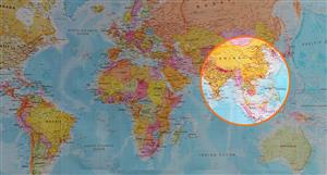
Region NEAR THE SOUTHEAST COAST OF AUSTRALIA
Distances 10 km (6 miles) SW of Moe, Australia
18 km (11 miles) W of Morwell, Australia
30 km (18 miles) WSW of Traralgon, Australia
78 km (48 miles) WSW of Sale, Australia
Location Uncertainty horizontal +/- 15.2 km (9.4 miles); depth +/- 2.9 km (1.8 miles)
Parameters NST= 44, Nph= 49, Dmin=410.8 km, Rmss=1.12 sec, Gp= 68°,
M-type=body wave magnitude (Mb), Version=5
Source
earthquake, page-29
-
- There are more pages in this discussion • 29 more messages in this thread...


You’re viewing a single post only. To view the entire thread just sign in or Join Now (FREE)
Featured News
Featured News
LU7
Discover the strong preliminary feasibility of the Bécancour Lithium Refinery, showcasing resilience in a low pricing environment and a strategic plan to capitalize on future price recoveries
NEWS
Antler Copper Project hits major permitting milestone – air quality permit advances to final review