2.3
Exploration Potential
and Strategy
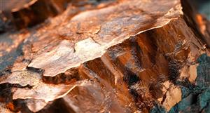
Located in a very productive gold province,
the Frances Furness tenement package
contains high grade gold occurrences that
have been mined in the past yielding over
25,000 ounces of gold at an average grade
of 16.7 g/t Au. The discovery of the high
grade Eric Lode adjacent to the Frances
Furness mine workings and other recent
significant drill intersections within the
tenement package, demonstrates that the
tenements have not been fully explored.
The persistence of gold mineralisation at
depth in the province is well known and
mineralisation within the tenements can be
expected to have similar depth potential.
The project as a whole has many similar
characteristics to the main Marvel Loch
mine. Stratigraphy, lithology, mineralisation
are similar and zones of dilation where
the best mineralisation is deposited have
been extensively intruded by pegmatite as
at Marvel Loch. At Frances Furness a large
pegmatite body occurs immediately south
of the main shaft. As well, from an historical
perspective, the Marvel Loch mine was a
set of small low tonnage – high grade mines at surface before developing into a series of
significant ore bodies at depth.
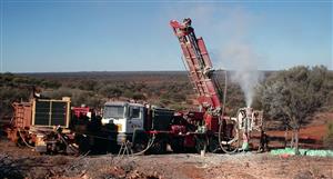
Brumby intends to test a variety of
targets with RC and diamond drilling and
develop new drill targets through further
surface exploration of the project area.
The East and West Lode high grade gold
mineralisation intersected in diamond
core drilling south of the Frances Furnace
mine fault is a target that could lead to the
delineation of a high grade underground
deposit. It is suggested this mineralisation
is the dislocated southern continuation
of the plunging ore shoots in the Frances
Furness mine. In this case potential
exists to define significant mineralisation
southeast towards the zone.
High grade intersections in the weathered
zone of the Eric Lode require further
evaluation for delineation of resources and
determination of a bedrock source. The
discovery of the Eric Lode in what appears to
be a new stratigraphic and structural position
suggests that further new discoveries may
be possible within the remainder of the
tenement area through the application of
airborne and ground geophysical surveys
and systematic RAB drilling.
High grade gold mineralisation intersected
adjacent to the Salvation gold mine is
potentially a parallel blind shoot and
although appearing to have limited
strike length may have extensive
plunge continuity. Close spaced drilling
immediately above and below the high
grade intersection is required to ascertain
dip and plunge potential.
Brumby has budgeted for expenditures of
$370,000 in Year 1 (including $230,000
as the exercise price of the option on
the project). Year 2 expenditure totals
$185,000. Total budgeted expenditure is
shown in the following table.
The proposed exploration program is
considered sound, and consistent with the
type of gold deposit sought and the mineral
potential of the project area. Budgeted
expenditure is adequate to cover the costs
of the proposed exploration program and
to meet annual expenditure commitments
set by the Western Australia Department of
Industry and Resources.3.
Brilliant Well Project (earning
85%) - Gold and Base Metals
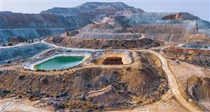
The Brilliant Well Project is located in the
Eastern Goldfields Province of Western
Australia, approximately 40 kilometres north
of the village of Leonora. The project consists
of three exploration licence applications,
EL37/799, EL37/820 and EL831 covering
an area of 208 square kilometres. All three
tenement applications are held by Brilliant
Gold Pty Ltd (“Brilliant Gold”) and are subject
to a joint venture agreement whereby Brumby
can earn up to 85% interest in the tenements
by reimbursing past expenditure of $25,000,
spending up to $400,000 on exploration and
tenement maintenance, and issuing 500,000
shares to Brilliant Gold on commencement
of the joint venture. Brilliant Gold will retain
a 2% net smelter royalty (NSR). Details
pertaining to the tenements and the joint
venture agreement are provided in the Legal
Report on Tenements and the Summary of
Material Contracts in this Prospectus.
Brilliant Well is accessible from the sealed
Leonora-Leinster Highway, located about
5 kilometres west of the project area.
Several pastoral station tracks traversing
the tenements, connect to the highway and
provide access throughout the tenement
area. The project is situated within the
Tarmoola pastoral lease owned by BHPBilliton
Limited.
The project area covers greenstone and
granite terrain of the Norseman-Wiluna
greenstone belt, in a region known for its
rich endowment of mineral deposits. The
Teutonic Bore and Jaguar volcanic-associated
massive sulphide (“VMS”) copper – zinc
deposits are located about 10 kilometres
to the west of the project area and the
Tarmoola and Thunderbox gold camps are
located 20 kilometres to the southwest and
40 kilometres to the northwest respectively.
All of these deposits are in close proximity
to the Keith Kilkenny Tectonic Zone, a trans
cratonic structure associated with nickel
– copper mineralisation, copper – zinc
mineralisation and major gold deposits at
various centres along its entire length. At
least one major north-northeast trending
splay, informally known as the Deep Well
Shear Zone, comes off the Keith Kilkenny
Lineament and cuts through the southern
and central part of the project area. Gold
anomalies occur at several locations along
the splay within the project area.3.1
Geologi cal Setting
The Eastern Goldfield Province occupies the
eastern third of the Yilgarn Craton. It is a
typical Archean granite-greenstone terrain
characterised by large areas of granitoid
and broad to narrow, linear and arcuate
belts of greenstone. The greenstones
are deformed and metamorphosed to
greenschist facies or higher and comprise
thick mafic to ultramafic volcanic
sequences and intrusives, felsic and
intermediate volcanic sequences pelitic
and psammitic sedimentary sequences and
interebedded chert, banded iron formation
and shale. Granitoid intrusions and regional
deformation involving multiple episodes of
folding and strike faulting have disrupted
the greenstone sequences.
The Brilliant Well tenements straddle the
contact between the extensive Bundarra
granite pluton, a large body of biotite
monzogranite, and greenstone stratigraphy
to the west. The contact may in part be
related to structures associated with the
Keith Kilkenny Tectonic Zone. In particular
within the tenement area, the Deep Well
Shear Zone forms a prominent zone along
the granite-greenstone contact. It traverses
the project tenements from the southwest
corner of EL37/820, through the central
part of the project area, passing out of
the tenements in the central north part of
EL37/871. It is up to one kilometre wide
and about 18 kilometres of strike length
occurs within the project area.
Most of the project area is covered
by a thin to moderately thick cover of
transported material, associated with the
surface drainage pattern in the area and
apart from a few granite outcrops in the
northern and central parts of EL37/871, the
underlying Archean geology is not exposed.
Consequently Archean stratigraphy
and lithologies are interpreted from
aeromagnetic data and limited data from
previous exploration drilling programs.
Much of the northern and southeastern
parts of the tenement area are underlain
by granitoid intrusive rocks. Previous
drilling, particularly in the northwest near
Christmas Well, identified gold anomalies
possibly associated with northwestsoutheast
structures, indicating that the
granite terrain is prospective for gold. In
the west and particularly the southwest,
both granitoid and greenstone rocks arepresent. Greenstone rocks, including
basalt, porphyritic basalt, dolerite, gabbro,
felsic to intermediate volcanic rocks and
sedimentary rocks and chert have been
intersected in previous drilling. These rocks
are sheared in some drill holes, indicating
the position of the Deep Well Shear Zone. In
the vicinity of Madman Well, aeromagnetic
data suggest the presence of ultramafic
rocks adjacent to the shear zone.
Alteration zones intersected in previous
shallow drilling within the Deep Well Shear
Zone are characterised by sericite, quartz
veining and minor oxidised sulphide.
The shear zone and several sub-parallel
structures to the east in the central portion
of EL37/820 are prospective targets which
have attracted minimal exploration to date.
Interpretation of aeromagnetic data has
also identified several other prominent
structures at various orientations which
intersect the Deep Well Shear Zone and
may be prospective for gold.
In the northeastern part of E37/820, a
prominent series of aeromagnetic highs,
has been interpreted to represent a
greenstone mass composed of folded
layered mafic sills within granite. Bedrock
in this area is obscured by moderately
thick transported cover. A series of thrusts
are interpreted to have broken up the
greenstone mass adding to the structural
complexity of the area. The feature has not
attracted any exploration to date.
2.3Exploration Potentialand StrategyLocated in a very productive...


Add to My Watchlist
What is My Watchlist?