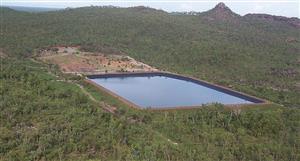
Perhaps they are using the Lidar to map detailed landform contours? This can be used for a variety of planning and design situations, from drainage, cut & fill calculations, road alignment just to name a few...
NEA Price at posting:
$1.99 Sentiment: Hold Disclosure: Not Held