We know about CRL's JV with SRI which is in the proximity of SIR, but what about Lake Dundas which the company will start drilling this quarter... is it also close to SIR???
Thoughts??
Project Summary
Location
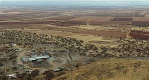
Lake Dundas Project is in the Eastern Goldfields of WA, 40km south of the mining town of Norseman. Despite its location, along strike from this major gold camp, it has undergone minimal previous exploration.
Geological Setting
The tenement is located at the southern end of the Archaean greenstone belt that extends from Menzies in the north through Norseman in the south. It is also just within that portion of the Yilgarn Craton that has been affected by Proterozoic metamorphism. The outcrop and the magnetic signature of the sediments are dominated by Banded Iron Formation ("BIF") units. The greenstone belt is interpreted to extend over about 9km from the north of the tenement to a major northeast trending fault system in the south of the tenement. Two north- northwest trending mafic dykes are interpreted to be present to the south of the fault. Outcrop within the tenement is restricted to the vicinity of the margins of the playa lake.
Previous Exploration
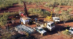
Central Norseman Gold Corporation Ltd explored the project area between 1985 and 1993 by means of geochemical soil sampling on a 400m by 40m grid and limited rock chip sampling.
Kinross Gold Australia Pty Ltd explored the area between 1994 and 1999. The exploration comprised of flying a detailed helimag survey, geological mapping, minor rock chip sampling, and the drilling of four RC holes for a total of 209m.
Interpretation of the geological mapping and the aeromagnetic data indicated that the main band of greenstones is present within the tenement with a strike length of up to 9km and over a width of up to 1km. The interpretation also identified seven target zones for gold mineralisation. Three of these zones were tested by four drill-holes, the locations of which are shown in figure 1 and given in the drill hole summary table at the end of this release.
Each hole intersected anomalous gold. The mineralised intersections were:
•
Hole SG1: 18m @ 0.15g/t Au from 18m, including 1m @ 0.44g/t Au;
•
Hole SG2: 4m @ 0.16g/t Au from 15m;
•
Hole SG3: 8m @ 0.43g/t Au from 1m, including 2m @ 0.7g/t, 12m @ 0.18g/t Au from 29m, and 24m @ 0.22g/t Au from 46m;
•
Hole SG4: 3m @ 0.11g/t Au from 39m and 1m @ 0.6g/t Au from 49m.
The mineralised intersections are in all of the rock types that were encountered, i.e. BIF, chert, metasediments, and mafic volcanics. The vertical depth-to- basement through the surficial sediments varied from 1m to 12m, and the base of oxidation from a minimum of 6m to a maximum of more than 33m vertically.
Exploration Potential
The Lake Dundas project area is situated at the very southern end of the Norseman-Wiluna Greenstone Belt, which contains major gold and nickel deposits along its 800km length. Despite its prime location, minimal exploration has been conducted over the tenement, presumably due to a relatively shallow cover of aeolian and lake sediments and to the fact that GSWA mapping showed the southernmost greenstones to be to the north of the tenement area.
The same greenstone units that host gold deposits at Norseman are, however, present within the tenement over a strike length of up to 9km and over a width of up to 1km. Further, they have been drill tested by a previous explorer by a total of only four holes over a strike length of three kilometres. All four holes intersected low-grade gold mineralisation. The locations of the holes were in part determined by ease of access and in part by geophysical targets.
Four other aeromagnetic targets remain untested and both these and, to a lesser extent the entire belt, are prospective for gold mineralisation.
Also of interest, is the location of the project on the margin of the terrain that was affected by Proterozoic metamorphism, within which are situated the AngloGold Ashanti Ltd-Independence Group Ltd Tropicana gold deposit and Beachcomber Prospect.
In summary, the area contains a belt of non-outcropping greenstones that are known to be strongly mineralised to the north along the same structural and stratigraphic trend. Approximately 5 Moz of gold has been produced from the same greenstone sequence in the Norseman district. The presence of significant intersections of gold in previous drilling and the low level of previous exploration makes this tenement very prospective.


Add to My Watchlist
What is My Watchlist?