Infrastruc planners use it all the time as its a gem of a product esp if u'r planning a 'mine to port' operation.
That's where one can use NM if they have that particular corridor covered to identify creek crossings, cattle corridors, topography etc.
I've hired aircrafts to acquire LiDAR & highres aerials (apart frm Satellite images which require booking a 'time' when a commercial satellite crosses over one's permits/tenements etc).
This can b very expensive & that's where NE comes in. Most mining companies do it this way (to monitor their overburden stockpiles as an example & Google Earth wont give a better alternative).
I've used NE when it was free a few years back, pissed me off when they took that version away & wouldn't roll out coverage over Central QLD (Cooper, Galilee, Bowen basins. Surat/Roma r good).
Note this was a good thing, as u get the 'lock the gate brigade' checking things out as well, so a subscription version is good.
Their products always needed a Infrastruc point of sale rather then LGA/Shires using it to monitor its assets & backyards.
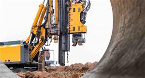
launch of @nearmap rail, page-12
-
- There are more pages in this discussion • 5 more messages in this thread...


You’re viewing a single post only. To view the entire thread just sign in or Join Now (FREE)
Featured News
Add NEA (ASX) to my watchlist
Currently unlisted public company.
The Watchlist
TON
TRITON MINERALS LTD
Adrian Costello, Executive Director
Adrian Costello
Executive Director
Previous Video
Next Video
SPONSORED BY The Market Online