12/02/2014 10:11am AEDT
nearmap launches nearmap Rail
ASX release
12 February 2014
nearmap launches nearmap Rail
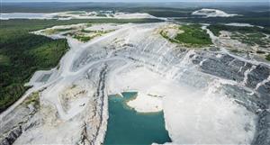
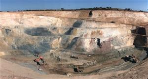
nearmap ltd (ASX: NEA), Australia’s exclusive provider of frequently updated, high resolution imagery, has today launched nearmap Rail a world-first service aimed at providing ports, mining and rail industries with a unique set of tools and ultra-high resolution aerial
imagery to monitor existing rail corridors and plan new ones.
“nearmap Rail is our first step to broaden our customer focus by meeting the needs of specific verticals,” said nearmap’s Managing Director Simon Crowther.
Built on nearmap’s powerful PhotoMaps™ technology platform,
nearmap Rail combines measurement tools, information overlays, elevation profiles, and access to source photos with new technology enabling nearmap to frequently capture ultra-high resolution PhotoMaps™ of thousands of kilometres of multi-billion dollar critical
infrastructure corridors such as rail lines.
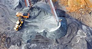
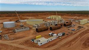
nearmap customers in the port, mining and rail industries can inspect areas after extreme weather events, check the conditions of assets, cost-effectively plan new infrastructure, and make reliable decisions based on timely, browser-based visual analytics.
“No one company is providing reliable and timely visual analytics as much as nearmap, and the features which make nearmap great make nearmap Rail even better,” said Mr. Crowther. “By bringing the site to a client’s desktop nearmap Rail is effectively providing an end-to-end planning and maintenance solution that saves time and
costly site visits as well as potentially billions of dollars in improved planning, asset management and change detection for critical infrastructure.”
nearmap continues to innovate and offer customers the most
compelling and up-to-date PhotoMaps™ and tools to help increase productivity, minimise the need to physically inspect infrastructure and thereby reduce costs.
For further information please visit:
http://nearmap.com/rail.
- END -


Add to My Watchlist
What is My Watchlist?