
Basic geology to more specific as suits a thread with this title. Continental to outcrop scale with the caveat that the geology is very much in flux given the recent discoveries. Improved access and funds for more studies will fine tune the regional data from the government end and the drilling will give much needed sub surface indications that were not available to the old timers.
A version of the geological framework of Australia - courtesy Wikipedia. Block containing WA1/ENR and much else highlighted.
Zooming in a little: Stars are schematic for Luni, P2 and smaller one for the wide spread carbonatites reported by ENR in the past year.
Only annotated 3 units as they are applicable to the West Arunta area. [Many complexities hidden in this simple map.
Complex basement is the host for known carbonatites so far and probably will remain so.
The light brown unit marked M is part of the Murraba basin which overlies the basement with or without fault contacts.
The Canning basin overlaps the basement and is the youngest unit in this area.
Regional West Arunta from an early WA1 source referring to Report 113 by Joly et al 2013.
Basic stratigraphy and ages - many subject to further study and potential modification.
Probably a significant age difference between the Murraba basin sediments and the complex basement. Ditto for the much younger Canning Basin sediments. How these younger units overlie the Older ones will determine if any deposits are shallow enough to become economic. This observation is very applicable to the tenements applications to the North of the known deposits.
LYN tenements are underlain by Murraba/Hidden Basin/Canning Basin but do have interesting geophysics locally. Depth??
A lot of work to stitch 4 map sheets together on the border of two states. Stansmore (NW 250K sheet N of Luni/P2) mapping dates back some 50 years. The Hidden Basin beds are the subject of debate regarding their age at present.
Zooming in on Luni/P2 area
The faults and Lake Mackay quartzite show correlation with Luni/P2 though only the faults may b prominent for Hoschke/Crean/Hurley based on this broad, early, interpretative geology map.
Drilling, outcrop outlines red (Government mapped Lake Mackay quartzite) green, yellow, pink ( gneissic/ Murraba - Hidden Basin).
The above map (joly et al 2013) was the result of cross referencing geophysics with previously mapped geology and other detail analysis.
I talked with ENR geos about the mapping. Good first pass but lot of work needed. A simple examination of outcrops visible in satellite imagery (GE and others) shows there are probably multiple lithologies within the Lake Mackay quartzite. Some images starting in the west at P1/2.
No outcrop at P2 but a lot at P1 to the west (Government mapped in blue, satellite interp yellow) where gneissic hosts were encountered in drilling.
Q2a-1
Generally massive outcrop with only slight hint of bedding in SW, White patches ?weathering zones or salt???
q2-1
hint of bedding in generally similar morphology.
Quartzite for either?
At Shackleton some 20 Kms to the east there is a large exposure of probable quartzite - nearly a one off for the area.
Q2-5
Q2-6
Just SW of Luni (some 3kms) are some outcrops with a 3rd different texture in Satellite view
Location image with symbols as for P2 (o/c, gravity) Blue line is government interpreted boundary of the lake Mackay quartzite.
Q3-2
Massive with only hing of bedding on margins.
Q1-3 image with strong foliation/bedding sub parallel to the gravity anomaly string SE from Emily.
Welcome to the world of geological mapping. Trying to be consistent with limited exposures of variably weathered lithologies. My impression is the Lake Mackay Quartzite needs revision.
Toss on the Carbonatites and Lamprophyres reported in drilling and revision of the bedrock geology is essentially a given. No real surprise to the old timers who did the best they could with limited resources and no obvious economic benefit from their work.
===============
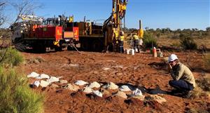
Annotated this drone image of southern central Luni.


Add to My Watchlist
What is My Watchlist?
 (20min delay) (20min delay)
|
|||||
|
Last
$16.34 |
Change
0.110(0.68%) |
Mkt cap ! $1.106B | |||
| Open | High | Low | Value | Volume |
| $15.95 | $16.74 | $15.95 | $2.167M | 132.2K |
Buyers (Bids)
| No. | Vol. | Price($) |
|---|---|---|
| 1 | 61 | $16.18 |
Sellers (Offers)
| Price($) | Vol. | No. |
|---|---|---|
| $16.40 | 500 | 1 |
View Market Depth
| Last trade - 16.10pm 11/07/2025 (20 minute delay) ? |
| WA1 (ASX) Chart |