dailytelegraphForbes, Lachlan Valley flooding: Aerial images show damage
Farmers are facing a bill of hundreds of millions of dollars as new images reveal the destruction of this month’s Lachlan Valley flooding.
November 24, 2021 - 2:04PMThe damage bill for the recent flooding of the Lachlan Valley is expected to run into the hundreds of millions, it can be revealed.
It comes as aerial photos show the devastating impact of the risings waters on farmland and rural communities.
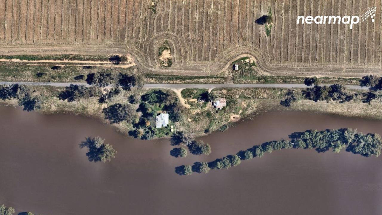
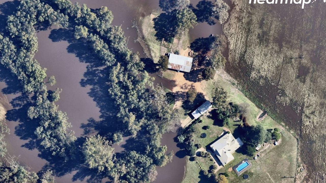
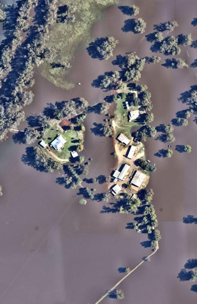
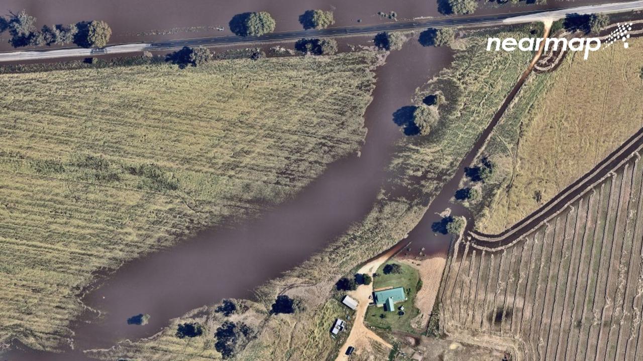
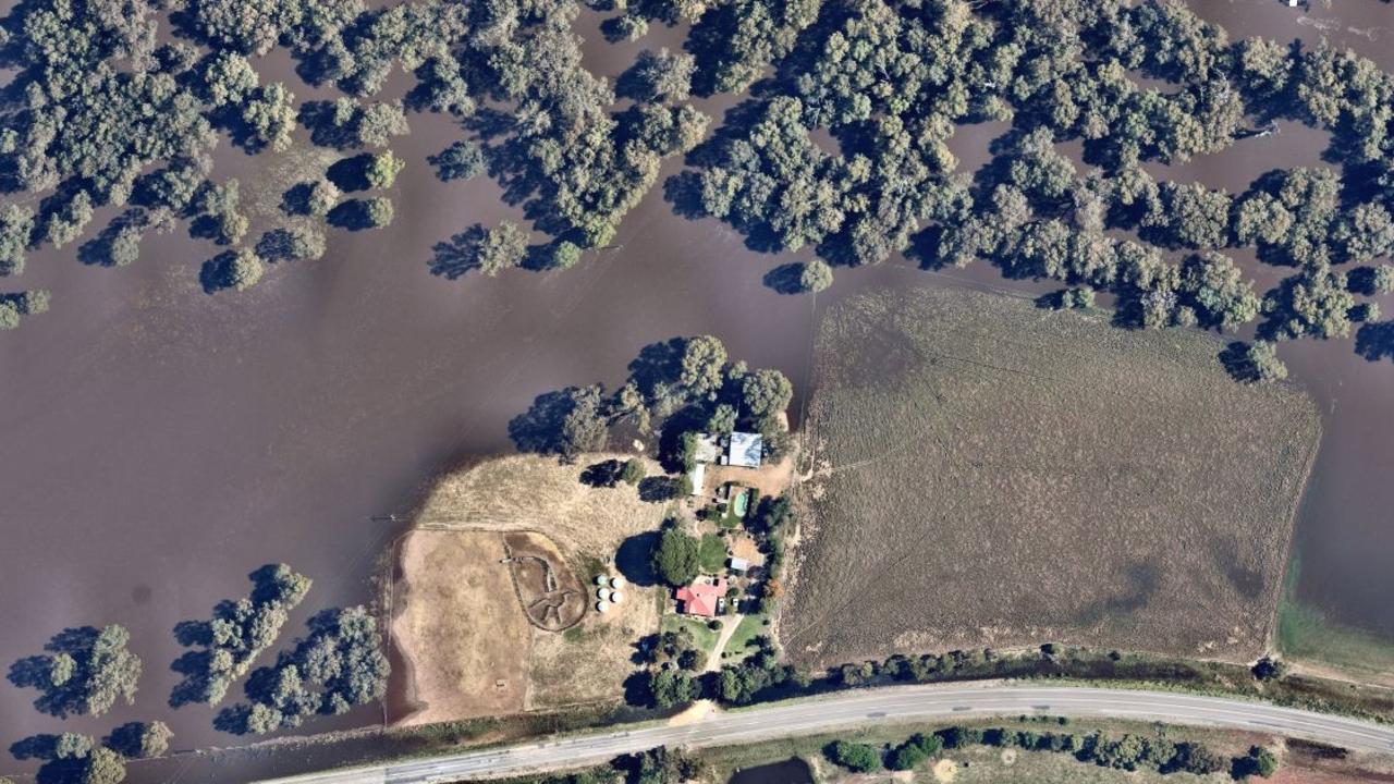
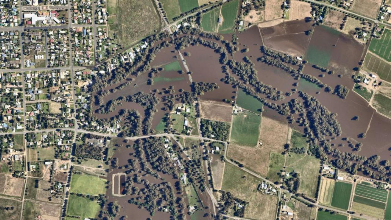
Aerial imagery and location data company Nearmap captured these incredible images around the Lachlan Valley region on November 17.
The images were captured on Wednesday (November 17) by Nearmap. Picture: Aerial imagery by Nearmap
The photos were taken in Forbes and near the town of Eugowra, about 35km to the east of Forbes.Nearmap captured the images around the town of Eugowra. Picture: Aerial imagery by NearmapMany homes now resemble islands. Picture: Aerial imagery by NearmapThe extent of damage to the area’s transport network is yet to be established. Picture: Aerial imagery by NearmapSome home narrowly escaped. Picture: Aerial imagery by NearmapIt wasn’t just farms, many homes went under as well. Picture: Aerial imagery by Nearmap


Add to My Watchlist
What is My Watchlist?