Some Facts that have been known by the local black fellows for thousands of years...but ignored by the " One-Nutted Experts " that are now trying to tell us ...it's the Man-Made CO2....
The NSW Hunter region is indeed characterized by extensive floodplains, making it a flood-prone area. The Hunter River, along with its tributaries, flows through a wide valley, creating a vast floodplain that stretches from the upper reaches to the coast. This makes the region susceptible to flooding, particularly during heavy rainfall or when the Hunter River's flow exceeds capacity.
In 1817, Governor Macquarie of New South Wales issued a General Order urging settlers to relocate farms and take precautions against future floods, warning against building on floodplains. He specifically warned that no compensation would be given for those who chose to build in flood-prone areas. This action reflected his exasperation with settlers continuing to build near rivers despite the known risks.

disallowed/national/nsw/governor-macquarie-warned-us-of-building-folly-centuries-ago-20221117-p5bz6w.html
About the Hunter catchment
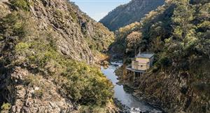
The Hunter catchment lies east of the Great Dividing Range, around 100 kilometres north of Sydney.
It is bounded by the Manning and Karuah catchments in the north, and by the Lake Macquarie and Hawkesbury-Nepean catchments in the south. The region is popularly known as the Hunter Valley.
The Hunter catchment supports a range of landscapes, from high mountain ranges up to 1,500 metres high, to broad fertile floodplains and extensive estuarine areas less than 50 metres high. In the west of the catchment there are large areas of wilderness and national park.
The Hunter is the largest coastal catchment in NSW, with an area of about 21,500 square kilometres
.
Extensive Floodplains:
The Hunter Valley's geography, with its broad valleys and river systems, creates a natural floodplain.
Flooding in the Hunter region can be caused by:- Heavy rainfall leading to runoff exceeding the capacity of creeks and drainage systems.
- Riverine flooding, where the Hunter River and its tributaries overflow their banks.
- Concurrent flooding of multiple waterways, exacerbating flood levels.
Flooding can have significant impacts on the Hunter region, including:
- Damage to property and infrastructure.
- Disruption to transportation and communication.
- Isolation of communities, particularly in rural areas.
Specific Areas at Risk:
Various towns and communities within the Hunter region are particularly susceptible to flooding, including Hinton, Wallalong, Duns Creek, Singleton, Maitland, and Muswellbrook.
Historical Flooding:
The Hunter region has a history of significant floods, with major events occurring in various years, including 1893, 1913, 1955, and 1990

.