Good idea for everyone to reread this in detail , Those that don’t know what is going on and the direction and focus of ASN after reading should IMO probably not be involved with speculative stocks . I am happy to hold and wait
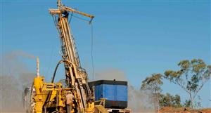
21 December 2020 ASX ANNOUNCEMENT ASX: ASN, ASNOCAnson Confirms Anomalous PGEs at The Bull Project Highlights:• Geochemical samples confirm anomalous PGEs at The Bull Project within the interpreted mafic-ultramafic intrusive complexo Samples were assayed from initial ground truthing program• No previous exploration had been carried out at The Bull Project which waspreviously mapped as granitic• The Bull Project is in the same geological terrane and approximately 20km south of Chalice Gold Mines’ (ASX: CHN) Julimar Ni-Cu-PGE discovery• Follow up exploration work continues at The Bull Project including extensive rock chip sampling and geological mappingAnson Resources Limited (ASX: ASN, ASNOC) (Anson or the Company) is pleased to advise that assays received from the initial ground truthing program completed at the Company’s 100% owned The Bull Project located in Western Australia (the Project), have returned anomalous Platinum Group Elements (PGE’s) with associated nickel and copper.Phase 1 Exploration Program UpdateThe initial ground truthing sampling program is the first phase in Anson’s low-cost exploration program at The Bull Project, and these initial results are encouraging. Anson has commenced the next stage of the program which will include completion of geological mapping and a detailed rock sampling program of the Target 1 area. The final steps in this initial exploration program are an airborne drone magnetic survey and a ground gravity survey to be completed early next year.The drone magnetic and the ground gravity surveys are aiming to demonstrate the distinct internal character of the magnetic anomaly at The Bull, showing the internal features of the ovoid-shaped magnetic anomaly.On completion of all the surveys and further evaluation, a soil geochemical program will be planned for the Target 1 area with a view to determining the source of the strong magnetic response.Samples from the detailed rock sampling program will also be assayed for Ni-Cu-PGE’s and the data will be used to provide a more detailed understanding of the geological setting to determine possible drilling targets.This program follows the exploration pathway established by Chalice Gold Mines Limited (ASX: CHN) leading to the world-class Julimar Ni-Cu-PGE discovery, located approximately 20km south from The Bull Project.Anson Resources LimitedLevel 1, 35 Outram Street, West Perth, WA 6005, Australia Tel: +61 478 491 355 ABN: 46 136 636 005 www.ansonresources.com The initial geochemical sampling survey was focused along a drainage system that drains to the south- west along Target 1 within the tenement area. Several samples returned anomalous palladium, with a peak value of 10ppb Pd, coincident with the position of the Target 1 anomaly interpreted from the aerial magnetics, see Figure 2.In addition, some of these samples returned anomalous platinum values, see Table 1 and 2. ID Easting Northing Cu (ppm) Ni (ppm) Pt (ppb) Pd (ppb) 5 4138606 4138588 41414210 41430511 41429412 41427613 41412018 4139526494422 140 56 6494404 138 64 6494071 148 94 6494096 166 80 6494079 80 100 6494056 90 90 6493969 120 92 6493834 164 845 5 10 5 10 55 10 10 5 10 105 5 <5 5 Table 1: Selected sample locations and grades from the initial ground truthing program.While the PGE’s values are anomalous, the results are consistent with expectations as the samples were mainly taken from topographic highs and from paddocks with little or no outcrop, and as a result float and sub-crop were sampled from easily accessible areas, see Figure 1 and 2 and the ASX Announcement of 13 October 2020.Management CommentaryAnson’s Executive Chairman and CEO, Bruce Richardson, commented,“We continue to make significant inroads at The Bull Project and assays from our initial field work programs are clearly demonstrating the significant exploration upside potential of The Bull. The objective of this initial reconnaissance sampling program was to confirm the presence of mafic/ultramafic rock within an area previously mapped as granitic and this was successfully achieved.“Anson has so far identified three major targets at The Bull measuring up to 1,400m in length and 800m in width, and our team is closely following an exploration pathway proven successful in discovering significant Ni-Cu-PGE deposits.“Our geological team is now in the process of completing further reconnaissance work before we undertake a drone magnetic and ground gravity survey early next year which will aim to generate targets for our initial drilling program at The Bull.” 2 Figure 1: Sample locations in and around Target 1, Palladium values (>10ppb) in red overlaying a TMI image.Figure 2: Looking north east towards the outcropping area in the central region of Target 1 at The Bull Project 3 The earlier confirmation of the mafic-ultramafic intrusive complex, see ASX announcement 19 November 2020, is significant as it determines that The Bull has a similar geological terrane as Chalice’s (ASX: CHN) Julimar Ni-Cu-PGE discovery correlating with Anson’s earlier geophysical interpretation.The samples collected from this small ground truthing program completed show that the area is not completely granitic and the anomalous Ni/Cu values suggests prospective ultramafic rocks in the project area.The Bull Project BackgroundThe Bull Project, which lies approximately 20km south of the Julimar Project, is interpreted as a layered intrusive complex located on the western edge of the Yilgarn Craton. The anomaly is an ovoid shaped, relatively discrete and strongly magnetic target (similar to the Gonneville Intrusion) hosting the Julimar mineralisation and is being investigated as a potential intrusive hosted magmatic Ni-Cu-PGE sulphide target.The Julimar mineralisation, which remains open in all directions, could point to a regional scale discovery, including The Bull Project area. Based upon the presence of similar magnetic signatures, similar copper and nickel results and the lack of previous exploration, it is considered that The Bull Project is highly prospective for Ni-Cu-PGE, as it could host extensions or repeat of similar orebodies discovered at Julimar.Anson’s Strategic FocusAnson has a multi-mineral/multi-revenue strategy and The Bull Project forms a key focus in the Company’s base metal exploration portfolio in Western Australia (see Figure 3) where exploration activity is continuing.While the Paradox Brine Project in Utah remains the Company’s flagship project, Anson plans to conduct further exploration activities at The Bull Project upon the exploration licence applications being granted, to potentially unlock further shareholder value from these assets. With renewed focus on nickel sulphide mineralisation and associated copper and PGE minerals Anson’s WA portfolio holds significant potential and is in a favourable position to benefit from the renewed interest in these minerals. 4 Figure 3: Map of the location of Anson’s and other base metal projects on the Yilgarn Craton margins.This announcement has been authorised for release by the Executive Chairman and CEO.For further information please contact:Bruce RichardsonExecutive Chairman and CEOE: [email protected] www.ansonresources.comENDSPh: +61 478 491 355Follow us on Twitter @anson_ir 5 Competent Person’s Statement: The information in this Announcement that relates to exploration results and geology is based on information compiled and/or reviewed by Mr Greg Knox, a member in good standing of the Australasian Institute of Mining and Metallurgy. Mr Knox is a geologist who has sufficient experience which is relevant to the style of mineralisation under consideration and to the activity being undertaken to qualify as a “Competent Person”, as defined in the 2012 Edition of the Australasian Code for Reporting of Exploration Results, Mineral Resources and Ore Reserves and consents to the inclusion in this report of the matters based on information in the form and context in which they appear. Mr Knox has reviewed and validated the metallurgical data and consents to the inclusion in this Announcement of this information in the form and context in which it appears. Mr Knox is a director of Anson and employee of Anson.Appendix 1The results of the geochemical sampling at The Bull prospect, see Table 2. ID Northing Easting Cu (ppm) Ni (ppm) Pt (ppb) Pd (ppb) Geology 1 64949282 64949243 64949114 64948965 64944226 64944057 64942278 64940729 649409110 649409711 649408012 649405713 649397014 649391015 649356716 649357317 649372018 6493835413844.6 413849.2 413839.5413832413860 413858.3 413847.6 414142.3 414288.1 414305.8 414294.1 414276.8 414120.2 414125.3 414087.8 414008.5 413920.1 413952.692 84 <5 <5 160 68 <5 <5 136 66 <5 <5 186 68 <5 <5 140 56 5 5 138 64 10 5 156 80 <5 <5 148 94 10 5 124 94 5 <5 166 80 5 10 80 100 10 590 90 10 10 120 92 5 592 80 <5 <5 46 18 <5 <5 60 18 <5 <58 4 <5 <5 164 84 <5 5Dolerite U/Mafic U/Mafic U/Mafic Mafic U/Mafic Dolerite Mafic Dolerite Mafic Dolerite U/Mafic U/Mafic U/Mafic Laterite Laterite Granite U/Mafic Table 2: Table showing the location and the assay results of the ground truthing sampling program.6 JORC CODE 2012 “TABLE 1” REPORTSampling Techniques and Data(Criteria in this section apply to all succeeding sections.) Criteria JORC Code explanation Commentary Sampling techniques• Nature and quality of sampling (eg cut channels, random chips, or specific specialised industry standard measurement tools appropriate to the minerals under investigation, such as down hole gamma sondes, or handheld XRF instruments, etc). These examples should not be taken as limiting the broad meaning of sampling.• Include reference to measures taken to ensure sample representivity and the appropriate calibration of any measurement tools or systems used.• Aspects of the determination of mineralisation that are Material to thePublic Report.• In cases where ‘industry standard’ work has been done this would berelatively simple (eg ‘reverse circulation drilling was used to obtain 1 m samples from which 3 kg was pulverised to produce a 30 g charge for fire assay’). In other cases more explanation may be required, such as where there is coarse gold that has inherent sampling problems. Unusual commodities or mineralisation types (eg submarine nodules) may warrant disclosure of detailed information.• Rock chip sampling program was carried out to industry standards.• Results (from Table 1 and 2) report geochemical assays which arelocated within Anson’s tenement area (ELA70/5420). Drilling techniques • Drill type (eg core, reverse circulation, open-hole hammer, rotary air blast, auger, Bangka, sonic, etc) and details (eg core diameter, triple or standard tube, depth of diamond tails, face-sampling bit or other type, whether core is oriented and if so, by what method, etc). • No drilling results have been reported. Drill sample recovery • Method of recording and assessing core and chip sample recoveries and results assessed.• Measures taken to maximise sample recovery and ensure representative nature of the samples.• Whether a relationship exists between sample recovery and grade and whether sample bias may have occurred due to preferential loss/gain of fine/coarse material. • No drilling results have been reported. 7 Criteria JORC Code Explanation Commentary Logging • Whether core and chip samples have been geologically and geotechnically logged to a level of detail to support appropriate Mineral Resource estimation, mining studies and metallurgical studies. • Geological observations noted. • Whether logging is qualitative or quantitative in nature. Core (or costean, channel, etc.) photography.• The total length and percentage of the relevant intersections logged. • Geological logging is qualitative in nature. Sub-sampling techniques and sample preparation • If core, whether cut or sawn and whether quarter, half or all core taken.• If non-core, whether riffled, tube sampled, rotary split, etc and whethersampled wet or dry.• For all sample types, the nature, quality and appropriateness of thesample preparation technique.• Quality control procedures adopted for all sub-sampling stages tomaximise representivity of samples.• Measures taken to ensure that the sampling is representative of the in situmaterial collected, including for instance results for fieldduplicate/second-half sampling.• Whether sample sizes are appropriate to the grain size of the materialbeing sampled, • No drilling is being reported.• The sampling techniques were considered appropriate for mineralisationbeing reported.• The rock chip samples were sent to a WA laboratory for assay for thecomplete suite minerals for that style of mineralisation. Quality of assay data and laboratory tests • The nature, quality and appropriateness of the assaying and laboratory procedures used and whether the technique is considered partial or total.• For geophysical tools, spectrometers, handheld XRF instruments, etc., theparameters used in determining the analysis including instrument make and model, reading times, calibrations factors applied and their derivation, etc.• Nature of quality control procedures adopted (e.g. standards, blanks, duplicates, external laboratory checks) and whether acceptable levels of accuracy (i.e. lack of bias) and precision have been established. • Samples were initially assayed using XRF for a quick turnaround.• XRF readings carried out with a Innov-X Systems Delta Dynamic XRF.• Samples have been assayed at certified laboratories in Western Australia.• Assay techniques used are considered appropriate for the style ofmineralisation.• Samples assayed for large suite of elements suitable for the regionalexploration programs. 8 Criteria JORC Code explanation Commentary Verification of sampling and assaying• The verification of significant intersections by either independent or alternative company personnel.• The use of twinned holes.• Documentation of primary data, data entry procedures, data verification,data storage (physical and electronic) protocols.• Discuss any adjustment to assay data.• No adjustment to assay data. Location of data points • Data spacing for reporting of Exploration Results.• Whether the data spacing and distribution is sufficient to establish thedegree of geological and grade continuity appropriate for the Mineral Resource and Ore Reserve estimation procedure(s) and classifications applied.• Whether sample compositing has been applied. • Locations surveyed using handheld GPS.• The grid system is MGA 94, Zone 50. • Data spacing and distribution• Data spacing for reporting of Exploration Results.• Whether the data spacing and distribution is sufficient to establish thedegree of geological and grade continuity appropriate for the Mineral Resource and Ore Reserve estimation procedure(s) and classifications applied.• Whether sample compositing has been applied.• Data spacing is considered sufficient for exploration.• Samples were collected at non-regular intervals according toobservations in the field.• No sample compositing has been applied.• Samples are taken on an ad hoc basis. Orientation of data in relation to geological structure • Whether the orientation of sampling achieves unbiased sampling of possible structures and the extent to which this is known, considering the deposit type.• If the relationship between the drilling orientation and the orientation of key mineralised structures is considered to have introduced a sampling bias, this should be assessed and reported if material. • No historic drilling is being reported. Sample security • The measures taken to ensure sample security. • No drilling has been carried out.• Samples were collected by Anson personnel and put in calico bags.Audits or reviews • The results of any audits or reviews of sampling techniques and data. • No audits or reviews of the data have been conducted at this stage.9 Section 2 Reporting of Exploration Results(Criteria in this section apply to all succeeding sections.) Criteria JORC Code explanation Commentary Mineral tenement and land tenure status• Type, reference name/number, location and ownership including agreements or material issues with third parties such as joint ventures, partnerships, overriding royalties, native title interests, historical sites, wilderness or national park and environmental settings.• The security of the tenure held at the time of reporting along with any known impediments to obtaining a licence to operate in the area. • The Project comprises 2 tenement applications, ELA70/5420 and ELA70/5619.• Tenements are 100% owned by Anson Resources through its subsidiary State Exploration Pty Ltd.• Land access agreement negotiations have commenced. Exploration done by other parties • Acknowledgment and appraisal of exploration by other parties. • No past exploration and mining in the region has been carried out. Geology • Deposit type, geological setting and style of mineralisation. • Previous geological unit interpretation was granite.• Ni-Cu-PGE mineralisation in ultramafics-mafic intrusives. Drill hole Information• A summary of all information material to the understanding of the exploration results including a tabulation of the following information for all Material drill holes easting and northing of the drill hole collaro elevation or RL (Reduced Level – elevation above sea level in metres) of the drill hole collaro dip and azimuth of the holeo down hole length and interception depth o hole length. • No drilling is being reported.• All rock chip co-ordinates are shown in Appendix 1 (Table 3). • If the exclusion of this information is justified on the basis that the information is not Material and this exclusion does not detract from the understanding of the report, the Competent Person should clearly explain why this is the case. • Not applicable, (no drilling being reported). 10 Criteria JORC Code explanation Commentary Data aggregation methods• In reporting Exploration Results, weighting averaging techniques, maximum and/or minimum grade truncations (eg cutting of high grades) and cut-off grades are usually Material and should be stated.• Where aggregate intercepts incorporate short lengths of high grade results and longer lengths of low grade results, the procedure used for such aggregation should be stated and some typical examples of such aggregations should be shown in detail.• The assumptions used for any reporting of metal equivalent values should be clearly stated. • No weighting or cut-off grades have been applied.• No aggregate sampling has been carried out.• No metal equivalent values are being used for reporting exploration results. Relationship between mineralisation widths and intercept lengths • These relationships are particularly important in the reporting of Exploration Results.• If the geometry of the mineralisation with respect to the drill hole angle is known, its nature should be reported.• If it is not known and only the down hole lengths are reported, there should be a clear statement to this effect (e.g. ‘down hole length, true width not known’). • No drilling is being reported or has been carried out in the area. Diagrams • Appropriate maps and sections (with scales) and tabulations of intercepts should be included for any significant discovery being reported. These should include, but not be limited to a plan view of drill hole collar locations and appropriate sectional views. • Appropriate diagrams are shown in the text. Balanced reporting • Where comprehensive reporting of all Exploration Results is not practicable, representative reporting of both low and high grades and/or widths should be practiced to avoid misleading reporting of Exploration Results. • The only assay results disclosed are located on the Bull Project area, ELA70/5420. Other substantive exploration data • Other exploration data, if meaningful and material, should be reported including (but not limited to): geological observations; geophysical survey results; geochemical survey results; bulk samples – size and method of treatment; metallurgical test results; bulk density, groundwater, geotechnical and rock characteristics; potential deleterious or contaminating substances. • No additional new exploration data. 11 Criteria JORC Code explanation Commentary Further work • The nature and scale of planned further work (eg tests for lateral extensions or depth extensions or large-scale step-out drilling).• Diagrams clearly highlighting the areas of possible extensions, including the main geological interpretations and future drilling areas, provided this information is not commercially sensitive. • Geological and sampling programs to verify initial results and to determine the extent of possible mineralisation on application being granted.• Carrying out aeromagnetic and ground gravity surveys.• Define future targets. 12
ASN Price at posting:
2.9¢ Sentiment: Buy Disclosure: Held
easting and northing of the drill hole collaro elevation or RL (Reduced Level – elevation above sea level in metres) of the drill hole collaro dip and azimuth of the holeo down hole length and interception depth o hole length. • No drilling is being reported.• All rock chip co-ordinates are shown in Appendix 1 (Table 3). • If the exclusion of this information is justified on the basis that the information is not Material and this exclusion does not detract from the understanding of the report, the Competent Person should clearly explain why this is the case. • Not applicable, (no drilling being reported). 10 Criteria JORC Code explanation Commentary Data aggregation methods• In reporting Exploration Results, weighting averaging techniques, maximum and/or minimum grade truncations (eg cutting of high grades) and cut-off grades are usually Material and should be stated.• Where aggregate intercepts incorporate short lengths of high grade results and longer lengths of low grade results, the procedure used for such aggregation should be stated and some typical examples of such aggregations should be shown in detail.• The assumptions used for any reporting of metal equivalent values should be clearly stated. • No weighting or cut-off grades have been applied.• No aggregate sampling has been carried out.• No metal equivalent values are being used for reporting exploration results. Relationship between mineralisation widths and intercept lengths • These relationships are particularly important in the reporting of Exploration Results.• If the geometry of the mineralisation with respect to the drill hole angle is known, its nature should be reported.• If it is not known and only the down hole lengths are reported, there should be a clear statement to this effect (e.g. ‘down hole length, true width not known’). • No drilling is being reported or has been carried out in the area. Diagrams • Appropriate maps and sections (with scales) and tabulations of intercepts should be included for any significant discovery being reported. These should include, but not be limited to a plan view of drill hole collar locations and appropriate sectional views. • Appropriate diagrams are shown in the text. Balanced reporting • Where comprehensive reporting of all Exploration Results is not practicable, representative reporting of both low and high grades and/or widths should be practiced to avoid misleading reporting of Exploration Results. • The only assay results disclosed are located on the Bull Project area, ELA70/5420. Other substantive exploration data • Other exploration data, if meaningful and material, should be reported including (but not limited to): geological observations; geophysical survey results; geochemical survey results; bulk samples – size and method of treatment; metallurgical test results; bulk density, groundwater, geotechnical and rock characteristics; potential deleterious or contaminating substances. • No additional new exploration data. 11 Criteria JORC Code explanation Commentary Further work • The nature and scale of planned further work (eg tests for lateral extensions or depth extensions or large-scale step-out drilling).• Diagrams clearly highlighting the areas of possible extensions, including the main geological interpretations and future drilling areas, provided this information is not commercially sensitive. • Geological and sampling programs to verify initial results and to determine the extent of possible mineralisation on application being granted.• Carrying out aeromagnetic and ground gravity surveys.• Define future targets. 12


 (20min delay)