PROPOSAL TO GRANT PETROLEUM EXPLORATION PERMIT
The State of Western Australia HEREBY GIVES NOTICE that the Minister for Mines and Petroleum C/- Department of Mines and Petroleum, 100 Plain Street,
East Perth WA 6004 may grant the following Petroleum Exploration Permit application/s applied for under section 31 of the Petroleum and Geothermal Energy
Resources Act 1967 (WA) .
NUMBER APPLICANT AREA SHIRE
STP-EPA-0109 NEW STANDARD ONSHORE PTY LTD 2741.1km2 EAST PILBARA SHIRE 26.5% AND HALLS CREEK SHIRE 73.5%
LOCALITY
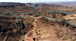
The application is situated in the Canning Basin and occupies a total of 34 5’x5’ blocks over four different 1 million mapsheets: 8 blocks over Broome (SE51),
1 block over Oakover River (SF51), 19 blocks over Halls Creek (SE52) and 6 blocks over Lake Mackay (SF52). The application is about 78 km wide and
55 km wide. Its northern boundary partly lies across the Ngarantjadu claypan. The south-east corner of the application is located approximately 15 kilometres
directly west of Mount Ernest on the Canning Stock Route.
The application commences at a point 125°55’4.58”E; 19°39’54.97”S, thence east along a parallel to a point 126°25’4.53”E; 19°39’54.95”S, thence south
along a meridian to a point 126°25’4.55”E; 19°54’54.96”S, thence west along a parallel to a point 126°20’4.56”E; 19°54’54.96”S, thence south along a
meridian to a point 126°20’4.56”E; 20°4’54.96”S, thence east along a parallel to a point 126°25’4.55”E; 20°4’54.96”S, thence south along a meridian
to a point 126°25’4.56”E; 20°9’54.96”S, thence west along a parallel to a point 126°10’4.58”E; 20°9’54.96”S, thence north along a meridian to a point
126°10’4.58”E; 20°4’54.96”S, thence west along a parallel to a point 126°5’4.58”E; 20°4’54.96”S, thence north along a meridian to a point 126°5’4.58”E;
19°59’54.96”S, thence west along a parallel to a point 125°50’4.61”E; 19°59’54.97”S, thence south along a meridian to a point 125°50’4.61”E; 20°4’54.97”S,
thence west along a parallel to a point 125°45’4.61”E’; 20°4’54.97”S, thence north along a meridian to a point 125°45’4.61”E; 19°59’54.97”S, thence west
along a parallel to a point 125°40’4.62”E; 19°59’54.97”S, thence north along a meridian to a point 125°40’4.62”E; 19°54’54.97”S, thence east along a
parallel to a point 125°50’4.60”E; 19°54’54.97”S, thence north along a meridian to a point 125°50’4.60”E; 19°49’54.97”S, thence east along a parallel to a
point 125°55’4.59”E; 19°49’54.97”S and fi nally north along a meridian to the starting point 125°55’4.58”E; 19°39’54.97”S.
All coordinates are in Geocentric Datum of Australia 1994 (GDA94)
PROPOSAL TO GRANT PETROLEUM EXPLORATION PERMIT The State of...


Add to My Watchlist
What is My Watchlist?