Hi all!I have a problem, it is a good problem to have but I don't know the solution.
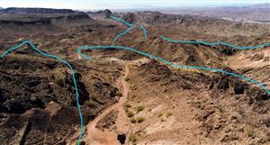
Background: Rural property I work near has uncovered a number of very large, very white quartz rock samples whilst constructing a dam. The quality of the quartz is apparently extremely good!, to the point that it has some small time local quarrying types extremely excited given the size (3 tonne boulders, description and weight a guesstimate) of the uncovered rock so far.
Land owner is interested in pursuing the opportunity as far as mining/crushing/selling the quartz but has no way to establish the direction of the reef outside of excavating/drilling and is wondering if there is a smarter way to ascertain the reef dimensions?, i.e. without drilling/digging unnecessarily.
The area has been tested historically for gold bearing quartz but did not return much in the way of results, not sure of the quality or accuracy of the tests as they were conducted quite a long time ago.
Question: What might be the best way to begin identifying the size of the quartz deposit/strike length using survey techniques/technologies?
google has mentioned a plethora of technologies yet recommended none
The area is located in the New England, NSW. mixture of granite and basalt type soils/rock in the area if that in any way impacts the answer
Cheers in advance for any help or direction pointing that is provided