I'm not sure if this is correct but i was looking at the potential of nambia and found info at http://www.wise-uranium.org/uoafr.html with this Tubas and Tumas tenements Size: 15278 tonnes U Ore grade: 0.022% U • Deep Yellow Ltd (being acquired)
and i'm not sure if this is the reptile tenements that was explored by from previous explores. Anyway i found a large file with namibian deposits and the results were this http://www.mme.gov.na/gsn/pdf/uranium.pdf
4.2.2.1.2 The Tubas Uranium deposit The Tubas deposit is situated along the Tumas River some 40 km east of Walvis Bay. The deposit was located during exploration conducted over the Tubas Grant (Fig. 25). Anomalous zones were located in the southern part of the grant which is transected by the westwards-flowing Tumas River. T-cup survey anomalies were percussion drilled and this located secondary uranium mineralisation associated with the palaeochannel of the Tumas valley. The Tumas valley is in excess of 40-m-deep and the rock types occupying the palaeovalley consist of red to brick-red sand or sandstone, grits, conglomerates, gypsum and calcrete. Red sands occur up to 10 m below surface. Calcretes of ranging shades are present below the red sands. Within the calcretes are loosely consolidated grits and gravels (Fig. 29). Uranium mineralisation in the Tumas River drainage is present mainly in tabular bodies of the upper 20 m. The mineralisation is Figure 29: Plan showing drillhole positions in the Tubas River area (after Anglo American Prospecting Services).
Mineral Resources of Namibia Nuclear and Fossil Fuels - Uranium predominantly associated with red sands but values in excess of 100 g/t have also been recorded from calcretes and gravels. Carnotite occurs as yellow specks and streaks, or coats worm burrows or shrinkage spaces around larger clasts. Traces of uranium have also been identified in refractory heavy minerals. Anomalous U results have been intersected in 41% of the boreholes drilled in the Tumas River (Fig. 30). These values range between 50 to 200 g/t. The highest individual assay result recorded was 951 g/t U over one metre, some 11 m below surface. The same borehole returned an average value of 639 g/t U over three metres. A preliminary estimate of the results of this programme indicated 130 million t at 90 g/t U over an average thickness of 7 m with an average overburden of 3 m. An additional percussion-drill programme was conducted over selected small areas and confirmed the gypsiferous red sandstone as the main host for mineralisation. Higher grades were also indicated with values in excess of 1 000 g/t U being returned from boreholes on three of the twelve lines drilled. The single highest assay was 8 177 g/t over 1 m (Wagener, 1977b). Pitting and trenching in selected areas indicated extreme variability of mineralisation over small areal separations of ±2 m. During the later phases of exploration, metallurgical tests were undertaken on the ore but the unfavorable uranium market led to the termination of exploration activities (Wagener, 1983). 4.2.2.1.4 Tumas Deposit The Tumas grant is situated 70 km due east of Walvis Bay and covers a portion of the Namib Desert Park (Fig. 25). The area is underlain mainly by biotite schists, quartzites, meta-greywackes, marbles and silicates of the Tinkas Member of the Karibib Formation. The rocks have been intensely folded and locally have a north- northeast - south-southwest strike and steep dips. Intrusive Salem type granites and pegmatites occur mainly in the west. Karoo age dolerite dykes have intruded parallel to the regional foliation trend of the Damaran metasediments. Aeromagnetic surveys located one major and three other significant anomalies. A detailed block, termed Block A, was designed to cover these anomalies. Block A is situated in the northeastern part of the grant area. A marked ridge of Tinkas Member metasediments on the western boundary of the grant has given rise to a restriction in the east-west drainage resulting in only one outlet to the west. This has resulted in a damming effect to the east and sedimentation of mainly calcareous lithologies took place within the palaeochannels (Fig. 31). The calcareous grit is a mature sediment containing grains of rounded to sub-angular quartz and feldspar cemented by calcium carbonate. Clasts of Damaran metasediments Figure 31: Simplified geology of the Tumas deposit (after Falconbridge of SWA).
Mineral Resources of Namibia Nuclear and Fossil Fuels - Uranium and Karoo dolerites are rarely present. The rock is very similar to the Langer Heinrich Formation found at the Langer Heinrich deposit. Carnotite mineralisation is generally sparsely distributed although rich patches associated with smoky quartz grains grade up to 510 g/t . An immature brown calcareous siltstone, containing greater amounts of angular fragments and a higher percentage of mafic minerals, is considered to be younger than the calcareous grits described above. It is cemented by calcium carbonate and its brown colouring is due to the weathering of mafic minerals. It crops out over an area of some 700 by 150 m, but radon cup surveys have indicated that it may extend for a further 1 000 m within the sand-filled present Tumas drainage system. The rock is consistantly mineralised across the outcrop and carnotite occurs as cavity-fills and also as a finely disseminated phase. The grades vary between 315 and 770 g/t U . Surficial sands cover most of the plains in Block A. Calcretisation of these sediments has occurred and concretionary calcretes form a continuous capping beneath the sand-covered areas. Gypcretes form the youngest of the sediments and occur as cements in river gravels and sedimentary breccias. Gypsiferous sedimentary breccias were found to contain up to 60 kg/t U (Borton, 1977). Five mineralised zones were detected within the northern channel. The zones correspond well with the palaeochannel which has been dissected by metasedimentary barriers. The thickness of the palaeochannel varies between 1 and 15 m, averaging 10 m, whereas the thickness of the mineralisation itself varies between 1 and 5 m, averaging 3.2 m. The grades are constant and average 200 g/t U . The southern channel is far more consistently mineralised and presumably formed the main palaeochannel. Thicknesses of calcretized gritty fluvio-sediments vary between 1 m and >20 m, averaging 12 m. The thickness of mineralisation is also variable between 1 m and 11 m with an average of 3.5 m. The grade averages 260 g/t U . However, a high-grade area containing approximately 1 million t at 560 g/t is present in the south of the southern channel. The total reserves of the Tumas deposit have been estimated at 13 million t at an average grade of 244 g/t U (Ransom, 1981). The southern channel extends eastwards into the Namib Park II grant area (Fig. 25). The area has been covered by a 1 by 1 km T-cup grid and a 0.5 by 1 km soil sample grid. Anomalous areas were then covered by a detailed T-cup grid. The reserves calculated are presented in Table 9. Table 9: Ore reserve calculation of the NIIWDE area (after Kotze, 1978) Cut-off Tonnage Grade Overburden grade g/t (tons) (g/t) 100 30 201 200 237 20 887 600 200 8 617 600 352 20 887 600 300 8 617 600 466 19 486 400 Two aero-radiometric anomalies situated over weathered schist were surveyed and drilled. No significant U 3 O 8 mineralisation was encountered (Kotzé, 1978).
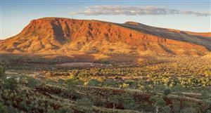
Can anyone confirm if this is the ground DYL are going to drill and hopefully mine
DYL Price at posting:
0.0¢ Sentiment: LT Buy Disclosure: Held


 (20min delay)