A couple of things which don't jump out at first blush. You got me thinking about this seriously, as the question has been posed many times before.
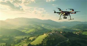
I speak as an amateur astrophotographer , having spent many frustrating hours trying to look through a murky, messed up atmosphere ... and that's at night, when things are relatively stable . During the day when you take aerial photographs things are so much worse because of the heat of the sun.
To get down to the resolution being demanded (say 7cm), you need a very stable atmosphere to shoot through or things get blurry. The finest cloud destroys high resolution imaging and there is high cloud most of the time that you can't see. We get over that by taking hundreds of photos of the same spot with long exposures ... you can't do that with a satellite. Astrophotographers call the stability of the atmosphere 'seeing', as in "How good is the seeing tonight?". Generally the answer is "Sheisenhousen"
The amount of data you are dealing with for these high res shots is immense. My astro camera is 16Mb, producing 32Mb images in monochrome. I take a lot of photos, and so I have to deal with massive amounts of data. This is nothing, though, compared to what Nearmap deals with. They have multiple high resolution colour cameras shooting at different angles.
I have no idea what the resolution of the NearMap cameras are, but taking one from around 5000m and moving it to 500,000m means that the the lens needs to be just 1% of the angle that it is on the plane to get the same resolution. Because of the angles you generate with the altitude you lose the ability to produce high quality 3d (look at google compared to NEA 3d), and you also lose the accuracy in calculating distances as they do for rooftop measurements.
With the satellite moving at some 28,000km/hr compared to a plane doing some 300km/hr it needs to take images nearly 100 times faster, and then it needs to transmit that data to earth. It can only take photos for a small part of its orbit because the sun has to be high above the area being photographed. It can only transmit for a certain amount of its orbit, so it needs storage ... lots of storage. But whilst it
can transmit, it needs to offload all the data it has stored . This means you need a very expensive tech heavy satellite with many cameras, big, fast transmitters and massive data storage .
Low earth orbit is a short term prospect for a satellite ... a few of years and your orbit diminishes due to the atmospheric drag. Musk plans for his pesky cheap satellites to last about 5 years. Larger satellites would last less. Replacing very expensive camera gear and transmission equipment that regularly is going to get expensive.
I have just brushed the surface very lightly, but a bit of consideration really leads you to the conclusion that aerial and satellite imagery are two very different things and neither will ever be a threat to the other.
So I think that Google can breath a sigh of relief that they are, most likely, safe from Nearmap