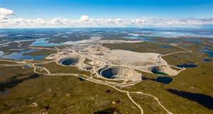
URANIUM EXPLORATION UPDATE – SIGNIFICANT RESULTS
FROM NORTHERN TERRITORY URANIUM PROJECTS
HIGHLIGHTS
13th February 2007
• Uranium values up to 8.8% U returned from rock chip sampling from the
Harts Range and Bundey Uranium Projects, Northern Territory.
• Three major palaeo-channels with potential to host Roll Front uranium
deposits identified from recently completed HoistEM survey covering the
Plenty Highway Uranium Project.
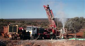
• Drilling programs at Plenty Highway and Hale River set to commence in
March/April 2007.
Thor Mining PLC (AIM/ASX: THR – “Thor”) is pleased to advise that further reconnaissance
sampling at its Harts Range, Plenty Highway and Bundey Uranium Projects in the
Northern Territory has returned encouraging results, including several elevated uranium
values. The Company has also announced initial results from the comprehensive Hoist EM
survey covering its Northern Territory uranium portfolio, with drill testing of key targets set
to commence shortly.
Reconnaissance exploration work has been completed within the Harts Range tenement
group. A number of samples returned significant results of >0.10% U, all of which have a
very strong REE (rare earth element) association. One particular sample from an area near
the Haddock Prospect within EL 24736 was very high in uranium (8.87% U), tantalum
(19%) and niobium (18%), suggesting that the sample contained coarse tantalite crystals.
Two significant results of 0.17% U and 0.26% U were also returned from the Garnet
Prospect, located within EL 24765. Detailed mapping and radiometric surveys of these
structures and pegmatites is essential in order to develop an exploration model which may
lead to an economic uranium discovery in the Harts Ranges.
Thor also advises that it has received an initial interpretation from the recently completed
HoistEM survey covering the Plenty Highway Uranium Project. This interpretation
indicates the presence of three major east west palaeo-channels with the potential to
host uranium mineralisation within the project area. These palaeo-channels are believed to
contain significant carbonaceous matter, the essential ingredient for the formation of Roll
Front uranium deposits.
Commenting on the results, Thor’s Chief Executive Officer, Mr John A. Young, said: “We are
very pleased with the results from the HoistEM Survey which has successfully defined
priority drilling targets, particularly within the major palaeo-channels identified at Plenty
Highway.”
“Further work is required within the Harts Range tenements to delineate drilling targets,
however we now have a much better understanding of the mineralisation styles and the
geology that hosts a number of high-priority uranium prospects. Importantly, the recent
sampling results have also confirmed the prospectivity of the area to host uranium
mineralisation.”
Summary
Harts Range Exploration
In late November 2006, a scintillometer orientation survey was carried out in the
Harts Range uranium prospect located approximately 200km east-northeast of
Alice Springs in the Arunta Province of the Northern Territory. The project includes
six tenements EL24827, EL24734, EL24735, EL24736, EL24765 and A24766.
The main objective of the sampling program was to identify known prospects and
determine optimal access routes and logistics for exploration in 2007.
In the Harts Range ground reconnaissance work was completed over tenements
EL24736, EL24765 and EL24734, with scintillometer readings taken at various
locations including several prospects with historic uranium exploration results. In
total, fourteen samples were collected.
Harts Range - EL24736
At the Haddock Creek and Daicos prospects, a number of sub-parallel pegmatites were
surveyed, with a maximum count of 19,000 cps. Four samples were taken within
EL24736, with one 1.5kg sample returning a very high uranium result of 8.87% U with
associated REE (rare earth elements),tantalum, niobium, and yttrium. Samples HR12,
HR14 and HR15 were also anomalous, with results ranging from 146ppm to 0.27%
uranium.
Further Haddock-style anomalies have been identified at points along a stratigraphic
arc extending north. Approximately 12 km of prospective strike length has been
identified representing potential host extensions or repetitions of epidosite-pegmatoid
layers.
SAMPLE
ID
EAST
(GDA94)
NORTH
(GDA94)
PROSPECT CPS COMMENTS Th(ppm) U(ppm)
HR 12 513123 7445215 Haddock Creek 1200-1800
Pegmatite.
Highly Anomalous
point source.
25.4 158.5
HR 13 516902 7439841 Daicos 6000-7000
Qtz Pegmatite.
Anomalous zone 18m
by 20-50cm wide at
contact.
0.71% 8.87%
HR 14 516902 7439841 Daicos 6000-7000
Qtz Pegmatite. Fault
zone.?
Anomalous parallel
zone to the south.
99.5 925
HR 15 516842 7439565 Daicos 1500
Large Pegmatite
above
HR13-14
Max 19,000cps.
245 0.27%
All units are in ppm unless otherwise stated
Harts Range – EL24765
Five samples (HR16-HR20) were taken from the Garnet Prospect, located on
adjacent tenement EL24765, with background readings at this locality ranging from
450-6600cps. Samples from this area were taken here in a medium-to-fine grained
altered pegmatite, rich in garnet. The results were very encouraging with two
samples returning elevated uranium values of 0.17% and 0.26%.
PNC mapped this area in 1993 and determined that the strongest radioactivity
occurs where the pegmatite has been more extensively altered to garnet. Historic
PNC assays at this prospect ranged between 18-2,900ppm U, 100-4,000ppm Y and
100-2,600ppm Nb. Garnet contaminated pegmatite returned the highest assays
while garnet-quartz-biotite alteration returned lower grades.
SAMPLE
ID
EAST
(GDA94)
NORTH
(GDA94)
PROSPECT CPS COMMENTS Th(ppm) U(ppm)
HR 16 514061 7429930 Garnet 450-6600
Altered Pegmatite Rich in
garnet, with skarn rafts in
pegmatite.
197 0.17%
HR 17 514061 7429930 Garnet 450-6600
Altered Pegmatite Rich in
garnet, with skarn rafts in
pegmatite.
244 0.26%
HR 18 514061 7429930 Garnet 450-6600
Altered Pegmatite Rich in
garnet, with skarn rafts in
pegmatite.
18.6 141
HR 19 514807 7429132 Ant 260
Anomalous zone associated
with silica-epidote veining.
Past digging in Creek Bed.
20.5 34.4
HR 20 513300 7429415 Near Goanna 2400
Single Anomaly, in thin (60-
80cm) Peg dyke, cross
cutting bedded mafic
metasediments (bio-qtzfdsp).
7.48 87.8
All units are in ppm unless otherwise stated
Harts Range – EL24734
The Harts Range project area lies on the eastern margin of the Entia Dome. The
Entia Gneiss (Harts Range Group) forms the core of the Entia Dome, which is
located on the western part of the exploration license area.
Regional exploration resulted in the identification of a single pegmatite some
6.3km in length and 50m wide at Mt Mary. Two rock chips taken from ‘hot spots’ in
this area returned elevated uranium values ranging from 107 to 246ppm. A
second pegmatite, which also has extensive strike (2km) and width (63m), has
been identified to the north-east, but has not been sampled as yet.
Further work is recommended in this area, given that these larger scale intrusives
are generally similar to the pegmatites mined at the Rossing Mine in Namibia. This
type of deposit generally has lower grades (~0.05% U) and high tonnages.
Detailed mapping and radiometric surveys of these structures and pegmatites is
essential in order to develop an exploration model which will lead to an economic
uranium discovery in the Harts Range. Mt Mary has had little historic exploration
and will be a priority target in the Company’s next field program.
Ongoing exploration will also cover the SNAF and Kelly Prospects, located to the
north and south of Mt Mary. Historic rock chip sampling by PNC at these prospects
returned very high-grade uranium assays ranging from 550-1,580 ppm U.
The mineralisation at these prospects is believed to be an intrusive-style, similar to
the uranium deposits occurring in the Olary Province in South Australia, which are
associated with mesoproterozoic intrusives. One of these, Radium Hill, has a
number of uranium-rare earth bodies occurring in narrow, steeply-dipping
pegmatitic veins in shear zones within quartzo-feldspathic gneiss.
SAMPLE
ID
EAST
(GDA94)
NORTH
(GDA94) PROSPECT CPS COMMENTS Th(ppm) U(ppm)
HR 23 532703 7452531 Mt Mary 700-1500
Large Pegmatite contact
zone with biotitegneissic
rock.
197 47.9
HR 24 532488 7452386 Mt Mary 450-2500
Signs of migmatite, and
partly melted biogneissic
zenoliths.
10.75 246
HR 25 532194 7452330 Mt Mary 450-2500 Similar 13.25 107.5
All units are in ppm unless otherwise stated
Bundey River – EL25378
Three radiometric anomalies have been identified in the eastern part of the Bundey
River Project area from airborne radiometric survey compiled by the Northern
Territory Geological Survey onto a 1:250,000 map.
Two samples were taken from this area with disappointing uranium results. While
no calcrete samples were able to be taken, a consistently high scintillometer count
was taken over the main drainage channel. Sampling returned an anomalous
thorium value in exposed lateritic remnants, confirming the potential for tertiary
basin and drainage hosted uranium.
This area requires investigation by a small drilling rig mounted on a four wheel drive
vehicle.
SAMPLE
ID
EAST
(GDA94)
NORTH
(GDA94) PROSPECT CPS COMMENTS Th(ppm) U(ppm)
HR 21 514060 7490850 Bundey River 350-900
Lateritised acid
volcanic? High
background (350-
900cps).
34.1 21.5
HR 22 514060 7490850 Bundey River 350-900
Couldn't find source of
anomaly (more active
than HR 21)
565 9.32
All units are in ppm unless otherwise stated
Plenty Highway HoistEM Interpretation
The Plenty Highway project area (EL24810) occurs on the Precambrian Arunta
Block with fluvial and lacustrine sediments accumulated in streams and lake
systems during the early to middle Tertiary. These sediments were slightly uplifted
in late Pliocene, and the upper parts of the sequence have been exposed by
erosion.
A specialist interpretation has been received from modelling of the data received
from the recently completed Hoist EM survey. A total of 126 traverses were
completed on 400m line spacing for collection of 1800 line kilometers. A HoistEM
survey maps the palaeo-topography of the crystalline basement due to significant
electrical contrast between overlying unconsolidated sediments and the basement
rocks.
This interpretation has identified three major palaeo-channels running in an eastwest
direction. Several areas have been highlighted which are believed to contain
significant carbonaceous matter, the essential ingredient for the formation of Roll
Front uranium deposits.
Palaeo-channels
Hale Energy Tenements
CURTIS POUND URANIUM PROJECT EL24823 Curtis Pound Project
HALE RIVER URANIUM PROJECT EL24809 Hale River Project
HARTS RANGE URANIUM PROJECT EL24734 Harts Range Project
EL24735 Harts Range Project
EL24736 Harts Range Project
EL24765 Harts Range Project
EL24827 Harts Range Project
A24766 Harts Range Project
PLENTY HIGHWAY URANIUM PROJECT EL24810 Plenty Highway Project
BUNDEY RIVER ELA25378 Bundey River Project
Yours faithfully
THOR MINING PLC
John A Young
Chief Executive Officer
The information in this report that relates to exploration results, mineral resources or ore reserves is
based on information compiled by John Young, who is a Member of The Australasian Institute of
Mining and Metallurgy. John Young is a director of Thor Mining PLC. John Young has sufficient
experience which is relevant to the style of mineralisation and type of deposit under consideration
and to the activity which he is undertaking to qualify as a Competent Person as defined in the 2004
Edition of the ‘Australasian Code for Reporting of Exploration Results, Mineral Resources and Ore
Reserves’. John Young consents to the inclusion in the report of the matters based on his information
in the form and context in which it appears.
Harts Range Rock Chips Results
Sample ID Recvd Wt. Ag Ba Ce Co Cr Cs Cu Dy Er Eu Ga Gd Hf Ho La Y Lu
kg ppm ppm ppm ppm ppm ppm ppm ppm ppm ppm ppm ppm ppm ppm ppm ppm ppm
HR12 2.39 <1 310 32.6 3.3 20 3.48 11 10.55 8.13 0.51 22 6.59 5.9 2.33 15.1 86.5 1.81
HR13 0.48 <1 807 868 2.6 <10 2.16 6 0.45% 0.26% 101 22.6 0.33% 246 729 156 3.20% 496
HR14 1 <1 308 39.9 4.9 20 28.5 9 58.7 36.2 1.8 66.3 39.2 28 11.35 20 430 7.36
HR15 1.16 <1 129.5 35.9 4.1 20 5.77 16 98.8 27.5 1.35 25.3 81.6 5.9 13 14.3 460 2.01
HR16 3.02 <1 205 84.4 2.8 10 63.5 8 389 327 5.53 61.3 130 231 93.9 40.2 4230 75.3
HR17 2.17 <1 120 258 3.9 70 25.4 <5 412 558 5.15 62.8 135 730 126.5 115 5700 173.5
HR18 1.29 <1 30.4 82.8 3.8 20 17 <5 251 599 1 57.8 26.3 169.5 111 33.7 4830 221
HR19 1.57 <1 70.3 77.7 6.3 20 0.31 5 17.4 13.25 1.15 34.9 12 4.5 4.13 22.1 131 2.02
HR20 0.89 <1 197.5 7.3 1.1 <10 4.34 <5 18.4 14.7 0.52 43.5 6 4.7 4.52 5.6 174 2.43
HR21 1.56 <1 88.9 34.7 2.1 120 0.67 16 4.19 4.04 0.19 30.4 2.83 12.5 1.06 18 42.2 0.98
HR22 1.56 <1 112 1235 5.8 280 0.43 46 9.05 5.96 1.49 53.4 42.4 24.4 1.61 692 52.5 1.29
HR23 0.85 <1 460 52.9 1 <10 1.96 <5 4 2.67 1.76 22.1 6.13 13.7 0.82 26.3 24.9 0.54
HR24 1 <1 381 12.6 5.7 30 14.05 35 3.14 2.15 0.57 22.6 2.57 7.1 0.68 7 21.6 0.34
HR25 1.82 <1 168.5 9.5 5.7 30 10.8 <5 3.08 1.89 0.57 26.6 2.43 9.2 0.64 4.8 16.9 0.23
Sample ID Nb Nd Pb Pr Rb Sm Sn Sr Ta Tb Th Tm U V W Yb Zn Zr
ppm ppm ppm ppm ppm ppm ppm ppm ppm ppm ppm ppm ppm ppm ppm ppm ppm ppm
HR12 206 13.2 52 3.33 178.5 5.44 1 86.7 257 1.69 25.4 1.51 158.5 28 8 11.8 19 145
HR13 15.20% 1585 3620 212 31.9 0.22% 82 957 19.20% 753 0.71% 417 8.87% 96 1350 0.35% 51 1150
HR14 1520 30.4 69 5.69 482 25.2 5 173.5 1615 10.4 99.5 6.75 925 45 28 51 37 357
HR15 3970 41.9 183 6.56 278 49.5 3 47.5 1065 22 245 3.25 0.27 24 48 16.85 27 116
HR16 5270 84.4 174 14.1 444 60.6 18 61.9 1880 50.1 197 63.4 0.17 13 20 497 49 1530
HR17 4440 127.5 170 29.7 337 71 31 34.3 3360 48.6 244 119 0.26 35 48 996 78 6040
HR18 304 27.6 25 7.46 125.5 8.35 13 3.3 36 17.1 18.6 141.5 141 66 5 >1000 100 2300
HR19 72.4 31.4 31 7.81 5.5 9.5 10 189 20.6 2.84 20.5 2.05 34.4 90 1 13.35 26 105
HR20 201 4.9 73 1.14 169.5 2.44 1 147.5 66.1 2.29 7.48 2.44 87.8 10 4 17.2 20 42
HR21 51.1 12.9 19 3.7 21.6 2.56 2 20.3 28.4 0.62 34.1 0.77 21.5 168 1 5.84 19 323
HR22 42.3 417 55 127 6.4 55.4 4 17.1 7.1 3.52 565 0.92 9.32 294 1 7.81 35 778
HR23 7.9 26 155 6.42 169.5 6.87 1 280 3.9 0.9 197 0.42 47.9 11 1 3.1 11 295
HR24 32.8 6.8 61 1.75 307 2.08 4 129 6.9 0.55 10.75 0.34 246 32 1 2.19 61 176
HR25 29.6 4.6 51 1.11 248 1.78 4 160 7.7 0.54 13.25 0.26 107.5 29 <1 1.64 72 221


Add to My Watchlist
What is My Watchlist?
