Check out CGM for advanced, high grade gold projects with near term production potential.
Market cap under $1 million.
CGM's Shoal Lake West Project area is host to the historic Duport Mine and current Duport Gold Deposit.
CGM's Shoal Lake East Project hosts the Mikado and Cedar Island Gold Mines, and the current Cedar Island Mainland mineralised zone.
The Shoal Lake gold properties comprise patented mining claims and leases, and staked mineral claims encompassing past gold producers, gold deposits, and gold occurrences.
Drill results, bulk sampling, surface sampling and historic production information on the properties confirm the high-grade nature of the gold mineralisation.
The properties provide exceptional logistics with close access to regional highway, power, pipeline, railway, and airport.
Shoal Lake West
Host to the Duport Mine past producer and to the current Duport Gold Deposit.
In excess of 90,000m drilling from surface and undergrou
The Duport Gold Deposit is partially developed with 3,700m of underground workings across seven levels with access from vertical shaft and decline.
High-grade gold mineralisation established along two regional structural trends provides additional significant potential.
Shoal Lake East
Host to Cedar Island Mainland Zone and Grano Zone gold deposits and numerous high-grade gold occurrences along three mineralised trends.
Hosts past gold producing Mikado and Cedar Island mines.
In excess of 30,000m surface drilling with high-grade gold intersections.
Mikado Gold Mine developed on 10 levels with access from vertical and inclined shaft (production halted 1934).
Cedar Island Gold Mine developed on 5 levels with access from vertical and inclined shaft (production halted 1936).
Duport Gold Deposit
The Duport Gold Deposit was discovered in 1896 with intermittent production through to 1936. Subsequent exploration and development activities have extended the original gold deposit and culminated in excess of 90,000 metres drilling and underground development of 3,700 metres. Underground development comprises a vertical shaft accessing four levels and a separate decline accessing an additional seven levels. No mining activities have been carried out since 1936 and the underground workings have remained closed since 1989. Recent work has been limited to surface diamond drilling to establish the continuity of the deposit.
Significant work completed by previous owner, Consolidated Professor Mines Limited (“CPM”) in the period 1973 to 1996 includes the underground development with decline access, resource drilling, bulk sampling, metallurgical testing, and environmental studies resulted in a positive feasibility study and a number of consecutive resources estimations.
SUMMARY OF HISTORIC CPM RESOURCES ESTIMATIONS
In 2006 RPA used a contour method to estimate the Duport Gold Deposit resources. The RPA estimation was based upon 81,391m of drilling including 7,054m drilled in 2005 but did not have access to a complete dataset from underground mapping and sampling.
The resulting estimate contained an Indicated Mineral Resources of 424,000t averaging 13.40g/t Au for a total 182,000oz plus an Inferred Mineral Resource of 387,000t averaging 10.69g/t Au for a total 131,000oz.
This resource was conducted under National Instrument 43-101 and differs substantially from earlier estimations reported by CPM.
Results from the 2010 Everton Resources drilling campaign totalling 8,321m in 28 surface diamond drill holes have not been incorporated into a revised resources estimation for the Duport gold deposit.
Other gold occurrences:
Duport East
Gold mineralization of the Duport East occurrence is identified in surface sampling and in drill core and associated with a geophysical conductive trend. Historic surface sampling from this occurrence include up to 87.45g/t Au. Historic drill intersection include up to 11.72g/t over 2.44m. Gold mineralization has been identified over a 800m strike along this trend.
Golden Reef
Located east of the Duport Gold deposit and within the same deformation zone as the Duport East gold occurrence. The prospect hosts a single shaft on a small island east of Stevens Island.
Pine Island
The prospect is located immediately south of the Duport Gold Deposit and host to a number of trenches and a single shaft. Discontinuous quartz veins with up to 30% sulphide in a shear is described as hosting the mineralisation.
SHOAL LAKE EAST PROPERTY
The property has undergone substantial exploration activity and holds the past producers Mikado and Cedar Island mines as well as a number of significant gold occurrences defining a series of elongate semi-parallel convergent gold mineralised trends over 1,000's metres strike across the property.
Historic reports indicate remaining mineable ore at both historic mines. Both mines remain “open” on trend and at depth, having had no significant exploration activities since their closure. In excess of 30,000 metres of surface drilling has been completed on the Shoal Lake East properties.
Mikado Gold Mine
The Mikado Mine operated intermittently from 1896 to 1934 for at an average grade of 16g/t Au. There are several known mineralised veins at Mikado but only the No. 1 and No. 2 veins have received any serious attention.
Ten underground levels were developed with access from a vertical and inclined shaft. The underground workings extend laterally for a distance of 1,200m. Gold at the mine occurs associated with quartz veining in a shear zone with high-grade ore shoots and visible coarse native gold.
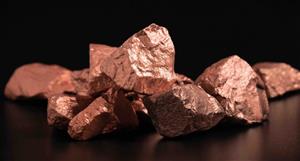
Visible gold from Mikado quartz vein (fist size sample).
Cedar Island Gold Mine
The Cedar Island Mine operated intermittently from 1897 to 1936 with reported production at an average grade of 10g/t Au. The Mine is also reported to have a remaining developed resource of 28,000t at 24g/t Au. Historical workings consist of an inclined and vertical shaft with underground development on five levels. Gold at the mine occurs in shear zones associated with sulphide mineralization.
From the closure of the Cedar Island Mine in 1936, no further substantial exploration was carried out in the Shoal Lake area until 1980 when it was optioned to Dennison Mines.
The present owners initiated a decline in 1993 which halted at the “brow”. Amador optioned the property between 2002 and 2004 and completed the last drilling campaign to-date on the property. The drill programs were successful in demonstrating that the gold mineralization extended onto the mainland and prompted the delineation of the CIMZ.
In excess of 30,000m of surface drilling was completed on the property in the period 1981 to 2004. Everton Resources held the property under option to 2012 but did not undertake any drilling.
Cedar Island Mine schematic longitudinal section.
Other Gold Occurrences
Grano Zone
The Grano Zone was discovered in 1981 and is located immediately adjacent to the east of the Mikado Mine trend. Historic drill intersections are high-grade similar to those of the other gold occurrences on the property and include 10.6g/t Au over 2.4 metres and 72g/t Au over 1 metre.
Ontario
There are 12 known veins allocated to this occurrence where historic assays results from channel samples indicate up to 20 ounces gold per ton. Up to 2% copper and 4% zinc was also encountered. Historic exploration included the development of two vertical shafts.
Bullion
Located east of the Mikado Gold Mine, this occurrence is described as two parallel quartz veins associated with gold mineralisation containing “considerable” free gold. Grab samples returned values up to 101g/t Au. Two pits are located at Bullion 1 and there are three shafts associated with the Bullion 2 occurrence.
McKinnon Reef
This occurrence is located on a small island in Bag Bay north of the Cedar Island Gold Mine and is described as a stockwork of interlaced quartz veins containing free gold. Historic reports describe grab samples assaying as a high as 11 ounces Au/tonne.
Mikado Bay
Drilling at the Mikado Bay occurrence returned assay results of 14.5g/t Au over 3.5 metres and up to 62g/t Au over 0.2 metres in multiple intersections.


 (20min delay)