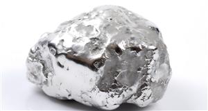
Hmmm, might want to re-assess our targets and I think we gonna need a bigger pit, they all the rage at the moment :-0)ThePerth-based partners last year paid a combined $2.2 billion to acquire 50 per cent stakesin the Super Pit, putting the mine under Australian ownership for the first time in its 30-year history.
The new owners ofKalgoorlie-Boulder's Super Pit say operations will now continue until at least2035 and the recruitment of up to 100 new workers has begun as one ofAustralia's largest gold mines ramps up production again.
Key points:
·The Super Pit has produced more than 21 million ounces of gold sinceopen pit mining began in 1989
·The mine is the largest single employer in Kalgoorlie-Boulder with 764direct employees and 461 contractors
·The new owners have told the stock market there is enough reserves tosupport open pit mining until 2035
The strategic review revealed exploration drilling discoveredsignificant new reserves — now sitting around 9.7 million ounces with anin-ground value of more than $26 billion at today's gold price — which willextend the mine life for another 15 years.
Batholiths arelarge bodies of intrusive igneous rock . Formed when magma coolsand crystallizes beneath Earth's surface, batholiths are the largest type of pluton . By definition, a batholith must cover at least 39 mi2 (100 km2), although most are even larger. Many batholiths cover hundreds tothousands of square miles. The Idaho batholith, for example, has a surface area of over 15,500 mi2 (40,000 km2).
Batholiths aregenerally not comprised of one continuous magmatic intrusion; rather, they areproduced by repeated intrusions, and most batholiths are made up of multipleindividual plutons. Intruded rock cools and solidifies, later to be exposed atthe surface through erosion . Because they cool beneathEarth's surface, batholiths have a coarse grained texture, and most aregranitic in composition.
Usually associatedwith mountain building, batholiths are often emplaced near continental marginsduring periods of subduction. As the subducting slab descends, it begins tomelt, and multiple plutons are intruded beneath the continent to form the coreof the volcanic arc. The Sierra Nevada Mountains, for example, are comprised ofa granitic batholith, which is made up of hundreds of individual plutonsintruded over a period of several million years. Emplacement of the SierraNevada batholith occurred during a mountain building episode known as the
Nevadan orogeny , initiated during the Jurassic.The Sierra Nevadabatholith not only forms a major mountain chain, but also was responsible fordriving the Californiagold rush. Precious minerals including gold are commonly associated with granitic batholiths. As mineral-rich solutions move along cracks in the rock body, gold, copper, and other minerals, especially quartz , precipitate out. Gold may be mined from deposits known as quartz veins that form along the fractures. The Mother Lode in the Sierra Nevada is possibly the most famous of such deposits.
Determining themechanism for batholith emplacement has been a topic of much debate. Whengigantic batholiths are intruded, the surrounding rock, known as the countryrock , must somehow make room for the intrusion. Several models havebeen suggested, but most geologists now agree that a mechanism known asforceful injection is probably responsible for emplacement. Apparently, as thebody of magma rises, it deforms the country rock, pushing it out of the way.
Sierra Nevada batholith is known best across its central part (Bateman, 1965; Bateman and others, 1963; Calkins, 1930; Ernst Cloos, 1932, 1935a, 1935b; Durrell, 1940; Hamilton, 1956; Krauskopf, 1953; Macdonald, 1941; Moore, 1963; Rinehart and Ross, 1964; D. C. Ross, 1958; Sherlock and Hamilton, 1958; and others). Bateman, Clark, Huber, Moore, and Rinehart (1963, pi. 1) compiled a geologic map of the central Sierra.
The batholith is 55 to 110 kilometers wide, has an exposed length of 650 km, and is a composite of plutons of Late Jurassic and Cretaceous ages (Kistler and others, 1965). Large plutons are elongate parallel to the North Westerly regional strike and small plutons lie between and within them. Younger plutons in many places cut sharply across structures of older plutons but in some places are nested concordantly inside them.
Adjacent plutons can be of markedly different compositions within the spectrum quartz diorite-granodiorite-quartz monzonite-alaskite. The larger plutons and the bulk composition tend to become more silicic and richer in alkalis eastward; the dominant rock types are mafic calcic quartz diorite and granodiorite in the west and leucocratic granodiorite and quartz monzonite in the east, but exceptions are numerous on both sides
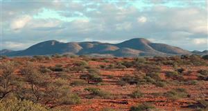
2.4.2 Local Geology In the El Zorro Project, the main mineralised intrusion is underlain by a Devonian age sedimentary rock sequence consisting of interbedded siltstone, volcaniclastics, and minor quartzite, all of which has been variably metamorphosed and folded.
Two separate sediment outcrops on the eastern side of the mapped area show cross-beds that indicate the sedimentary sequence has been overturned. In the El Zorro project area, both the sediments and the granodiorite have been intruded by a mineralised tonalite to diorite intrusion (referred to as diorite herein) interpreted from field mapping as a possible late stage differentiate of the granodiorite body, emplaced as a sill and referred to as the El Zorro Tonalite (EZT).
Another interpretation is that the EZT is related to the later Cretaceous Andean arc evolution. This intrusion has significantly thermally metamorphosed the sediments within several hundred metres of the contact resulting in highly resistant phyllite, dark fine grained hornfels and quartzite. The phyllite is a very fine grained, foliated, black, dense rock. The mineralised diorite has plan dimensions of approximately 2 km along strike and 50–150 m wide with a general strike of 065°. Alteration in the diorite occurs as selvedges to quartz ± sulphide veins represented by strong albite, biotite, weak chlorite and very weak sericite and clay
Blue Geographical placement markers covering a large area of the current prospect.
10 Km to the coastal subduction area
And possibly why with the new IP we saw need to push the back fence out a bit..8H
TSO fair value? Short term target 30c, medium term 60c!, page-74


Add TSO (ASX) to my watchlist
 (20min delay) (20min delay)
|
|||||
|
Last
2.6¢ |
Change
-0.001(3.70%) |
Mkt cap ! $39.35M | |||
| Open | High | Low | Value | Volume |
| 3.0¢ | 3.0¢ | 2.6¢ | $38.81K | 1.432M |
Buyers (Bids)
| No. | Vol. | Price($) |
|---|---|---|
| 3 | 1126292 | 2.6¢ |
Sellers (Offers)
| Price($) | Vol. | No. |
|---|---|---|
| 2.9¢ | 50000 | 1 |
View Market Depth
| Last trade - 16.10pm 16/08/2024 (20 minute delay) ? |
| TSO (ASX) Chart |