This is from a consultant's website.
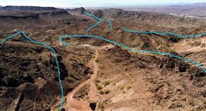
It would appear that mgal surveys can be carried out very quickly. So, once the process begins we should have initial data within days. After all we are simply proving the existence of the Olympic Dam type structure prior to drilling.
Types of surveys:
http://www.daishsat.com/services.php
Heliborne Gravity
In heliborne operations, the crew usually consists of the helicopter pilot and the gravity surveyor, who is responsible for both the gravity and GPS observations. The usual procedure is for the pilot to navigate to the proposed survey station and land in a clear flat spot. The gravity surveyor will then exit the aircraft and take a gravity reading as close as possible to the GPS sensor, which is generally mounted on the rear of the helicopter. Using kinematic GPS techniques and multi-code GPS receivers, positions and levels of the gravity station can be resolved to better than 5cm while the reading resolution of the Scintrex CG-5 is around one 0.01 mGal. Production rates of the heliborne crew can be up to 60 to 70 stations per day, depending on the station spacing and terrain type. This makes it a cost effective method for large scale regional surveys were vehicle access is impractical or in rugged mountain areas where other types of access would be impossible.
Vehicle-borne Gravity
In regional gravity surveys completed by 4wd vehicles, the surveys are usually completed using a two man crew, one driver/navigator and one gravity surveyor. Surveys can sometimes be completed with one person who drives and completes the acquisition, but for safety and production reasons we often use a two-person crew. During vehicle operations, gravity acquisition is conducted concurrently with GPS observations. As with the heliborne operations, multi-code dual frequency GPS receivers are used for the surveying and Scintrex CG-5 gravity meters are used for the gravity observations. Similar to the heliborne work, using kinematic GPS techniques and multi-code GPS receivers, positions and levels of the gravity station can be resolved to better than 5cm while the reading resolution of the Scintrex CG-5 is around 0.01 mGal. Production rates of the vehicle crew can be up to 120 stations per day, depending on the station spacing and terrain type.
Detailed Gravity Surveys by Foot
On surveys where the station spacing is very short, say 10 to 50m, or the terrain is too rugged for vehicles, then the gravity survey can be conducted on foot. Generally this is completed using a two-person crew, one completing the GPS observations with the other conducting the gravity acquisition. For the surveying, Leica GX1230 GPS receivers are used to provide positions and levels on each gravity station to an accuracy of 20mm or better. Production rates can be up to 150 stations per day depending on access and terrain.
Microgravity
In microgravity, the station spacing is very short, say 1 to 2 meters. In these surveys both the gravity and levelling must be rigorously surveyed. The company use a combination of RTK GPS and traditional conventional surveying equipment to survey the levels of all gravity stations to better than 5mm. Daishsat owns and operates the Scintrex CG-5, a gravity meter specially designed for microgravity surveys. It has a reading resolution of 0.001 mGal and a standard deviation in field use of 0.005 mGal. Special field techniques must be utilised to reliably obtain this level of accuracy.


Add to My Watchlist
What is My Watchlist?